Méru
| Méru | ||
|---|---|---|
| Commune | ||
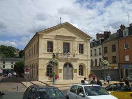 City hall | ||
| ||
 Méru Location within Hauts-de-France region  Méru | ||
| Coordinates: 49°14′08″N 2°08′02″E / 49.2356°N 2.1339°ECoordinates: 49°14′08″N 2°08′02″E / 49.2356°N 2.1339°E | ||
| Country | France | |
| Region | Hauts-de-France | |
| Department | Oise | |
| Arrondissement | Beauvais | |
| Canton | Méru | |
| Government | ||
| • Mayor | Yves Leblanc | |
| Area1 | 22.83 km2 (8.81 sq mi) | |
| Population (2012)2 | 13,948 | |
| • Density | 610/km2 (1,600/sq mi) | |
| Time zone | UTC+1 (CET) | |
| • Summer (DST) | UTC+2 (CEST) | |
| INSEE/Postal code | 60395 /60110 | |
| Elevation |
72–184 m (236–604 ft) (avg. 102 m or 335 ft) | |
|
1 French Land Register data, which excludes lakes, ponds, glaciers > 1 km2 (0.386 sq mi or 247 acres) and river estuaries. 2 Population without double counting: residents of multiple communes (e.g., students and military personnel) only counted once. | ||

Méru (Latin: Matrius, Meruacum)[1] is a commune in the Oise department in northern France.
See also
References
External links
| Wikimedia Commons has media related to Méru. |
- City council website (in French)
| Authority control |
|---|
This article is issued from
Wikipedia.
The text is licensed under Creative Commons - Attribution - Sharealike.
Additional terms may apply for the media files.