Gourchelles
| Gourchelles | |
|---|---|
| Commune | |
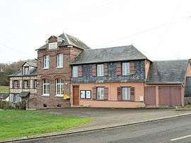 The town hall in Gourchelles | |
 Gourchelles Location within Hauts-de-France region  Gourchelles | |
| Coordinates: 49°43′48″N 1°46′51″E / 49.73°N 1.7808°ECoordinates: 49°43′48″N 1°46′51″E / 49.73°N 1.7808°E | |
| Country | France |
| Region | Hauts-de-France |
| Department | Oise |
| Arrondissement | Beauvais |
| Canton | Grandvilliers |
| Intercommunality | Picardie Verte |
| Government | |
| • Mayor (2008–2014) | Serge Chaput |
| Area1 | 2.23 km2 (0.86 sq mi) |
| Population (2012)2 | 129 |
| • Density | 58/km2 (150/sq mi) |
| Time zone | UTC+1 (CET) |
| • Summer (DST) | UTC+2 (CEST) |
| INSEE/Postal code | 60280 /60220 |
| Elevation |
158–215 m (518–705 ft) (avg. 169 m or 554 ft) |
|
1 French Land Register data, which excludes lakes, ponds, glaciers > 1 km2 (0.386 sq mi or 247 acres) and river estuaries. 2 Population without double counting: residents of multiple communes (e.g., students and military personnel) only counted once. | |
Gourchelles is a commune in the Oise department in northern France.
See also
References
| Wikimedia Commons has media related to Gourchelles. |
This article is issued from
Wikipedia.
The text is licensed under Creative Commons - Attribution - Sharealike.
Additional terms may apply for the media files.