Bonvillers
| Bonvillers | |
|---|---|
| Commune | |
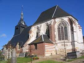 The church in Bonvillers | |
 Bonvillers Location within Hauts-de-France region  Bonvillers | |
| Coordinates: 49°35′28″N 2°21′21″E / 49.5911°N 2.3558°ECoordinates: 49°35′28″N 2°21′21″E / 49.5911°N 2.3558°E | |
| Country | France |
| Region | Hauts-de-France |
| Department | Oise |
| Arrondissement | Clermont |
| Canton | Saint-Just-en-Chaussée |
| Intercommunality | Vallées de la Brèche et de la Noye |
| Government | |
| • Mayor (2008–2014) | Vincent Loisel |
| Area1 | 5.86 km2 (2.26 sq mi) |
| Population (2009)2 | 207 |
| • Density | 35/km2 (91/sq mi) |
| Time zone | UTC+1 (CET) |
| • Summer (DST) | UTC+2 (CEST) |
| INSEE/Postal code | 60085 /60120 |
| Elevation |
111–161 m (364–528 ft) (avg. 150 m or 490 ft) |
|
1 French Land Register data, which excludes lakes, ponds, glaciers > 1 km2 (0.386 sq mi or 247 acres) and river estuaries. 2 Population without double counting: residents of multiple communes (e.g., students and military personnel) only counted once. | |
Bonvillers is a commune in the Oise department in northern France.
Population
| Historical population | ||
|---|---|---|
| Year | Pop. | ±% |
| 1793 | 436 | — |
| 1800 | 344 | −21.1% |
| 1806 | 505 | +46.8% |
| 1821 | 444 | −12.1% |
| 1831 | 485 | +9.2% |
| 1836 | 482 | −0.6% |
| 1841 | 480 | −0.4% |
| 1846 | 489 | +1.9% |
| 1851 | 470 | −3.9% |
| 1856 | 430 | −8.5% |
| 1861 | 401 | −6.7% |
| 1866 | 356 | −11.2% |
| 1872 | 341 | −4.2% |
| 1876 | 300 | −12.0% |
| 1881 | 270 | −10.0% |
| 1886 | 236 | −12.6% |
| 1891 | 226 | −4.2% |
| 1896 | 216 | −4.4% |
| 1901 | 212 | −1.9% |
| 1906 | 202 | −4.7% |
| 1911 | 189 | −6.4% |
| 1921 | 175 | −7.4% |
| 1926 | 164 | −6.3% |
| 1931 | 174 | +6.1% |
| 1936 | 170 | −2.3% |
| 1946 | 163 | −4.1% |
| 1954 | 160 | −1.8% |
| 1962 | 146 | −8.8% |
| 1968 | 143 | −2.1% |
| 1975 | 145 | +1.4% |
| 1982 | 165 | +13.8% |
| 1990 | 177 | +7.3% |
| 1999 | 191 | +7.9% |
| 2006 | 201 | +5.2% |
| 2009 | 207 | +3.0% |
See also
References
| Wikimedia Commons has media related to Bonvillers. |
This article is issued from
Wikipedia.
The text is licensed under Creative Commons - Attribution - Sharealike.
Additional terms may apply for the media files.