Haute-Épine
| Haute-Épine | |
|---|---|
| Commune | |
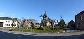 The church square in Haute-Épine | |
 Haute-Épine Location within Hauts-de-France region  Haute-Épine | |
| Coordinates: 49°35′04″N 2°00′41″E / 49.5844°N 2.0114°ECoordinates: 49°35′04″N 2°00′41″E / 49.5844°N 2.0114°E | |
| Country | France |
| Region | Hauts-de-France |
| Department | Oise |
| Arrondissement | Beauvais |
| Canton | Grandvilliers |
| Intercommunality | Picardie Verte |
| Government | |
| • Mayor (2008–2014) | Aleth Beliard |
| Area1 | 6.73 km2 (2.60 sq mi) |
| Population (2012)2 | 276 |
| • Density | 41/km2 (110/sq mi) |
| Time zone | UTC+1 (CET) |
| • Summer (DST) | UTC+2 (CEST) |
| INSEE/Postal code | 60304 /60690 |
| Elevation |
137–189 m (449–620 ft) (avg. 188 m or 617 ft) |
|
1 French Land Register data, which excludes lakes, ponds, glaciers > 1 km2 (0.386 sq mi or 247 acres) and river estuaries. 2 Population without double counting: residents of multiple communes (e.g., students and military personnel) only counted once. | |
Haute-Épine is a commune in the Oise department in northern France.
See also
References
| Wikimedia Commons has media related to Haute-Épine. |
This article is issued from
Wikipedia.
The text is licensed under Creative Commons - Attribution - Sharealike.
Additional terms may apply for the media files.