Erquinvillers
| Erquinvillers | |
|---|---|
| Commune | |
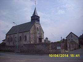 The town hall and church in Erquinvillers | |
 Erquinvillers Location within Hauts-de-France region  Erquinvillers | |
| Coordinates: 49°27′33″N 2°28′44″E / 49.4592°N 2.4789°ECoordinates: 49°27′33″N 2°28′44″E / 49.4592°N 2.4789°E | |
| Country | France |
| Region | Hauts-de-France |
| Department | Oise |
| Arrondissement | Clermont |
| Canton | Saint-Just-en-Chaussée |
| Intercommunality | Plateau Picard |
| Government | |
| • Mayor (2001–2020) | Bruno Levesque |
| Area1 | 3.77 km2 (1.46 sq mi) |
| Population (1999)2 | 161 |
| • Density | 43/km2 (110/sq mi) |
| Time zone | UTC+1 (CET) |
| • Summer (DST) | UTC+2 (CEST) |
| INSEE/Postal code | 60216 /60130 |
| Elevation |
102–137 m (335–449 ft) (avg. 120 m or 390 ft) |
|
1 French Land Register data, which excludes lakes, ponds, glaciers > 1 km2 (0.386 sq mi or 247 acres) and river estuaries. 2 Population without double counting: residents of multiple communes (e.g., students and military personnel) only counted once. | |
Erquinvillers is a commune in the Oise department in northern France.
See also
References
| Wikimedia Commons has media related to Erquinvillers. |
This article is issued from
Wikipedia.
The text is licensed under Creative Commons - Attribution - Sharealike.
Additional terms may apply for the media files.