Martinton Township, Iroquois County, Illinois
| Martinton Township | |
|---|---|
| Township | |
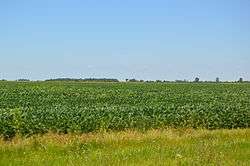 Fields along U.S. Route 52, southwest of Martinton | |
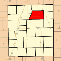 Location in Iroquois County | |
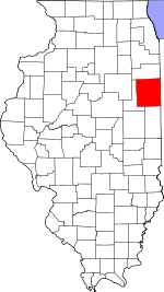 Iroquois County's location in Illinois | |
| Coordinates: 40°54′04″N 87°44′18″W / 40.90111°N 87.73833°WCoordinates: 40°54′04″N 87°44′18″W / 40.90111°N 87.73833°W | |
| Country | United States |
| State | Illinois |
| County | Iroquois |
| Established | September 1857 |
| Area | |
| • Total | 54.41 sq mi (140.9 km2) |
| • Land | 54.22 sq mi (140.4 km2) |
| • Water | 0.19 sq mi (0.5 km2) 0.35% |
| Elevation | 623 ft (190 m) |
| Population (2010) | |
| • Estimate (2016)[1] | 904 |
| • Density | 17.4/sq mi (6.7/km2) |
| Time zone | UTC-6 (CST) |
| • Summer (DST) | UTC-5 (CDT) |
| ZIP codes | 60912, 60931, 60951, 60970 |
| FIPS code | 17-075-47293 |
Martinton Township is one of twenty-six townships in Iroquois County, Illinois, USA. As of the 2010 census, its population was 943 and it contained 460 housing units.[2] Buchanan Township formed from a portion of Papineau Township, then known as Wygant Township, in September 1857; its name was changed to Martinton Township on an unknown date.
Geography
According to the 2010 census, the township has a total area of 54.41 square miles (140.9 km2), of which 54.22 square miles (140.4 km2) (or 99.65%) is land and 0.19 square miles (0.49 km2) (or 0.35%) is water.[2]
Cities, towns, villages
Extinct towns
- Freedville at 40°51′39″N 87°44′35″W / 40.860868°N 87.74309°W
Cemeteries
The township contains these four cemeteries: Greentown, Mount Olivet, Old Burg and Teege.
Major highways
Demographics
| Historical population | |||
|---|---|---|---|
| Census | Pop. | %± | |
| Est. 2016 | 904 | [1] | |
| U.S. Decennial Census[3] | |||
School districts
- Donovan Community Unit School District 3
- Iroquois County Community Unit School District 9
Political districts
- Illinois' 15th congressional district
- State House District 79
- State Senate District 40
References
- "Martinton Township, Iroquois County, Illinois". Geographic Names Information System. United States Geological Survey. Retrieved 2010-01-17.
- United States Census Bureau 2007 TIGER/Line Shapefiles
- United States National Atlas
- 1 2 "Population and Housing Unit Estimates". Retrieved June 9, 2017.
- 1 2 "Population, Housing Units, Area, and Density: 2010 - County -- County Subdivision and Place -- 2010 Census Summary File 1". United States Census. Retrieved 2013-05-28.
- ↑ "Census of Population and Housing". Census.gov. Retrieved June 4, 2016.
External links
Places adjacent to Martinton Township, Iroquois County, Illinois | |
|---|---|
Municipalities and communities of Iroquois County, Illinois, United States | ||
|---|---|---|
| Cities | ||
| Villages | ||
| Townships | ||
| Unincorporated communities | ||
| Footnotes | ‡This populated place also has portions in an adjacent county or counties | |
This article is issued from
Wikipedia.
The text is licensed under Creative Commons - Attribution - Sharealike.
Additional terms may apply for the media files.