Toyama Airport
| Toyama Airport 富山空港 Toyama Kūkō | |||||||||||
|---|---|---|---|---|---|---|---|---|---|---|---|
 | |||||||||||
| Summary | |||||||||||
| Airport type | Public | ||||||||||
| Operator | Toyama Prefecture | ||||||||||
| Location | Toyama | ||||||||||
| Elevation AMSL | 127 ft / 39 m | ||||||||||
| Coordinates | 36°38′54″N 137°11′15″E / 36.64833°N 137.18750°ECoordinates: 36°38′54″N 137°11′15″E / 36.64833°N 137.18750°E | ||||||||||
| Map | |||||||||||
 RJNT Location in Japan | |||||||||||
| Runways | |||||||||||
| |||||||||||
| Statistics (2015) | |||||||||||
| |||||||||||
|
Source: Japanese Ministry of Land, Infrastructure, Transport and Tourism[1] | |||||||||||
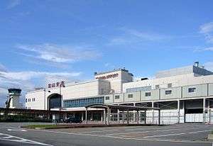
Toyama Airport (富山空港 Toyama Kūkō) (IATA: TOY, ICAO: RJNT) is an airport located 3 NM (5.6 km; 3.5 mi) south southwest[2] of Toyama City, Toyama Prefecture, Japan, about 20 minutes by car from the city center.
This airport is the center for the sightseeing spots such as Yukino-ōtani at Mount Tate, Gokayama, Kurobe, Himi, Takayama and Kanazawa. Only 20 minutes takes you to Toyama Station, where you can go to Tokyo by Hokuriku Shinkansen for 2 hours 8minutes.
Airlines and destinations
| Airlines | Destinations | Terminal |
|---|---|---|
| Air Seoul | Seoul–Incheon | International |
| All Nippon Airways | Sapporo–Chitose, Tokyo–Haneda | Domestic |
| China Airlines | Taipei–Taoyuan | International |
| China Eastern Airlines | Shanghai–Pudong | International |
| China Southern Airlines | Dalian | International |
References
- ↑ "Toyama Airport" (PDF). Japanese Ministry of Land, Infrastructure, Transport and Tourism. Archived from the original (PDF) on 21 October 2016. Retrieved 7 January 2017.
- ↑ AIS Japan Archived 2011-07-22 at the Wayback Machine.
External links
| Wikimedia Commons has media related to Toyama Airport. |
1 Joint civil-military use | |||||||
| Major hubs | |||||||
| International |
| ||||||
| Domestic |
| ||||||
| General aviation |
| ||||||
| Military | |||||||
| Heliports |
| ||||||
| Defunct | |||||||
Transit in Toyama Prefecture | |||||||||
|---|---|---|---|---|---|---|---|---|---|
| Ainokaze Toyama Railway | |||||||||
| Toyama Chihō Railway (Chitetsu) |
| ||||||||
| Toyama Light Rail | Toyamakō Line (Portram) | ||||||||
| Tateyama Kurobe Alpine Route |
| ||||||||
| Other Operators |
| ||||||||
| Misc |
| ||||||||
| |||||||||
This article is issued from
Wikipedia.
The text is licensed under Creative Commons - Attribution - Sharealike.
Additional terms may apply for the media files.