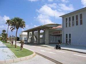
Kitadaito Airport
| Kitadaito Airport 北大東空港 Kitadaitō Kūkō | |||||||||||
|---|---|---|---|---|---|---|---|---|---|---|---|
 | |||||||||||
| Summary | |||||||||||
| Airport type | Public | ||||||||||
| Operator | Okinawa Prefecture | ||||||||||
| Location | Kitadaitō, Japan | ||||||||||
| Elevation AMSL | 71 ft / 22 m | ||||||||||
| Coordinates | 25°56′41″N 131°19′37″E / 25.94472°N 131.32694°ECoordinates: 25°56′41″N 131°19′37″E / 25.94472°N 131.32694°E | ||||||||||
| Map | |||||||||||
 RORK Location in Japan | |||||||||||
| Runways | |||||||||||
| |||||||||||
| Statistics (2015) | |||||||||||
| |||||||||||
|
Source: Japanese Ministry of Land, Infrastructure, Transport and Tourism[1] | |||||||||||
Kitadaitō Airport (北大東空港 Kitadaitō Kūkō, (IATA: KTD, ICAO: RORK)) is located on the island of Kitadaitōjima in the village of Kitadaitō, Shimajiri District, Okinawa Prefecture, Japan.
The prefecture operates the airport, which is classified as a third class airport.
Only a round flight from Naha, to Kitadaitō and Minami Daito Airport, back to Naha is operated every day. The route differs on the day of the week. Flight from Kitadaitō to Minamidaitō is the shortest flight in Japan, costs JPY¥7,600, and is only 12 km (7.5 mi) long, takes 3 minutes in the air.
Kitadaito Airport was opened in 1971 as an emergency 760 meter airstrip, constructed of crushed coral by the United States Civil Administration of the Ryukyu Islands. The runway was paved and extended to 800 meters in 1978, when scheduled passenger services commenced. The runway was extended to 1500 meters in 1997. At present, there is only one scheduled flight per day.
Airlines
| Airlines | Destinations |
|---|---|
| Japan Transocean Air operated by Ryukyu Air Commuter | Minami-Daito, Naha |
References
- ↑ "Kita Daito Airport" (PDF). Japanese Ministry of Land, Infrastructure, Transport and Tourism. Archived from the original (PDF) on 21 October 2016. Retrieved 7 January 2017.
External links
| Wikimedia Commons has media related to Kitadaito Airport. |
- Kitadaito Airport
- Kitadaito Airport Guide from Japan Airlines
- Accident history for KTD at Aviation Safety Network
1 Joint civil-military use | |||||||
| Major hubs | |||||||
| International |
| ||||||
| Domestic |
| ||||||
| General aviation |
| ||||||
| Military | |||||||
| Heliports |
| ||||||
| Defunct | |||||||