Sado Airport
| Sado Airport 佐渡空港 | |||||||||||
|---|---|---|---|---|---|---|---|---|---|---|---|
 | |||||||||||
| Summary | |||||||||||
| Airport type | Public | ||||||||||
| Operator | Niigata Prefecture | ||||||||||
| Location | Sado, Japan | ||||||||||
| Elevation AMSL | 75 ft / 23 m | ||||||||||
| Coordinates | 38°03′40″N 138°24′51″E / 38.06111°N 138.41417°ECoordinates: 38°03′40″N 138°24′51″E / 38.06111°N 138.41417°E | ||||||||||
| Map | |||||||||||
 SDS Location in Japan | |||||||||||
| Runways | |||||||||||
| |||||||||||
| Statistics (2015) | |||||||||||
| |||||||||||
|
Source: Japanese AIP at AIS Japan[1] Japanese Ministry of Land, Infrastructure, Transport and Tourism[2] | |||||||||||
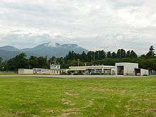
Sado Airport (Japanese: 佐渡空港) (IATA: SDS, ICAO: RJSD) is a public aerodrome located 4 km (2.5 mi) southwest of Ryōtsu[1] in Sado, Niigata Prefecture, Japan.
The airport opened in 1959 as a landing field (場外離着陸場) to provide air service connecting Sado Island to Niigata Airport, and was expanded in 1971 to allow more extensive general aviation service. Service to and from Sado Airport has been indefinitely suspended since April 2014. New Japan Aviation provided scheduled service until the airport's closure, although other scheduled operators have served the airport in the past.[3] Kyokushin Air operated the Sado-Niigata route until September 2008. In November 2015, Sado Airport announced to expend the runway to 2,000 meter from December 2015 to handle Jet service with additional destination to Tokyo-Haneda.[4]
| Wikimedia Commons has media related to Sado Airport. |
References
- 1 2 AIS Japan Archived 2011-07-22 at the Wayback Machine.
- ↑ "Sado Airport" (PDF). Japanese Ministry of Land, Infrastructure, Transport and Tourism. Archived from the original (PDF) on 21 October 2016. Retrieved 7 January 2017.
- ↑ "佐渡空港". Niigata Prefectural Government. Retrieved 27 January 2014.
- ↑ "ありがとう旭伸航空!9/30の午後4時からラストフライトセレモニーを行います". Niigata Prefecture. Retrieved 27 January 2014.
1 Joint civil-military use | |||||||
| Major hubs | |||||||
| International |
| ||||||
| Domestic |
| ||||||
| General aviation |
| ||||||
| Military | |||||||
| Heliports |
| ||||||
| Defunct | |||||||