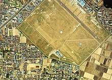
Kasuminome Air Field
| Kasuminome Air Field 霞目飛行場 Kasuminome Hikōjō | |||||||||||||||
|---|---|---|---|---|---|---|---|---|---|---|---|---|---|---|---|
 | |||||||||||||||
| Summary | |||||||||||||||
| Airport type | Military | ||||||||||||||
| Operator |
| ||||||||||||||
| Location | Sendai, Japan | ||||||||||||||
| Elevation AMSL | 23 ft / 7 m | ||||||||||||||
| Coordinates | 38°14′08″N 140°55′23″E / 38.23556°N 140.92306°ECoordinates: 38°14′08″N 140°55′23″E / 38.23556°N 140.92306°E | ||||||||||||||
| Map | |||||||||||||||
 RJSU Location in Japan | |||||||||||||||
| Runways | |||||||||||||||
| |||||||||||||||
Kasuminome Air Field (霞目飛行場 Kasuminome Hikōjō) (ICAO: RJSU) is a military aerodrome of the Japan Ground Self-Defense Force Camp Kasuminome (霞目駐屯地 Kasuminome Chūtonchi). It is located 2.7 NM (5.0 km; 3.1 mi) southeast[1] of Sendai in the Miyagi Prefecture, Japan.
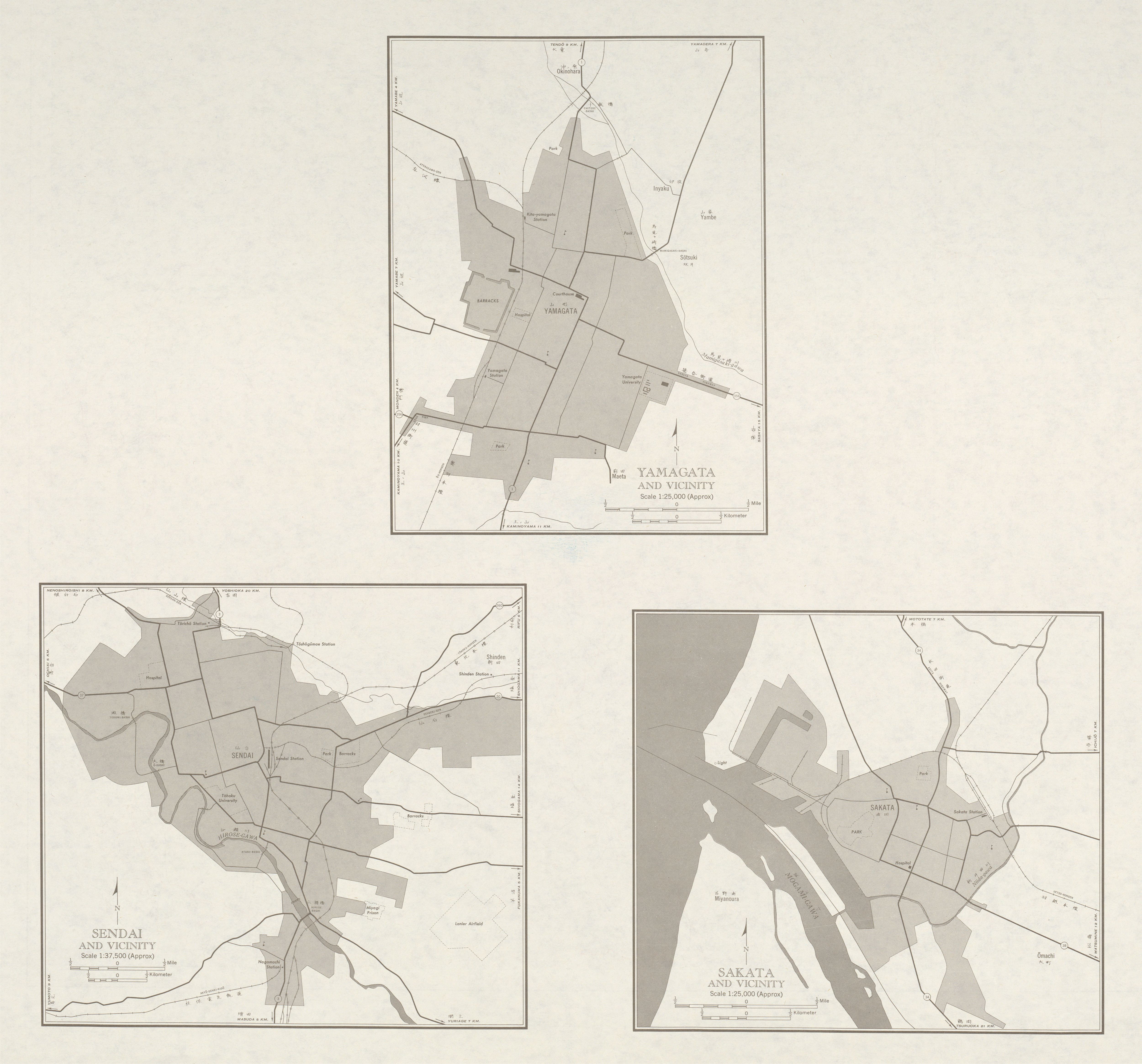
The air field was opened in 1937 as the Sendai Air Field (仙台飛行場 Sendai Hikojo) by the Imperial Japanese Army, and was the location of an air crew training facility. It was called "Lanier Airfield" by the Allied Powers during the Occupation of Japan.[2]
References
- 1 2 AIS Japan Archived 2016-05-17 at the Portuguese Web Archive
- ↑ "NJ 54-6 verso Yamagata and Vicinity; Sendai and Vicinity; Sakata and Vicinity", Japan AMS Topographic Maps, University of Texas at Austin
1 Joint civil-military use | |||||||
| Major hubs | |||||||
| International |
| ||||||
| Domestic |
| ||||||
| General aviation |
| ||||||
| Military | |||||||
| Heliports |
| ||||||
| Defunct | |||||||
This article is issued from
Wikipedia.
The text is licensed under Creative Commons - Attribution - Sharealike.
Additional terms may apply for the media files.