Sumba Strait
| Sumba Strait Indonesian: Selat Sumba | |
|---|---|
 Sumba Strait Flores island and Sumba Strait | |
| Coordinates | 9°05′00″S 120°00′00″E / 9.083333°S 120°ECoordinates: 9°05′00″S 120°00′00″E / 9.083333°S 120°E |
| Type | strait |
| Basin countries |
|
| References | Sumba Strait: Indonesia National Geospatial-Intelligence Agency, Bethesda, MD, USA |
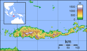
Sumba Strait (Indonesian: Selat Sumba) is a strait in Indonesia.
It separates the island of Sumba from the major islands of Flores and Sumbawa, as well as minor islands including Komodo and Rinca. It connects the Indian Ocean to the Savu Sea.
Prior to Indonesian independence it was known as Sandalwood Strait. It is also known as the Savu Sea.
Notes
- ↑ Goodall, George (Editor)(1943) Philips' International Atlas London, George Philip and Son map 'East Indies' pp.91-92
This article is issued from
Wikipedia.
The text is licensed under Creative Commons - Attribution - Sharealike.
Additional terms may apply for the media files.