Streatley, Berkshire
| Streatley | |
|---|---|
 Streatley nucleus and riverside beyond. | |
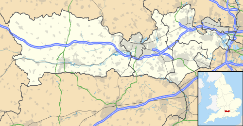 Streatley Streatley shown within Berkshire | |
| Area | 13.14 km2 (5.07 sq mi) |
| Population | 1,060 (2011 census)[1] |
| • Density | 81/km2 (210/sq mi) |
| OS grid reference | SU5980 |
| Civil parish |
|
| Unitary authority | |
| Ceremonial county | |
| Region | |
| Country | England |
| Sovereign state | United Kingdom |
| Post town | Reading |
| Postcode district | RG8 |
| Dialling code | 01491 |
| Police | Thames Valley |
| Fire | Royal Berkshire |
| Ambulance | South Central |
| EU Parliament | South East England |
| UK Parliament | |
| Website | Streatley Parish Council |
Streatley is a village and civil parish on the River Thames in Berkshire, England. The village faces Goring-on-Thames. The two places share in their shops, services, leisure, sports and much of their transport; across the river is Goring & Streatley railway station and the village cluster adjoins a lock and weir. The west of the village is a mixture of agriculture and woodland plus a golf course. The village has a riverside hotel.
Streatley is mostly at steeply varying elevations, ranging from 51m AOD to 185m at Streatley Warren, a hilltop point on its western border, forming the eastern end of the Berkshire Downs an Area of Outstanding Natural Beauty topped by the 87-mile The Ridgeway path, which crosses the Thames at Goring and Streatley Bridge.
Location
Streatley is centred 9 miles (14 km) north-west of Reading and 17 miles (27 km) south of Oxford. Its developed area occupies half of the narrow Goring Gap on the River Thames and is directly across the river from the Oxfordshire village of Goring-on-Thames. The two villages are connected by Goring and Streatley Bridge, with its adjacent lock and weir, and are often considered as a single settlement: Goring & Streatley railway station on the Great Western Main Line is in Goring and serves both villages.[A][B]
The village is mostly surrounded by National Trust land: Lardon Chase, the Holies and Lough Down. Nearby villages include Aldworth, Goring-on-Thames, Lower Basildon, Moulsford and Pangbourne
The Ridgeway long distance path passes through the village, which is the finishing line for the annual "Ridgeway 40" walk and trail run.[2] The Thames Path, Icknield Way and the Ridgeway cross the Thames at Streatley.
History
Being in such a vital crossing point on the Thames, Streatley has been around for a long time and was mentioned in the Domesday book. Its history is even older; Neolithic tools have been found at the base of Lough Down, and Bronze age artefacts have been found in the village. There is also a Roman milestone still present in the village, at the Bull crossroads.[3] The iron wheel pump, on the forecourt of The Bull pub, was the only reliable water source in the great freeze of 1895 and water was sold from this point for six pence a bucket. Photos of the wheel and historic images of the local area can be found on the pub's website bullstreatley.com/history Sixty people were drowned at Streatley in 1674 when a ferry capsized in the flash lock.[4]
The whole of Streatley used to be owned by the Morrell family of brewers from Oxford, whose resistance to change enabled the village to withstand the trainline and extra houses that went to Goring. However, the mill burned down in 1926, and wasn't rebuilt. On the death of Emily Morrell, in 1938, the estate was sold, and the manor house as well as other houses in the village became part of the Royal Veterinary College, which had moved out of London during the Blitz. They left in 1958.[5]
The village is mentioned in the poem "A Streatley Sonata" by J. Ashby-Sterry[6] from the late 19th century
| “ | And when you're here, I’m told that you
Should mount the hill and see the view; And gaze and wonder, if you'd do Its merits most completely; The air is clear, the day is fine, The prospect is, I know, divine – But most distinctly I decline To climb the hill at Streatley But from the Hill, I understand You gaze across rich pasture-land; And fancy you see Oxford and P'r'aps Wallingford and Wheatley: Upon the winding Thames you gaze, And, though the view’s beyond all praise, I'd rather much sit here and laze Than scale the Hill at Streatley! |
” |
A bomb exploded in a postman's bag on a bicycle in the village in 1979. It was targeted at a retired judge in the village, but went off early when the postman's bicycle fell over.[7][8] It was apparently the work of the IRA.
Government
Streatley is a civil parish with an elected parish council. Besides the riverside village of Streatley, the parish covers an area of the Berkshire Downs to the west, and includes the small cluster of homes named Stichens Green.[9]
The parish is bordered to the north and east by the Oxfordshire parishes of Moulsford, South Stoke and Goring. To the west and south, it is bordered by the Berkshire parishes of Basildon, Ashampstead and Aldworth.[9]
The parish falls within the area of the unitary authority of West Berkshire. Both the parish council and the unitary authority are responsible for different aspects of local government. The parish also forms part of the Newbury parliamentary constituency.[9]
Amenities
Public house

Streatley contains one public house, The Bull at Streatley. Its garden is the unusual burial site for a monk and a nun executed in 1440 for "misconduct" and contains an ancient yew tree.[10] The pub is mentioned in Jerome K Jerome's Three Men in a Boat:
| “ | We had intended to push on to Wallingford that day, but the sweet smiling face of the river here lured us to linger for a while; and so we left our boat at the bridge, and went up into Streatley, and lunched at the Bull, much to Montmorency's satisfaction....
It is an ancient place, Streatley, dating back, like most river-side towns and villages, to British and Saxon times. Goring is not nearly so pretty a little spot to stop at as Streatley, if you have your choice; but it is passing fair enough in its way, and is nearer the railway in case you want to slip off without paying your hotel bill. |
” |
Near the Bull is ayouth hostel.
Hotel
There is a four-star hotel and restaurant in the village – the Swan at Streatley. During the 1970s, it was owned by the drag artist Danny La Rue. The hotel was subsequently purchased by Diplomat Hotels of Sweden, before being sold in 2001 to Nike Group Hotels, part of the Bracknell-based Nike Group of Companies, whose Chairman is John Nike. Since 2012, the hotel has been owned by Rare Bird Hotels, backed by Punch Taverns and Pizza Express entrepreneur Hugh Osmond. During the summer small electric boats can be rented from here to explore the Thames.
Leisure facilities

Goring and Streatley Golf Club is in the village, founded in 1895. It has a 6,355 yard, par 72 golf course, designed in part by Harry Colt, and has views of the Thames and Ridgeway.
Streatley Hill is a destination for cycling hill climbs – the annual Didcot Phoenix Cycle Club and Reading Cycle Club Hill Climb competitions take place every September. The hill featured in the Tour of Britain in 2008 as a designated King of the Mountains climb.
Religious venue

The Church of England parish church of Saint Mary in Streatley used to be part of the Reading Episcopal Area of the Diocese of Oxford, but has now moved to the Dorchester Episcopal Area, crossing the old Wessex-Mercia boundary for the first time in 1400 years. The village has a Church of England primary school with a feeder pre-school attached to it.
Events
The annual Goring and Streatley Regatta is held each July on the Streatley side of the river. In the 19th century, it was a serious regatta to rival Henley or Marlow, but now it is a local regatta for amateur teams of inhabitants of the two villages.
A torchlight procession of villagers and visitors merges with another stream from Goring each Christmas Eve, in a night-time spectacle that continues onto Streatley Recreation Ground for a carol service.
Nearest places
Nearest Places (by Civil Parish) | ||||||||||
|---|---|---|---|---|---|---|---|---|---|---|
| ||||||||||
See also
References
- ↑ Key Statistics: Dwellings; Quick Statistics: Population Density; Physical Environment: Land Use Survey 2005
- ↑ Ridgeway 40 website
- ↑ Golton, Edward (2002). "Roman Milestones near Streatley?". The South Oxfordshire Archaeological Group Bulletin (57). Archived from the original on 24 December 2012. Retrieved 22 October 2009.
- ↑ Fred. S. Thacker The Thames Highway: Volume II Locks and Weirs 1920 – republished 1968 David & Charles
- ↑ "Goring and Streatley amenity website". Gandsamenity.co.uk. Retrieved 5 February 2010.
- ↑ John Eade. "Where Thames Smooth Waters Glide". Thames.me.uk. Retrieved 5 February 2010.
- ↑ "Hansrd HC Deb 8 July 1994 vol 246 c330W". Hansard.millbanksystems.com. 8 July 1994. Retrieved 5 February 2010.
- ↑ "BUfVC Recording".
- 1 2 3 "Election Maps". Ordnance Survey. Retrieved 27 February 2008.
- ↑ Christopher Winn: I Never Knew That about the Thames (London: Ebury Press, 2010), p. 78.
Sources and further reading
- Page, W.H.; Ditchfield, P.H., eds. (1923). A History of the County of Berkshire, Volume 3. Victoria County History. pp. 511–516.
- Pevsner, Nikolaus (1966). Berkshire. The Buildings of England. Harmondsworth: Penguin Books. p. 230.
- A Ordnance Survey (1999). OS Explorer Map 170 – Abingdon, Wantage & Vale of White Horse. ISBN 0-319-21794-9.
- B Ordnance Survey (1999). OS Explorer Map 171 – Chiltern Hills West, Henley-on-Thames & Wallingford. ISBN 0-319-21795-7.
External links
| Wikimedia Commons has media related to Streatley, Berkshire. |
| Wikivoyage has a travel guide for Goring and Streatley. |
- English Heritage historic photos most of them taken by Henry Taunt
- Goring & Streatley Amenity Association Website
- All about Streatley-on-Thames