Thatcham
| Thatcham | |
|---|---|
 The Broadway, Thatcham | |
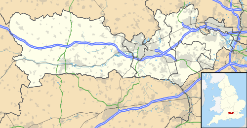 Thatcham Thatcham shown within Berkshire | |
| Area | 21.76 km2 (8.40 sq mi) |
| Population | 26,000 (2016 est.) |
| • Density | 1,195/km2 (3,100/sq mi) |
| OS grid reference | SU5167 |
| Civil parish |
|
| Unitary authority | |
| Ceremonial county | |
| Region | |
| Country | England |
| Sovereign state | United Kingdom |
| Post town | THATCHAM |
| Postcode district | RG18 and RG19 |
| Dialling code | 01635 |
| Police | Thames Valley |
| Fire | Royal Berkshire |
| Ambulance | South Central |
| EU Parliament | South East England |
| UK Parliament | |
Thatcham is a market town in the historic county of Berkshire, England, centred 3 miles (5 km) east of Newbury, 14 miles (24 km) west of Reading and 54 miles (87 km) west of London. Its population grew rapidly in the second half of the 20th century: from 5,000 in 1951 and 7,500 in 1961 to 22,824 in 2001. During World War II, Thatcham housed one of the biggest Prisoner of War camps in the South, known as camp 1001.
Thatcham straddles the River Kennet, the Kennet and Avon Canal, the A4 and the course of a Roman road. It is served by Thatcham railway station on the line between Reading and Newbury. Local employment is chiefly in light industrial premises, sales and distribution, retail and public sectors; see also West Berkshire, its district. Although there are many primary schools in the area, the only secondary school in Thatcham is the Kennet School.
History
The area has evidence of occupation dating from prehistoric times[1] and was listed in the Guinness Book of Records as the strongest claimant to being the oldest continuously inhabited place in Britain. The well-preserved remains of a Mesolithic settlements dating from 8400 to 7700 BC[1] have been found in its vicinity. Evidence also exists of Bronze and Iron Age settlements and of a Roman settlement.
The name may have been derived from that of a Saxon chief called Tace (or perhaps Tac or Tec), who established a village in around AD 500.[2][3] The settlement might have been known as Taceham - ham meaning hamlet in Saxon. However the first written reference[2] in c.975 records it as Thaecham. The Thaec comes from the Saxon þæc or thaec meaning roof-covering. By the time of Domesday Norman Conquest in 1086 the name had altered slightly to Taceham before going through several minor changes until the current form was adopted in the 16th century.
The town had a period of great prosperity around 1304[4] when the Chapel of St. Thomas the Martyr on the A4, now called the Old Bluecoat School, was constructed. At that time the population was larger than Newbury's[2] but it declined as a result of the Black Death in 1348. There is a Norman parish church of St. Mary, which was largely reconstructed in 1857. This is believed to be built on the same site as an earlier Saxon church. It was also previously known as St. Luke's.
In 1121 King Henry I founded the great Abbey of Reading and endowed it with many gifts of land, including the Manor of Thatcham. At the same time Thatcham Hundred ceased to exist: the western part was transferred to Faircross Hundred, and the remainder to the Hundred of Reading.
In 1141 Thatcham Church, previously the property of the Diocese of Salisbury, was granted to Reading Abbey by the Empress Matilda, who at the same time confirmed her father's gift of the manor to the Abbey.
July 2007 flooding

On 20 July 2007 parts of Thatcham were flooded during a period of sustained heavy rain, during which three times the average July monthly rainfall hit the town in just 24 hours. While the rivers did not overtop, the quantity of water flowing down the hills from Cold Ash and Bucklebury made many roads impassable and stranded hundreds of pupils at Kennet School who tried to wade with rope across Stoney Lane. About 1,100 properties were affected; many residents moved out into mobile homes.[5]
Geography
Thatcham has a site of Special Scientific Interest (SSSI) just to the south of the town, called Thatcham Reed Beds.[6]
Thatcham ratings
The name "Thatcham" is brand-associated with the approval ratings for car security systems issued by the Motor Insurance Repair Research Centre based near the town (see link below). For instance, "Thatcham Cat 1" (or just "Cat 1") is the approval for a combined car alarm and immobiliser, "Thatcham Cat 2" is for a standalone immobiliser and "Thatcham Cat 3" is for additional physical security devices such as steering wheel locks.
Demography
| Output area | Homes owned outright | Owned with a loan | Socially rented | Privately rented | Other | km² roads | km² water | km² domestic gardens | Usual residents | km² |
|---|---|---|---|---|---|---|---|---|---|---|
| Civil parish | 2,640 | 4,629 | 1,439 | 1,160 | 65 | 0.871 | 0.676 | 2.323 | 25,267 | 21.78 |
Transport
Rail
Thatcham railway station is the only railway station within the town. The station falls on the Reading to Taunton line, with regular services between Reading and Newbury are operated by Great Western Railway, as well as between London Paddington and Bedwyn. The station saw 581,000 passengers in the 2016–17 period.
Road
The town is split in the middle by the A4, which runs between London and Bristol, in a east-west direction. This road has been superseded as a long distance route by the M4 motorway which runs almost parallel to the A4, located 3 miles (4.8 km) north. The closest junction to the town is the Chieveley interchange at Junction 13.
Sports and leisure

Thatcham is home to non-league football club Thatcham Town, who play their matches at Waterside Park located 300 metres (330 yd) south of the town's railway station. The club reached the final of the FA Vase in the 2017–18 season, becoming the first Berkshire side to reach a national cup final. Their highest league finish is fifth in the Southern League Division One South & West, the eighth tier of English football, set in the 2010–11 season. The club won the Berks & Bucks Senior Cup in 1975.
Thatcham Town Cricket Club are based in the town, playing their matches 500 metres (550 yd) west of the Broadway – the town centre – on Brownsfield Road, next to the Town Council offices.
The Henwick Worthy Sports Ground is the home of the Newbury and Thatcham Hockey Club and the Thatcham Rugby Union Football Club. The ground is approximately 37 acres (15 hectares) in size, located in the west of the town. Henwick plays host to a number of amateur and youth sports, such as football and rugby.
Town twinning
Thatcham is twinned with:
See also
References
- 1 2 Thatcham: an historic town in a changing world | Thatcham Historical Society
- 1 2 3 Thatcham, Berks, and its manors. Edited and arranged for publication by James Parker : Barfield, Samuel, 1829-1899 : Free Download & Streaming : Internet Archive
- ↑ "Archived copy". Archived from the original on 20 November 2008. Retrieved 18 October 2009.
- ↑ http://thatchamhistoricalsociety.org.uk/content/thatchams-growth-prosperity-under-royal-protection%5Bpermanent+dead+link%5D
- ↑ "Briefing note: Flooding and Thatcham" (PDF). West Berkshire Council.
- ↑ Magic Map Application
- ↑ Key Statistics: Dwellings; Quick Statistics: Population Density; Physical Environment: Land Use Survey 2005
External links
| Wikivoyage has a travel guide for Newbury and Thatcham. |
| Wikimedia Commons has media related to Thatcham. |
Berkshire Portal | |
| Unitary authorities | |
| Major settlements | |
| Topics | |
| Authority control |
|---|