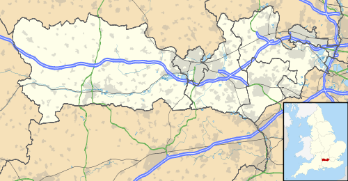
Hermitage, Berkshire
| Hermitage | |
|---|---|
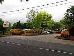 Garden Centre | |
 Hermitage Hermitage shown within Berkshire | |
| Area | 6.36 km2 (2.46 sq mi) |
| Population | 1,943 (2011 census)[1] |
| • Density | 306/km2 (790/sq mi) |
| Civil parish |
|
| Unitary authority | |
| Ceremonial county | |
| Region | |
| Country | England |
| Sovereign state | United Kingdom |
| Post town | NEWBURY |
| Postcode district | RG18 |
| Dialling code | 01635 |
| Police | Thames Valley |
| Fire | Royal Berkshire |
| Ambulance | South Central |
| EU Parliament | South East England |
Hermitage is a village and civil parish, near to Newbury, in the English county of Berkshire. The civil parish is made up of a number of settlements: Hermitage village, Little Hungerford and Wellhouse.
Location
The village is focussed residentially on the B4009, 5 miles (8.0 km) north east of Newbury in the heart of the North Wessex Downs, an Area of Outstanding Natural Beauty. It is thus surrounded by protected woodlands and undulating fields providing a few elevated viewpoints.
Transport
Roads
Access to the M4 is within 5 miles (and it also passes through the edge of the parish), which links Wales to London, and the A34 passes through the edge of the parish, a main transport artery from the north to the south of the United Kingdom.
Public transport
From 1882 until the 1960s the village had a minor halt station. The station was erected by the Didcot, Newbury and Southampton Railway, also the name of its line. As of 18 February 2013, Hermitage is served by buses 6 and 6A from Newbury.[2]
Amenities
It has a general store and post office, a church (Holy Trinity) and two public houses (The Fox and The White Horse of Hermitage). There is a large garden centre with a cafe, bonsai shop, pool & spa concession and lawnmower centre. The village primary school feeds into the Downs School. The area is predominantly agricultural and the main local employers are the village school, village pre-school, the garden centre and a small light industrial unit housing several small businesses. In addition, there is the Royal School of Military Survey at Denison Barracks housing a small garrison of troops and their families. However, though generally referred to as being in Hermitage, it is actually just across the border in the Curridge area of Chieveley parish.
History
On Oare Common are two curvilinear ditched enclosures which are probably of prehistoric date, although it has also been suggests that they may represent a motte and bailey castle. The hill fort of Grimsbury Castle is in Grimsbury Wood. A folly stands at its centre. A 2nd and 3rd century Roman villa of some pretensions was discovered at Wellhouse in Victorian times. Between 1917 and 1918 D. H. Lawrence lived in Hermitage.[3]
Housing expansion
Three early 21st century housing areas were completed in the north and south. These include Forest Edge and Hermitage Green.
Demography
| Output area | Homes owned outright | Owned with a loan | Socially rented | Privately rented | Other | Usual residents | km² |
|---|---|---|---|---|---|---|---|
| Civil parish | 192 | 312 | 66 | 104 | 16 | 1943 | 6.36 |
References
- 1 2 Key Statistics: Dwellings; Quick Statistics: Population Density; Physical Environment: Land Use Survey 2005
- ↑ http://www.newburyanddistrict.co.uk/pdf/jan13/connect-service-6-and-6A-%28effective-from-18-Feb-2013%29.pdf
- ↑ Online exhibitions - The University of Nottingham. Nottingham.ac.uk. Retrieved on 2013-07-17.
External links
| Wikimedia Commons has media related to Hermitage, Berkshire. |