Tidmarsh
| Tidmarsh | |
|---|---|
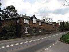 The Tithe Barn | |
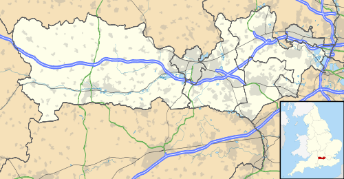 Tidmarsh Tidmarsh shown within Berkshire | |
| Area | 7.02 km2 (2.71 sq mi) |
| Population | 501 (2011 census including Sulham)[1] |
| • Density | 71/km2 (180/sq mi) |
| OS grid reference | SU6374 |
| Civil parish |
|
| Unitary authority | |
| Ceremonial county | |
| Region | |
| Country | England |
| Sovereign state | United Kingdom |
| Post town | READING |
| Postcode district | RG8 |
| Dialling code | 0118 |
| Police | Thames Valley |
| Fire | Royal Berkshire |
| Ambulance | South Central |
| EU Parliament | South East England |
| UK Parliament | |
Tidmarsh is a village and civil parish in West Berkshire England. Its development is mainly residential or agricultural and centred on the A340 road between Pangbourne and Theale. Its rural area is bounded by the M4 motorway to the south. It is centred 1.5 miles (2.4 km) south of Pangbourne, 5.5 miles (8.9 km) west of Reading and 40 miles (64 km) west of London. Though marsh is in its name, most of the parish is elevated more than 5 metres above the level of the Pang.
Geography
Its civil parish council is unusually in this district shared and is Tidmarsh with Sulham. Further east, Sulham Woods separate the villages from Tilehurst, the western suburb of Reading.
Its elevation ranges between 42m (north-east) and 85m (western projection) AOD. The vast majority of the parish (more than 90%) is at more than five metres above the Pang. Much of the main street is between 1 and 10 metres above the large stream's level.
Woodland covers less than a tenth of its total area but about a quarter of the western or south-western projection which has the highest parts.[2]
The River Pang flows north through the village on its way to join the River Thames at Pangbourne. The river flows through the Moor Copse Nature Reserve, in December 2006 doubled in size, to about 140 acres (0.57 km2).[3] The Tidmarsh and Sulham circular walk, of length about 2.5 miles, passes through the reserve and both villages.
Its 21st century development has included housing at the north end of the village, Strachey Close.
History
The Tidmarsh section of the A340 is thought to follow the Roman road from the Roman Town of Calleva Atrebatum in Silchester parish (about 7 mi or 11 km south), either to Dorchester-on-Thames (about 10 mi or 16 km north) or a river-crossing at Pangbourne.
Tidmarsh has two main listed buildings by age. The most conspicuous is the 13th century Greyhound Pub, now reopened following a serious fire in 2005. The other is the much-rebuilt 12th Century church is dedicated to St Laurence. The Norman doorway of the church of the date of its construction is particularly noted in its listing as is a "very rare 13th century polygonal apse". It includes 13th century lancet windows to left and right.[4] It has a listing entry in the highest category under the statutory grading, Grade I.
Notable residents
These include author Lytton Strachey (1880-1932) and the painter Dora Carrington (1893-1932). Carrington painted the Greyhound Pub sign in the village. Rex Partridge, renamed Ralph by the Bloomsbury set, also settled at Tidmarsh and formed a very "Bloomsbury" trio with Lytton and Dora.[5]

Demography
| Output area | Homes owned outright | Owned with a loan | Socially rented | Privately rented | Other | km² roads | km² water | km² domestic gardens | Usual residents | km² |
|---|---|---|---|---|---|---|---|---|---|---|
| Civil parish | 83 | 81 | 2 | 35 | 5 | 0.130 | 0.071 | 0.171 | 501 | 7.02 |
Footnotes
- 1 2 Key Statistics: Dwellings; Quick Statistics: Population Density; Physical Environment: Land Use Survey 2005
- ↑ Historic England. "Details from listed building database (1289074)". National Heritage List for England. Retrieved 16 December 2014.
- ↑ Natural World Spring 2007 p10: "Ratty's Paradise joins eight new reserves"
- ↑ Historic England. "Details from listed building database (1287940)". National Heritage List for England. Retrieved 16 December 2014.
- ↑ https://www.telegraph.co.uk/finance/property/period-property/7827396/The-Mill-at-Tidmarsh-bohemian-days-leave-a-rich-legacy.html
External links
| Wikimedia Commons has media related to Tidmarsh. |