Upper Lambourn
| Upper Lambourn | |
|---|---|
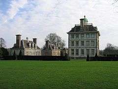 Ashdown House | |
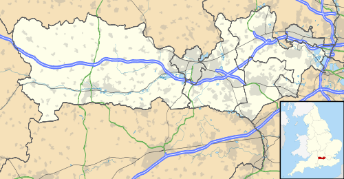 Upper Lambourn Upper Lambourn shown within Berkshire | |
| OS grid reference | SU312803 |
| Civil parish | |
| Unitary authority | |
| Ceremonial county | |
| Region | |
| Country | England |
| Sovereign state | United Kingdom |
| Police | Thames Valley |
| Fire | Royal Berkshire |
| Ambulance | South Central |
| EU Parliament | South East England |
| UK Parliament | |
Upper Lambourn is a small village in the county of Berkshire, England.[1] The village is situated in the civil parish of Lambourn ,[2] and is 1.2 miles (2 km) to the north-west of the village of Lambourn, just off the Lambourn to Shrivenham road. The parish is within the district of West Berkshire, close to the point where the counties of Berkshire, Oxfordshire and Wiltshire meet.
Geography
Upper Lambourn has several sites of Special Scientific Interest (SSSI) near the village, these include the famous prehistoric Seven Barrows.[3] Other sites of SSSI near the village are Croker's Hole, Parkfarm Down and Fognam Chalk Quarry.[4][5][6] Ashdown House, of which part of the grounds is also an SSSI, lies approximately 2.5 miles (4.0 km) to the north-west, on the Shrivenham road.[7]
See also
References
- ↑ Ordnance Survey: Landranger map sheet 174 Newbury & Wantage (Hungerford & Didcot) (Map). Ordnance Survey. 2014. ISBN 9780319228739.
- ↑ "Ordnance Survey Election Maps". www.ordnancesurvey.co.uk. Ordnance Survey. Retrieved 3 April 2016.
- ↑ "Magic Map Application". Magic.defra.gov.uk. Retrieved 2017-03-09.
- ↑ "Magic Map Application". Magic.defra.gov.uk. Retrieved 2017-03-08.
- ↑ "Magic Map Application". Magic.defra.gov.uk. Retrieved 2017-03-09.
- ↑ "Magic Map Application". Magic.defra.gov.uk. Retrieved 2017-03-09.
- ↑ "Magic Map Application". Magic.defra.gov.uk. Retrieved 2017-03-09.
External links
| Wikimedia Commons has media related to Upper Lambourn. |