Stratford-on-Avon District
| Stratford-on-Avon District | |
|---|---|
| Non-metropolitan district | |
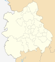
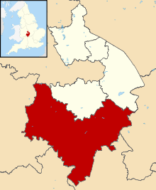 Shown within Warwickshire | |
| Sovereign state | United Kingdom |
| Constituent country | England |
| Region | West Midlands |
| Administrative county | Warwickshire |
| Admin. HQ | Stratford-upon-Avon |
| Government | |
| • Type | Non-metropolitan district |
| • Leadership: | Leader and cabinet |
| • MPs: |
Nadhim Zahawi (C) Jeremy Wright (C) |
| Area | |
| • Total | 377.6 sq mi (977.9 km2) |
| Area rank | 27th |
| Population (mid-2017 est.) | |
| • Total | 125,200 |
| • Rank | Ranked 180th |
| • Density | 330/sq mi (130/km2) |
| Time zone | UTC+0 (Greenwich Mean Time) |
| • Summer (DST) | UTC+1 (British Summer Time) |
| ONS code |
44UE (ONS) E07000221 (GSS) |
| Ethnicity (2011 Census) [1] |
97.3% White (93.6% White British) 1.3% Asian 1.0% Mixed 0.2% Black 0.1% Other |
| Religion (2011 Census) [2] |
70.3% Christian 21.2% No Religion 7.1% Religion not stated 0.3% Other Religion 0.3% Buddhist 0.2% Hindu 0.2% Muslim 0.2% Sikh 0.1% Jewish |
| Website | stratford.gov.uk |
Stratford-on-Avon is a local government district of southern Warwickshire in England.
The district is named "Stratford-on-Avon" to distinguish it from its main town of Stratford-upon-Avon where the district council is based.
The district is mostly rural and covers most of the southern half of Warwickshire. As well as Stratford, the district also includes the towns of Alcester, Southam, and Shipston-on-Stour, and the large villages of Studley and Wellesbourne.
The district was formed on 1 April 1974 by the merger of the borough of Stratford-upon-Avon, Alcester Rural District, Shipston-on-Stour Rural District, Southam Rural District and a majority of Stratford-upon-Avon Rural District.
Education
In the state sector, children start school in the school year (1 September to 31 August) in which they turn five. They stay at primary school for seven years until they are eleven. As part of Warwickshire, Stratford-on-Avon still maintains the grammar school system. In the final year of primary school, children are given the opportunity of sitting the eleven plus exam in order to compete for a place at one of the grammar schools.
The grammar schools in the district are King Edward VI, Stratford-upon-Avon Grammar School for Girls and Alcester Grammar.
The area gets the best GCSE results overall in Warwickshire.
Politics
Elections to the district council are held in three out of every four years, with one third of the 53 seats on the council being elected at each election. The Conservative party has controlled the council for most of the time since the first election in 1973, and recently has had a majority since the 2003 election. As a result of the last election in 2010 the Conservatives had 30 councillors, compared to 20 Liberal Democrats and 3 independents.[3]
Parishes and settlements
Other than Stratford-upon-Avon the district includes:
- Admington, Alcester, Alderminster, Ardens Grafton, Arlescote, Arrow, Aston Cantlow, Atherstone-on-Stour, Avon Dassett,
- Barcheston and Willington, Barton-on-the-Heath, Bearley, Beaudesert, Bidford-on-Avon, Billesley, Binton, Bishops Itchington, Brailes, Broom, Burmington, Burton Dassett, Butlers Marston
- Chadshunt, Chapel Ascote, Charlecote, Cherington and Stourton, Chesterton and Kingston, Claverdon, Clifford Chambers and Milcote, Combrook, Compton Verney, Compton Wynyates, Coughton
- Dorsington
- Ettington, Exhall
- Farnborough, Fenny Compton, Fulbrook
- Gaydon, Great Alne, Great Wolford
- Halford, Hampton Lucy, Harbury, Haselor, Henley-in-Arden, Hodnell and Wills Pastures, Honington
- Idlicote, Ilmington
- Kineton, Kinwarton
- Ladbroke, Langley, Lighthorne, Lighthorne Heath, Little Compton, Little Wolford, Long Compton, Long Itchington, Long Marston, Lower Shuckburgh, Loxley, Luddington
- Milcote, Moreton Morrell, Morton Bagot
- Napton-on-the-Hill, Newbold Pacey, Northend
- Oldberrow, Oversley Green, Oxhill
- Pillerton Hersey, Pillerton Priors, Preston Bagot, Preston-on-Stour, Priors Hardwick, Priors Marston
- Quinton
- Radbourne, Radway, Ratley and Upton
- Salford Priors, Sambourne, Shipston-on-Stour, Shotteswell, Snitterfield, Southam, Spernall, Stockton, Stoneton, Stourton and Cherington, Stratford-upon-Avon, Stretton-on-Fosse, Studley, Sutton-under-Brailes
- Tanworth-in-Arden, Temple Grafton, Tidmington, Tredington, Tysoe
- Ufton, Ullenhall, Upper Shuckburgh, Warmington, Watergall, Weethley, Welford-on-Avon, Wellesbourne, Weston-on-Avon, Whatcote, Whichford, Whitchurch, Wilmcote, Wixford, Wolverton, Wootton Wawen, Wormleighton
See also
References
- ↑ "2011 Census: Key Ethnicity Statistics Per Local Authority Area" . ONS. Retrieved 25 Dec 2012
- ↑ "2011 Census: Key Religion Statistics Per Local Authority Area" . ONS. Retrieved 25 Dec 2012
- ↑ "Stratford-On-Avon". BBC News Online. 19 April 2009. Retrieved 3 March 2011.
External links
| Boroughs or districts | |
|---|---|
| Major settlements | |
| Rivers | |
| Canals | |
| Topics | |