River Sowe
| Sowe | |
| River | |
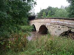 The bridge over the River Sowe near the Mill in Baginton | |
| Country | England |
|---|---|
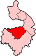
| Counties | Warwickshire, West Midlands |
| Source | |
| - location | Hookham |
| Mouth | River Avon |
| - location | Stoneleigh |
| - coordinates | 52°20′55″N 1°31′31″W / 52.34861°N 1.52528°WCoordinates: 52°20′55″N 1°31′31″W / 52.34861°N 1.52528°W |
The River Sowe is a river in Warwickshire and West Midlands, England. It is a tributary of the River Avon, and flows into it just south of Stoneleigh about 5 miles (8 km) south of Coventry. It is about 12 miles (19 km) long.[1]
The Sowe rises in Bedworth 5.5 miles (9 km) to the north of Coventry.[2][1][3] Its route takes it through Exhall near to Junction 3 of the M6 motorway and the A444 road, to the northern and then the eastern suburbs of Coventry, in particular the districts of Longford, Wood End, Walsgrave, Binley, Willenhall and near the village of Baginton.[4] Near Baginton the river has a large steep bank on its southern side and the remains of the Roman Lunt Fort have been found at the top of this bank.
There is an established local park called the Sowe Valley Footpath that runs alongside the river for 8½ miles from Hawkesbury Junction Conservation Area to Stonebridge Meadows Local Nature. It also runs through Wyken Slough Local Nature Reserve, Wyken Croft Nature Park and Stoke Floods Local Nature Reserve.[5]
Gallery
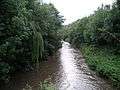 View downstream from the bridge over River Sowe near the Mill in Baginton.
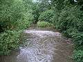 View upstream from the Baginton bridge showing the small weir and the union of the main river with a small diverted waterway from the Mill.
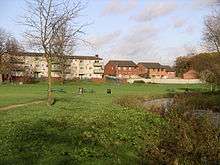 Stoke Aldermoor and Pinley Fields by the River Sowe.
References
- 1 2 http://idlersquest.blogspot.co.uk/p/the-sowe.html
- ↑ https://www.riverlevels.uk/flood-warning-river-sowe-at-bedworth#.WIfGermbWNc
- ↑ https://www.geograph.org.uk/snippet/14198
- ↑ AA Street by Street. Coventry Rugby (2nd edition (May 2003) ed.). AA Publishing. pp. 24, 32 and 40–41. ISBN 0-7495-3973-9.
- ↑ "The Sowe Valley Footpath". Coventry City Council. 2002.