Steeles Avenue
| |||||||
|---|---|---|---|---|---|---|---|
|
Peel Regional Road 15 Halton Regional Road 8 | |||||||
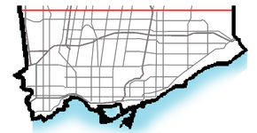 Steeles in Toronto and York Region | |||||||
| Route information | |||||||
|
Maintained by City of Toronto Region of Peel Region of Halton | |||||||
| Length | 77.3 km[1] (48.0 mi) | ||||||
| Major junctions | |||||||
| West end | Appleby Line | ||||||
|
Hurontario Street / Main Street Islington Avenue Weston Road Jane Street Keele Street Dufferin Street Bathurst Street Yonge Street Bayview Avenue Don Mills Road Warden Avenue Kennedy Road McCowan Road Markham Road | |||||||
| East end |
Scarborough-Pickering Townline / | ||||||
| Location | |||||||
| Major cities |
Toronto Vaughan Markham Brampton | ||||||
| Towns |
Milton Halton Hills | ||||||
| Highway system | |||||||
| |||||||

Steeles Avenue is an east-west street that forms the northern city limit of Toronto and the southern limit of York Region, Ontario, Canada. It stretches 77.3 km (48.0 mi) across the western and central Greater Toronto Area from Appleby Line in Milton in the west to the Toronto-Pickering city limits in the east, where it continues east into Durham Region as Taunton Road, which itself extends 58 km (36 mi) across the length of Durham Region to its boundary with Northumberland County. It is named after J. C. Steele, who owned the Green Bush Hotel on the northwest corner of the street's intersection with Yonge Street.[2] York Region refers to Steeles Avenue as Regional Road 95, but the designation is strictly internal and there are no signs posted. Steeles in Scarborough was once referred to as Scarborough Town Line.
The combination of Steeles and Taunton Road is the only arterial road to cross almost the entire Greater Toronto Area without breaks or turnoffs.
Route description
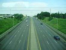
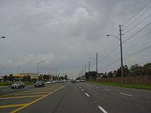
Steeles Avenue is a two-lane rural road east of York Regional Road 69 (Ninth Line). It becomes a four lane suburban road with bicycle lanes on each side from Kennedy Road to Markham Road, six lanes from Kennedy to Victoria Park Avenue, and eight lanes from Victoria Park to Highway 404. The area consists of parklands in the east end, a mix of commercial and residential in the middle, and industrial zonings near the west end. Like many other east-west arterial roads within Toronto and York Region, Steeles is divided into an east and west segment by Yonge Street.
East of Scarborough-Pickering Town Line / York-Durham Line, it becomes Taunton Road or Durham Regional Road 4.
West of Albion Road, Steeles Avenue continues into Peel Region, where it is also designated as Peel Regional Road 15. Like the section in Toronto, Steeles Avenue in Brampton has east-west segments, this time on either side of Hurontario and Main Streets. It runs through Brampton and into Halton Region, where it is also designated as Halton Regional Road 8, through the town of Milton, ending at Appleby Line. Originally, the road had a second section west of the height of the Niagara Escarpment (the location of the Crawford Lake Conservation Area), which ran from just east of Guelph Line west to the Milborough Townline on the boundary between Milton and Hamilton, but this section was renamed to Conservation Road and is thus no longer part of Steeles.
Public transit
The road is served predominantly by TTC bus routes 53 Steeles East and 60 Steeles West. Both routes turn south at Yonge Street to terminate at Finch Station on the eastern portion of the Line 1 Yonge–University subway line. There are several routes serving the portions of the road, including 7 Bathurst, 17B and 17C Birchmount, 25 Don Mills, 35A and 35B Jane, 37B Islington, 43A Kennedy, 51 Leslie, 57 Midland, 84C and 84D Sheppard West, 97B, 97C and 97F Yonge, 98A and 98C Willowdale–Senlac, 102B and 102C Markham Road, 105A Dufferin North, 107 St. Regis, 108A and 108B Driftwood, 117 Alness–Chesswood, 165 Weston Road North, 925 Don Mills Express, 927B and 927C Highway 27 Express, 935 Jane Express, 937 Islington Express, and 989 Weston Express. York Region Transit routes that run along Steeles include 3, 10, 12, 13, 20, 27, 88, 91, 96, 107, 165.
Several TTC bus routes provide service on north-south arterial roads in York Region that continue north from Toronto on a contractual basis. Steeles forms the fare zone boundary, and extra fare is required for bus riders to continue across it.
On December 17, 2017, an extension of the western portion of the Line 1 subway up to Vaughan was opened, passing through York University, with a station at Steeles called Pioneer Village, which was named after the nearby Black Creek Pioneer Village heritage museum. Unlike TTC-contracted bus routes however, no extra fare is charged when crossing Steeles on the subway, due the difficulty of implementing a payment-on-exit system.[3] MoveOntario 2020 also includes plans to extend the Yonge branch north and add a station at Steeles.
In Peel Region, Brampton Transit and Mississauga's MiWay operate several routes that travel along Steeles:
Brampton
- 11 Steeles
- 40 Central Industrial (short section)
- 10 South Industrial (short section)
- 4/4A Chinguacousy
- 3 McLaughlin
- 8 Centre
- 52 McMurchy
- 6 James Potter
- 511 Zum Steeles
Mississauga
- 103 Hurontario Express
Miway and Brampton Transit routes (3, 4, 4A, 8, 11, 51, 52, 53A/B, and 103) connect to Shoppers World Terminal at Shoppers World Mall at the northwest corner of Main Street and Steeles. Steeles Ave. East is served by route 511 Züm Steeles of Brampton's Züm bus rapid transit.
In Halton Region, Milton Transit operates a single route on a short stretch of Steeles Avenue:
- 1 Woodward/Maple
Canadian Automobile Association rating
Steeles Avenue was listed by the CAA as the "worst road in Ontario" for 2006, and as the fifth worst road in October 2007. In October 2008, it was again crowned the worst road in Ontario.[4] Reasons include potholes and general quality of surface. Soon after the results of CAA's survey were made public, some parts of the road between Dufferin Street and Bayview Avenue were resurfaced. The results of the 2009 survey listed Steeles as Ontario's worst road, for the second year in a row.
However, in 2010, Steeles Avenue was resurfaced from Yonge Street to Markham Road, with the funds coming from the federal infrastructure stimulus program, and the CAA named it the "Best Road in Ontario".[5]
Landmarks
Landmarks and notable sites along Steeles from west to east
| Landmark | Cross street | Notes | Image |
|---|---|---|---|
| Crawford Lake Conservation Area | Guelph Line | Former separate section of road west of Guelph Line now known as Conservation Road |  |
| Rattlesnake Point | Appleby Line, Guelph Line | Road now officially begins at Appleby Line |  |
| Toronto Premium Outlets | Trafalgar Road | First Premium Outlets Center in Canada | |
| Sheridan College-Davis Campus | McLaughlin Road | Sheridan’s largest campus, educating nearly 8,000 students. | 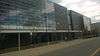 |
| Shoppers World Brampton | Hurontario Street | Road becomes Steeles West and Steeles East | 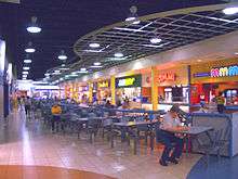 |
| Bramalea GO Station | Bramalea Road | 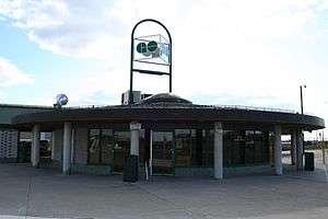 | |
| Wet 'n' Wild Toronto | Finch Avenue West | Canada's largest waterpark | |
| Black Creek Pioneer Village | Jane Street | 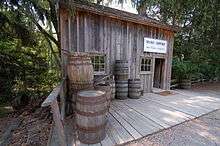 | |
| Pioneer Village station | Northwest Gate | 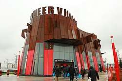 | |
| York University | Keele Street, Founders Road, Murray Ross Parkway | Toronto's second largest university | .jpg) |
| Centerpoint Mall | Yonge Street | Formerly Towne and Countrye Square | 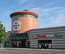 |
| Brebeuf College School | Conacher Drive | 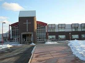 | |
| Pacific Mall | Kennedy Road | largest indoor Chinese Asian mall in North America | 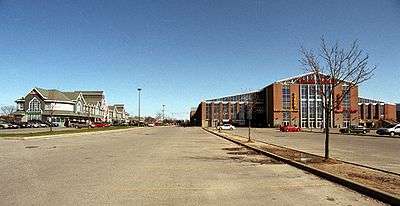 |
| Market Village | Kennedy Road, Redlea Avenue | Currently closed on March 1, 2018. To be replaced by Remington Centre | 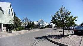 |
| Splendid China Mall | Kennedy Road, Redlea Avenue | Former Canadian Tire store | 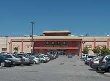 |
| Milliken GO Station | Old Kennedy Road, Silverstar Boulevard | Station moved across street from Markham to Toronto | 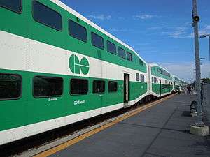 |
| Cedar Brae Golf & Country Club | Staines Road | Road enters Rouge Park | Formerly Cedar Brook Golf and Country Club c. 1922 |
References
- ↑ "Steeles Ave. route". Google Maps. Retrieved April 2, 2017.
- ↑ Toronto Archives photo
- ↑ James Bow. "A History of Subways on Bloor and Queen Streets: Celebrating the Subway's first stop in the suburbs". Transit Toronto.
- ↑ "Ontario's Worst Roads Final Results". 2007-10-04. Archived from the original on 2007-10-06. Retrieved 2007-10-06.
- ↑ Rush, Curtis (2010-10-28). "Federal infrastructure money resurfaced Steeles Ave. from Yonge St., to Markham Rd., which is now the Best Road in Ontario". The Star. Toronto. Retrieved 2010-10-28.
Major roads, highways and streets in Toronto | |||||||||
|---|---|---|---|---|---|---|---|---|---|
| North–south |
| ||||||||
| East–west |
| ||||||||
| |||||||||
| |||||||||