Harlem Valley–Wingdale station
Harlem Valley–Wingdale | ||||||||||||||||||||||||||
|---|---|---|---|---|---|---|---|---|---|---|---|---|---|---|---|---|---|---|---|---|---|---|---|---|---|---|
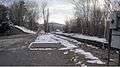
 Station from the parking lot side | ||||||||||||||||||||||||||
| Location |
Wheeler Road off of Route 22 Wingdale, NY, 12594 | |||||||||||||||||||||||||
| Coordinates | 41°38′15″N 73°34′18″W / 41.6374°N 73.5717°WCoordinates: 41°38′15″N 73°34′18″W / 41.6374°N 73.5717°W | |||||||||||||||||||||||||
| Line(s) | ||||||||||||||||||||||||||
| Platforms | 1 side platform | |||||||||||||||||||||||||
| Tracks | 1 | |||||||||||||||||||||||||
| Construction | ||||||||||||||||||||||||||
| Disabled access | Yes | |||||||||||||||||||||||||
| Other information | ||||||||||||||||||||||||||
| Fare zone | 9 | |||||||||||||||||||||||||
| History | ||||||||||||||||||||||||||
| Previous names | State Hospital (–October 30, 1977)[1] | |||||||||||||||||||||||||
| Traffic | ||||||||||||||||||||||||||
| Passengers (2007) |
39,260 | |||||||||||||||||||||||||
| Services | ||||||||||||||||||||||||||
| ||||||||||||||||||||||||||
The Harlem Valley–Wingdale (formerly State Hospital) Metro-North Railroad station serves the residents of Wingdale, New York via the Harlem Line. It is adjacent to the Harlem Valley State Hospital. Trains leave for New York City every two hours, and about every 30 minutes during rush hour. It is 69 miles (111 km) from Grand Central Terminal and travel time to Grand Central is approximately one hour, 55 minutes.
This station is the southernmost station in the Zone 9 Metro-North fare zone.
The 7.5 miles (12.1 km) distance from Harlem Valley–Wingdale to Dover Plains, the next station to the north, is the longest between two stations on the Harlem Line.
History
The station was formerly known as "State Hospital" and was a flag stop between the 1930s and 1960s.[2][3] It was built to serve the Harlem Valley State Hospital, and was expanded from a simple wooden platform to a shelter with a wood-burning stove. The Wingdale station (originally known as "Wing's station," then "South Dover station") was approximately one half mile north in the hamlet on Dutchess CR 21 (Pleasant Ridge Road). It was located near such hotels as the 1806-built Jackson Wing Inn, and the 1858-built Duell Hotel, the latter of which still stands today. In the post-World War II era, the station was reduced from a station house, to a shelter along the platform. As with most of the Harlem Line, the merger of New York Central with Pennsylvania Railroad in 1968 transformed the two stations into Penn Central Railroad stations. Penn Central's continuous financial despair throughout the 1970s forced them to turn over their commuter service to the Metropolitan Transportation Authority and abandon service north of Dover Plains. Penn Central continued to provide coal service to the hospital until it was taken over by Conrail, which continued coal service well into the 1990s. The stations were consolidated in 1977 with the State Hospital station being renamed Harlem Valley-Wingdale and the Wingdale stop being discontinued, thus transforming the station into the penultimate station on the Harlem Line,[4] until Metro-North acquired the line in 1983, and re-extended it to Wassaic in 2000.
Station layout
This station has one four-car-long high-level side platform to the east of the track.
| P Platform level |
Track 1 | ← Harlem Line toward Southeast or Grand Central (Appalachian Trail or Pawling) Harlem Line toward Wassaic (Dover Plains) → |
| Side platform, doors will open on the left or right | ||
| Street level | Exit/entrance and parking | |
Gallery
 Location of the former Wingdale shelter
References
- ↑ "Conrail's New Timetables Effective Sunday, Oct. 30". The Pawling-News Chronicle. October 26, 1977. p. 14. Retrieved August 9, 2018.
- ↑ "Harlem Division Timetable". New York Central Railroad. July 12, 1959. Retrieved April 12, 2011.
- ↑ "Harlem Division Timetable". Penn Central Railroad. February 5, 1968. Archived from the original on August 31, 2010. Retrieved April 12, 2011.
- ↑ Grogan, Louis V. (1989). The Coming of the New York and Harlem Railroad. New York: L.V. Grogan. pp. 185–188. ISBN 0-9621206-5-0.
External links
| Wikimedia Commons has media related to Harlem Valley – Wingdale (Metro-North station). |
- Metro-North Railroad - Harlem Valley-Wingdale
- List of upcoming train departure times from MTA
- Station from Google Maps Street View
- Harlem Valley-Wingdale Station; January, 1984. Photo by Seymour Fass (I Ride the Harlem Line; Facebook Page)