Sibratsgfäll
| Sibratsgfäll | ||
|---|---|---|
 | ||
| ||
 Sibratsgfäll Location within Austria
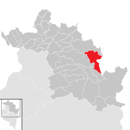
Location in the district
| ||
| Coordinates: 47°25′36″N 10°02′17″E / 47.42667°N 10.03806°ECoordinates: 47°25′36″N 10°02′17″E / 47.42667°N 10.03806°E | ||
| Country | Austria | |
| State | Vorarlberg | |
| District | Bregenz | |
| Government | ||
| • Mayor | Konrad Stadelmann | |
| Area | ||
| • Total | 29.25 km2 (11.29 sq mi) | |
| Elevation | 929 m (3,048 ft) | |
| Population (1 January 2016)[1] | ||
| • Total | 395 | |
| • Density | 14/km2 (35/sq mi) | |
| Time zone | UTC+1 (CET) | |
| • Summer (DST) | UTC+2 (CEST) | |
| Postal code | 6952 | |
| Area code | 05513 | |
| Vehicle registration | B | |
| Website | www.sibra.at | |
Sibratsgfäll is a municipality in the district of Bregenz in the Austrian state of Vorarlberg.
Geography
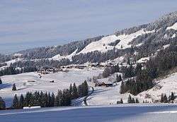
Sibratsgfäll is located in the westernmost province of Austria, Vorarlberg, in the district of Bregenz, south of Lake Constance, at an altitude of 929 meters. 46.0% of the area is forested, 34.2% of the area is mountainous (Alps). The community is located directly on the border with Germany. There are no other cadastral communities in Sibratsgfäll.
The municipality Sibratsgfäll borders on two Austrian and two German communities. These are the municipalities of Hittisau and Egg in the Austrian district of Bregenz and the Balderschwang and Oberstdorf communities in the Bavarian district of Oberallgäu.
Sibratsgfäll is a member of the German-Austrian joint project Naturpark Nagelfluhkette.
History
The Habsburgs ruled Vorarlberg's villages alternately from Tyrol and Vorderösterreich (Freiburg im Breisgau). From 1805 to 1814, this place belonged to Bavaria, then again to Austria. Sibratsgfäll has belonged to the Austrian state of Vorarlberg since its founding in 1861.
The village was part of the French occupation zone in Austria from 1945 to 1955.
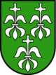
Coat of arms
The coat of arms was created in 1969, inspired by a design by the Schruns artist and heraldist Konrad Honold.
Culture
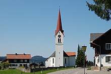
The parish church Sibratsgfäll is located north of the cemetery. It is dedicated to the Archangel Michael and belongs to the deanery of Vorderwald-Kleinwalsertal. In 1732, a chapel was first mentioned in a document. In 1805, a new church building was built and extended in 1845.
Population
| Historical population | ||
|---|---|---|
| Year | Pop. | ±% |
| 1869 | 304 | — |
| 1880 | 352 | +15.8% |
| 1890 | 289 | −17.9% |
| 1900 | 267 | −7.6% |
| 1910 | 284 | +6.4% |
| 1923 | 268 | −5.6% |
| 1934 | 270 | +0.7% |
| 1939 | 256 | −5.2% |
| 1951 | 340 | +32.8% |
| 1961 | 330 | −2.9% |
| 1971 | 308 | −6.7% |
| 1981 | 367 | +19.2% |
| 1991 | 404 | +10.1% |
| 2001 | 422 | +4.5% |
| 2011 | 393 | −6.9% |
External links
References
| Wikimedia Commons has media related to Sibratsgfäll. |