Shire of Mckinlay
| Shire of Mckinlay Queensland | |||||||||||||||
|---|---|---|---|---|---|---|---|---|---|---|---|---|---|---|---|
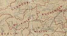
 Location within Queensland | |||||||||||||||
| Population | 796 (2016 census)[1] | ||||||||||||||
| • Density | 0.019471/km2 (0.05043/sq mi) | ||||||||||||||
| Established | 1891 | ||||||||||||||
| Area | 40,880.3 km2 (15,784.0 sq mi) | ||||||||||||||
| Mayor | Belinda Murphy | ||||||||||||||
| Council seat | Julia Creek | ||||||||||||||
| Region | North West Queensland | ||||||||||||||
| State electorate(s) | Traeger | ||||||||||||||
| Federal Division(s) | Kennedy | ||||||||||||||
|
| |||||||||||||||
| Website | Shire of Mckinlay | ||||||||||||||
| |||||||||||||||
The Shire of Mckinlay is a local government area in north-western Queensland, Australia.
It covers an area of 40,880.3 square kilometres (15,784.0 sq mi), and has existed as a local government entity since 1891. The shire economy is based on beef production and mining. BHP Billiton operate the Cannington mine in the shire, extracting silver, lead and zinc.
History
The Mackinlay Division was created on 9 December 1891 out of parts of Boulia and Cloncurry under the Divisional Boards Act 1887.
With the passage of the Local Authorities Act 1902, Mackinlay Division became the Shire of Mackinlay on 31 March 1903.
In 1932, the spelling of the shire's name was altered to be Shire of Mckinlay, as the shire was named after the explorer John McKinlay.[2]
On 24 July 1930, it was abolished and a new Shire of Mckinlay was formed from parts of the Shires of Cloncurry, Mckinlay, Winton and Wyangarie (Richmond).
Towns and localities
The Shire of McKinlay includes the following settlements:
Amenities
The Mckinlay Shire Council operates public libraries at Julia Creek and McKinlay.[3]
Chairmen and mayors
- 1927: W. M. Allison
Population
| Year | Population |
|---|---|
| 1933 | 1,899 |
| 1947 | 1,633 |
| 1954 | 1,647 |
| 1961 | 2,132 |
| 1966 | 1,701 |
| 1971 | 1,582 |
| 1976 | 1,468 |
| 1981 | 1,477 |
| 1986 | 1,446 |
| 1991 | 1,306 |
| 1996 | 1,423 |
| 2001 | 1,358 |
| 2006 | 1,351 |
| 2011 | 1,050 |
| 2016 | 796 |
References
- ↑ Australian Bureau of Statistics (27 June 2017). "McKinlay (S)". 2016 Census QuickStats. Retrieved 4 May 2018.

- ↑ "McKinlay Shire". Queensland Places. Centre for the Government of Queensland, University of Queensland. Retrieved 18 September 2013.
- ↑ "McKinlay Shire Council". Public Libraries Connect. State Library of Queensland. 20 September 2017. Archived from the original on 6 February 2018. Retrieved 6 February 2018.
- ↑ "2008 McKinlay Shire - Mayoral Election - Election Summary". results.ecq.qld.gov.au. Retrieved 2017-12-04.
- ↑ "2012 McKinlay Shire - Mayoral Election - Election Summary". results.ecq.qld.gov.au. Retrieved 2017-12-04.
- ↑ "2016 McKinlay Shire Council - Mayoral Election - Election Summary". results.ecq.qld.gov.au. Retrieved 2017-12-04.
Coordinates: 20°39′24″S 141°44′44″E / 20.65667°S 141.74556°E