Shaksgam River
Coordinates: 36°05′N 76°39′E / 36.083°N 76.650°E
| Shaksgam River | |
|---|---|
 | |
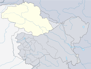 The mouth of Shaksgam River with respect to Gilgit-Baltistan | |
| Country | India (disputed), China |
| Provinces | Jammu and Kashmir, Xinjiang |
| Physical characteristics | |
| Main source |
Karakoram range Gasherbrum Glaciers 35°37′34″N 77°18′03″E / 35.62603°N 77.300913°E |
| River mouth |
Yarkand River 36°37′36″N 76°12′11″E / 36.626697°N 76.202991°E |
The Shaksgam River (Chinese: 沙克斯干河; pinyin: Shakesigan He, Hindi: शक्सगाम नदी, Urdu: دریائے شکسگام) is a left tributary of the Yarkand River. The river is also known as the Kelechin River and Muztagh River.[1] It rises in the Gasherbrum, Urdok, Staghar, Singhi and Kyagar Glaciers in the Karakoram.[2] It then flows in a general northwestern direction parallel to the Karakoram ridge line in the Shaksgam Valley. The river valley was explored in 1889 by Francis Younghusband (who referred to the Shaksgam as the Oprang).,[3] and again in 1926 by Kenneth Mason, who confirmed the sources of the river.[4]
The upper river valley is used by climbers approaching the north face of K2. The approach requires a crossing of the river, which is hazardous. Between its confluence with the Shimshal Braldu River and its confluence with the Oprang River the river forms the border between China and Pakistan-administered Kashmir.[1] The area is used as winter pastures by yak herdsmen from the village of Shimshal.[5] Historically, the bed of the Yarkand river where Shaksgam joins it, was used for cultivation by farmers from the state of Hunza. The rulers of Hunza are said to have obtained these "territorial rights to Raskam" in the distant past.[6][7]
Administratively, the Chinese part of the valley is within the southernmost portions of Yarkand County (the source) and the Tashkurgan Tajik Autonomous County (lower course).
The average annual temperature in the region can fall below freezing.
See also
References
- 1 2 US Bureau of Intelligence and Research International Boundary Study No. 85 (1968) Archived 2012-02-11 at the Wayback Machine.
- ↑ Hewitt, K. (1982) Natural dams and outburst floods of the Karakoram Himalaya Archived 2011-07-21 at the Wayback Machine.
- ↑ Younghusband, Francis (1896). The Heart of a Continent. pp. 200ff.
- ↑ Mason, Kenneth (1928). Exploration of the Shaksgam Valley and Aghil ranges, 1926. pp. 62ff.
- ↑ 2000 Mock & O'Neil Oprang Expedition Report
- ↑ Dani, Ahmad Hasan (1998), "The Western Himalayan States", in M. S. Asimov; C. E. Bosworth, History of Civilizations of Central Asia, Vol. IV, Part 1 — The age of achievement: A.D. 750 to the end of the fifteenth century — The historical, social and economic setting, UNESCO, pp. 215–225, ISBN 978-92-3-103467-1
- ↑ Mehra, Parshotam (1992), An "agreed" frontier: Ladakh and India's northernmost borders, 1846-1947, Oxford University Press, pp. 95–97
External links