Hunza River
| Hunza River | |
|---|---|
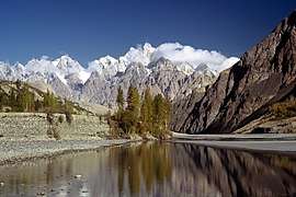 Hunza river near Gulmit | |
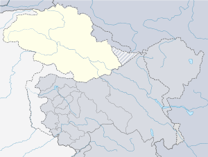  | |
| Country | Pakistan |
| Province | Gilgit-Baltistan |
| Physical characteristics | |
| River mouth |
Gilgit River 35°55′N 74°22′E / 35.917°N 74.367°E |
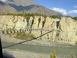
Hunza River(Urdu: دریائے ہنزہ) is the principal river of Hunza in Gilgit–Baltistan, Pakistan It is formed by the confluence of the Chapursan and Khunjerab nalas (gorges) which are fed by glaciers. It is joined by the Gilgit River and the Naltar River, before it flows into the Indus River.
The river cuts through the Karakoram range, flowing from north to south. The Karakoram Highway (N-35) runs along the Hunza River valley, switching to the Khunjerab River valley at the point of confluence, eventually reaching the Khunjerab Pass at the border with China Xinjiang.
The river is dammed for part of its route.[1]
The Attabad landslide disaster in January 2010 completely blocked the Hunza Valley. A new lake — now called the Attabad Lake or Gojal Lake — [2] which extends 30 kilometers and rose to a depth of 400 feet, was formed as the Hunza River backed-up.[3] The landslide completely covered sections of the Karakoram Highway.[3]
See also
References
- ↑ "Pictorial – Some spectacular photographs of the dammed Hunza River". Pamir Times. Retrieved 27 May 2013.
- ↑ "Gojal Lake Hazard", Pamir Times, Islamabad, 21 July 2015
- 1 2 Michael Bopp; Judie Bopp (May 2013). "Needed: a second green revolution in Hunza" (PDF). HiMaT. p. 4. Retrieved 26 November 2015. Karakorum Area Development Organization (KADO), Aliabad
External links
![]()
Coordinates: 35°55′N 74°22′E / 35.917°N 74.367°E