Kaptai Upazila
| Kaptai Sub-District কাপ্তাই | |
|---|---|
| Upazila | |
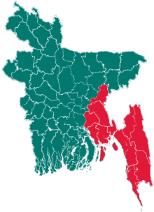
 Kaptai Sub-District Location in Bangladesh | |
| Coordinates: 22°30′N 92°13′E / 22.500°N 92.217°ECoordinates: 22°30′N 92°13′E / 22.500°N 92.217°E | |
| Country |
|
| Division | Chittagong Division |
| District | Rangamati District |
| Area | |
| • Total | 259 km2 (100 sq mi) |
| Population (2001) | |
| • Total | 66,135 |
| • Density | 260/km2 (660/sq mi) |
| Time zone | UTC+6 (BST) |
| Postal code | 4530 |
| Website | Official Map of Kaptai |
Kaptai (Bengali: কাপ্তাই) is an Upazila of Rangamati District in the Division of Chittagong, Bangladesh.[1]
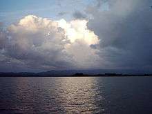
Notable landmarks are the Karnaphuli Hydroelectric Power Station, the only Hydro-electric power plant of Bangladesh. The Kaptai Dam, built for this purpose on the Karnaphuli River, created the Kaptai Lake, the largest man-made dam in Bangladesh.
Geography
Kaptai is located at 22°30′00″N 92°13′00″E / 22.5000°N 92.2167°E . It has 12992 households and total area 259 km².
Demographics
At the 2001 Bangladesh census, Kaptai had a population of 66,135. Males constituted 55.45% of the population, and females 44.55%. The population of those aged 18 and older was 32,352. The average literacy rate was 49.9% (7+ years).[2]
Points of interest
Karnaphuli Paper Mills
It is one of the greatest paper mills in Asia. It streams alongside Karnaphuli river. The distance between Chittagong and the mill is forty eight kilometers. [3]
Kaptai National Park
It situated at Rangamati. It was established in 1999 and its area is 5,464.78 hectares(13,498.0 Acres).
- Navy camp picnic spot
- Joom picnic spot
Waggachara Tea Estate
It is situated on the bank of the Karnaphuli river. It takes one and half hour to reach there from the city Chittagong. [4]
Administration
Kaptai has 5 Unions/Wards, 10 Mauzas/Mahallas, and 144 villages.[5] The names of the unions given below,
- Chandraghona
- Chitmarang
- Kaptai
- Raikhali
- Waggya [6]
See also
References
- ↑ Atikur Rahman (2012), "Kaptai Upazila", in Sirajul Islam and Ahmed A. Jamal, Banglapedia: National Encyclopedia of Bangladesh (Second ed.), Asiatic Society of Bangladesh
- ↑ "Population Census Wing, BBS". Archived from the original on 2005-03-27. Retrieved November 10, 2006.
- ↑ "Karnaphuli paper mill in Kaptai".
- ↑ "Kaptai tea garden".
- ↑ http://www.bbs.gov.bd/RptZillaProfile.aspx Bangladesh Bureau of Statistics, geographic unit, 2001 census
- ↑ "The names of the unions".
External links
- Sifatul Quader Chowdhury (2012), "Karnafuli Hydropower Station", in Sirajul Islam and Ahmed A. Jamal, Banglapedia: National Encyclopedia of Bangladesh (Second ed.), Asiatic Society of Bangladesh
- Nuruddin Mahmood and M Abdul Hai (2012), "Kaptai Lake", in Sirajul Islam and Ahmed A. Jamal, Banglapedia: National Encyclopedia of Bangladesh (Second ed.), Asiatic Society of Bangladesh
| Upazila/Thana: | ||
|---|---|---|