Lakshmipur Sadar Upazila
| Lakshmipur / Laxmipur লক্ষ্মীপুর সদর | |
|---|---|
| Upazila | |
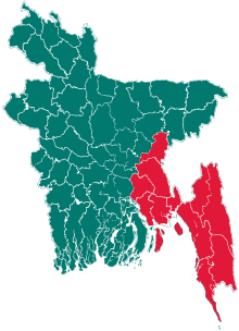
 Lakshmipur / Laxmipur Location in Bangladesh | |
| Coordinates: 22°57′N 90°49.5′E / 22.950°N 90.8250°ECoordinates: 22°57′N 90°49.5′E / 22.950°N 90.8250°E | |
| Country |
|
| Division | Chittagong Division |
| District | Lakshmipur District |
| Area | |
| • Total | 514.78 km2 (198.76 sq mi) |
| Population (2011) | |
| • Total | 684,425[1] |
| Time zone | UTC+6 (BST) |
| Chowpalli | 3707 |
| Website | Official Map of Lakshmipur Sadar |
Lakshmipur or Laxmipur Sadar (Bengali: লক্ষ্মীপুর সদর) is an Upazila of Lakshmipur District in the Division of Chittagong, Bangladesh.
Geography
Lakshmipur Sadar is located at 22°57′00″N 90°49′30″E / 22.9500°N 90.8250°E. It has 95,664 households and total area 514.78 km².
Demographics
As of the 1991 Bangladesh census, Lakshmipur Sadar has a population of 525188. Males constitute 50.27% of the population, and females 49.73%. This Upazila's eighteen up population is 244605. Lakshmipur Sadar has an average literacy rate of 37.8% (7+ years). National average of 32.4% literate.[2]
_%E2%80%94_in_Bangladesh..jpg)
Administration
Lakshmipur Sadar Upazila is divided into Lakshmipur Municipality and 19 union parishads: Bangakha, Basikpur, Bhabaniganj, Chandraganj, Char Ruhita, Charramani Mohan, Charsai, Dakshin Hamchadi, Dalal Bazar, Datta Para, Dighali দিঘলী, Hajir Para, Kushakhali, Laharkandi, Mandari মান্দারী, Parbati Nagar, Shak Char, Uttar Hamchadi, and Uttar Joypur. The union parishads are subdivided into 226 mauzas and 258 villages.
Lakshmipur Municipality was established in 1976.[3] It is subdivided into 12 wards and 22 mahallas.[4]
Transport
- Moju Chowdhury Hat, transport hub
- Z1405 Lakshmipur-Ramgoti Road
- Z1432 Mandari-Dasher Hat- Maijdee Road
- N809 Lakshmipur-Bhola-Barisal Road
- Z1422 Lakshmipur-Ramgonj Road
- R140 Lakshmipur-Noakhali-Chandpur Road
Education
- Rawshan Jahan Eastern Medical College & Hospital, South Maguri, Dattapara
- Panpara High School, Ramgonj
- Pal Para D M High School
- hazir hat millat academi
- Khaguria High School
- Rupa Chara sofi ullah High School
- Dighali High School
- Janata Degree college
- Lakshmipur Government Girl's High School
- Bhabanigonj M.L. High School
- Dalal Bazar Pilot High School
- Lakshmipur Adarsha Samad Government High School
- Lakshmipur Collegiate High School
- Lakshmipur Government College
- Lakshmipur Government Women College
- Bhabanigonj College
- Dattapara Degree College
- Radhapur High School
- Mandari High School
- Lakshmipur Private Polytechnic Institute(LPPI)
- Titer kandi Bhuyanerhat Fazil Madrasha
- Rampur High School
Religious institutions
Mosques 731, temples 3, churches 1, dargahs 1, tombs 3. Noted religious institutions: Majupur Matka Mosque, South Shanki Bhanga Jameh Masjid, Tita Khan Mosque, Syedpur Jami Mosque, Madhu Banu Mosque, Shree Shree Govinda Mahaprovu Jeu Akhra, Joseph Church, Lakshmi Narayan Baishnab Math.
NGO
- BRAC
- ASA
- COAST, Lakshmipur
- VOICE
- SHDO
- CWDA
- SWDA
- TWSDA
- SURGE
Newspapers and periodicals
Online newspaper
- www.raipurnews24.com (2016)
- www.lakshmipur24.com (2012)
Daily
- Lakshmipur Kantha (1995)
- Al-Chist (1995)
- Malancha,
- Rob,
Weekly
- Natun Samaj (Natun Desh, 1973)
- Elan (1982)
- Natun Path (1987)
- Damama (1992)
♦Bortoman Laxmipur (2012)
Monthly
- Lakshmipur Barta (1989)
- Bangla Awaj (2000)
- Unnoyan Barta (2012) NGO Based
Defunct newspapers and periodicals
- Mukti Bani (1928)
- weekly Ganamukh (1973)
- Chetana (1969)
- weekly Ananda Akash (1995)
- Prachchhad (1984)
- Chhayapath
- Kabita Barta
See also
References
- ↑
- ↑ "Population Census Wing, BBS". Archived from the original on 2005-03-27. Retrieved November 10, 2006.
- 1 2 Nazimuddin Mahmud (2012). "Lakshmipur Sadar Upazila". In Sadequr Rahman Jewell. Banglapedia: National Encyclopedia of Bangladesh (Second ed.). Asiatic Society of Bangladesh.
- ↑ "District Statistics 2011: Lakshimpur" (PDF). Bangladesh Bureau of Statistics. Retrieved July 25, 2014.
| Upazila/Thana: | ||
|---|---|---|