Ramu Upazila
| Ramu রামু | |
|---|---|
| Upazila | |
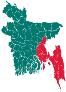
 Ramu Location in Bangladesh | |
| Coordinates: 21°27.5′N 92°6′E / 21.4583°N 92.100°ECoordinates: 21°27.5′N 92°6′E / 21.4583°N 92.100°E | |
| Country | Bangladesh |
| Division | Chittagong Division |
| District | Cox's Bazar District |
| Area | |
| • Total | 391.71 km2 (151.24 sq mi) |
| Population (1991) | |
| • Total | 167,480 |
| • Density | 428/km2 (1,110/sq mi) |
| Time zone | UTC+6 (BST) |
| Website | http://ramu.coxsbazar.gov.bd |
Ramu (Bengali: রামু) is an Upazila of Cox's Bazar District in the Division of Chittagong, Bangladesh.[1]
Geography
Ramu is located at 21°27′30″N 92°06′00″E / 21.4583°N 92.1000°E . It has 26964 households and the area of the town is 22.03 km2.
Demographics
As of the 1991 Bangladesh census, Ramu has a population of 167480. Males constitute 51.41% of the population, and females 48.59%. This Upazila's eighteen up population is 74742. Ramu has an average literacy rate among town people is 34%., and the national average of 32.4% literate. Ramu thana was transformed into an upazila in 1983. It consists of 9 union parishads, 39 mouzas and 102 villages.[2]
Administration
Ramu has 9 unions or wards, 39 Mauzas/Mahallas, and 102 villages. According to tradition Ramu, Cox's Bazar got its name from the Ramu dynasty of the Arakan. It came under the Mughals when Chittagong was captured by them and during that time a thirteen-foot-high Buddha statue was found.
References
- ↑ Chowdhury, Muhammad Tawhid Hossain (2012). "Ramu Upazila". In Islam, Sirajul; Jamal, Ahmed A. Banglapedia: National Encyclopedia of Bangladesh (Second ed.). Asiatic Society of Bangladesh.
- ↑ "Table S04: Selected Statistics By Thana, 1991 (Enumerated)". Bangladesh Government. Archived from the original on 27 March 2005. Retrieved 25 August 2018.
| Upazila/Thana: | ||
|---|---|---|