Barura Upazila
| Barura বরুড়া | |
|---|---|
| Upazila | |
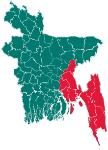
 Barura Location in Bangladesh | |
| Coordinates: 23°22.5′N 91°3.5′E / 23.3750°N 91.0583°ECoordinates: 23°22.5′N 91°3.5′E / 23.3750°N 91.0583°E | |
| Country |
|
| Division | Chittagong Division |
| District | Comilla District |
| Government | |
| • Former Member of parliament Bangladesh. | Late Mr. AKM Abu-Taher (1932 – 23 September 2004) |
| • An advocate of female education, a philanthropist and social worker. | Begum Faizunnesa Choudhurani (1834–1903) |
| Area | |
| • Upazila | 242 km2 (93 sq mi) |
| • Metro | 0 km2 (0 sq mi) |
| Elevation | 21 meters above sea level. m (68.8976 ft) |
| Population (2016) | |
| • Upazila | 473,590 |
| • Density | 2,000/km2 (5,100/sq mi) |
| Time zone | UTC+6 (BST) |
| 3560 | 3560 |
| Website | Official Map of Barura |
Barura (Bengali: বরুড়া) is an Upazila of Comilla District in the Division of Chittagong, Bangladesh.[1]
Geography
Barura is located at 23°22′30″N 91°03′30″E / 23.3750°N 91.0583°E . It has 52,851 households and a total area of 241.65 km².
Demographics
According to the 1991 Bangladesh census, Barura had a population of 310,778.[2]
Notable residents
- AKM Nazir Ahmed, politician, was born in Boalia village c. 1939.[3]
See also
References
- ↑ AKM Jasim Uddin (2012). "Barura Upazila". In Sirajul Islam and Ahmed A. Jamal. Banglapedia: National Encyclopedia of Bangladesh (Second ed.). Asiatic Society of Bangladesh.
- ↑ "Population Census Wing, BBS". Archived from the original on 2005-03-27. Retrieved November 10, 2006.
- ↑ "Nayeb-e-Ameer of Jamaat-e-Islami, Professor Nazir Ahmed Dies at 74". Bangladesh Jamaat-e-Islami. Archived from the original on October 8, 2014. Retrieved October 28, 2017.
| Upazila/Thana: | ||
|---|---|---|
This article is issued from
Wikipedia.
The text is licensed under Creative Commons - Attribution - Sharealike.
Additional terms may apply for the media files.