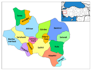
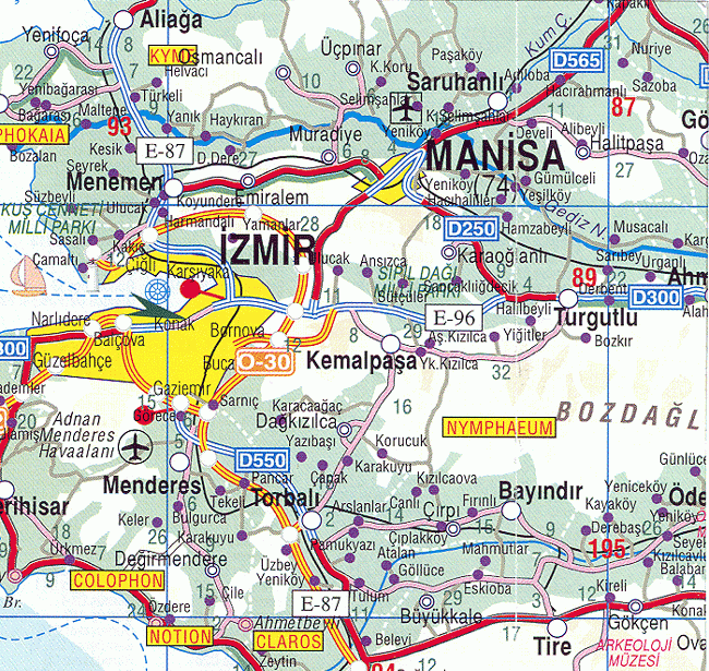
Saruhanlı
| Saruhanlı | |
|---|---|
| District | |
 Location of Saruhanlı within Turkey. | |
 Saruhanlı Location of Saruhanlı | |
| Coordinates: 38°44′N 27°34′E / 38.733°N 27.567°E | |
| Country |
|
| Region | Aegean |
| Province | Manisa |
| Area[1] | |
| • District | 839.37 km2 (324.08 sq mi) |
| Elevation | 32 m (105 ft) |
| Population (2012)[2] | |
| • Urban | 15,781 |
| • District | 54,160 |
| • District density | 65/km2 (170/sq mi) |
| Time zone | UTC+2 (EET) |
| • Summer (DST) | UTC+3 (EEST) |
| Postal code | 45xxx |
| Area code(s) | 236 |
| Licence plate | 45 |
| Website | www.saruhanli.bel.tr |
Saruhanlı is a town and district of Manisa Province in the Aegean region of Turkey. According to the 2000 census, population of the district is 68,134 of which 13,025 live in the town of Saruhanlı.[3] The district covers an area of 839 km2 (324 sq mi),[4] and the town lies at an elevation of 32 m (105 ft).
Notes
- ↑ "Area of regions (including lakes), km²". Regional Statistics Database. Turkish Statistical Institute. 2002. Retrieved 2013-03-05.
- ↑ "Population of province/district centers and towns/villages by districts - 2012". Address Based Population Registration System (ABPRS) Database. Turkish Statistical Institute. Retrieved 2013-02-27.
- ↑ Turkish Statistical Institute. "Census 2000, Key statistics for urban areas of Turkey" (in Turkish). Archived from the original (XLS) on 2007-07-22. Retrieved 2009-04-04.
- ↑ Statoids. "Statistical information on districts of Turkey". Archived from the original on 2010-05-26. Retrieved 2009-04-04.
References
- Falling Rain Genomics, Inc. "Geographical information on Saruhanlı, Turkey". Archived from the original on 2012-11-02. Retrieved 2009-04-04.
External links
Coordinates: 38°44′03″N 27°33′57″E / 38.73417°N 27.56583°E
This article is issued from
Wikipedia.
The text is licensed under Creative Commons - Attribution - Sharealike.
Additional terms may apply for the media files.