Salisbury Township, Lancaster County, Pennsylvania
| Salisbury Township, Lancaster County, Pennsylvania | |
|---|---|
| Township | |
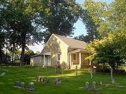 Bart Friends Meeting House Salisbury Township | |
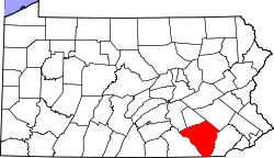
 Map of Lancaster County highlighting Salisbury Township | |
| Country | United States |
| State | Pennsylvania |
| County | Lancaster |
| Settled | 1712 |
| Incorporated | 1729 |
| Government | |
| • Type | Board of Supervisors |
| Area[1] | |
| • Total | 41.95 sq mi (108.64 km2) |
| • Land | 41.76 sq mi (108.16 km2) |
| • Water | 0.19 sq mi (0.49 km2) |
| Population (2010) | |
| • Total | 11,062 |
| • Estimate (2016)[2] | 11,408 |
| • Density | 273.18/sq mi (105.48/km2) |
| Time zone | UTC-5 (Eastern (EST)) |
| • Summer (DST) | UTC-4 (EDT) |
| Area code(s) | 717 |
| FIPS code | 42-071-67568 |
| Historical population | |||
|---|---|---|---|
| Census | Pop. | %± | |
| 2000 | 10,012 | — | |
| 2010 | 11,062 | 10.5% | |
| Est. 2016 | 11,408 | [2] | 3.1% |
| U.S. Decennial Census[3] | |||
Salisbury Township is a township in east central Lancaster County, Pennsylvania, United States. The population was 11,062 at the 2010 census.[4]
History
Salisbury Township was carved out of Pequea Township in 1729 and named for Salisbury, England. Though still mostly agricultural, it has been a center of commerce and industry of Lancaster County, with nickel mining beginning in 1718 and a more profitable limestone mining beginning soon after.
White Chimneys was listed on the National Register of Historic Places in 1975.[5]
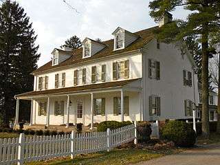 White Chimneys
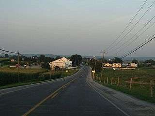 Near White Horse
Geography
According to the United States Census Bureau, the township has a total area of 41.9 square miles (108.4 km²), all of it land. The village of Gap, Pennsylvania is located wholly within Salisbury Township.
Demographics
As of the census[6] of 2000, there were 10,012 people, 3,027 households, and 2,530 families residing in the township. The population density was 239.2 people per square mile (92.3/km²). There were 3,112 housing units at an average density of 74.4/sq mi (28.7/km²). The racial makeup of the township was 97.47% White, 0.76% African American, 0.12% Native American, 0.49% Asian, 0.04% Pacific Islander, 0.34% from other races, and 0.78% from two or more races. Hispanic or Latino of any race were 1.08% of the population.
There were 3,027 households, out of which 44.5% had children under the age of 18 living with them, 74.2% were married couples living together, 5.7% had a female householder with no husband present, and 16.4% were non-families. 13.7% of all households were made up of individuals, and 5.5% had someone living alone who was 65 years of age or older. The average household size was 3.29 and the average family size was 3.64.
In the township the population was spread out, with 34.8% under the age of 18, 8.6% from 18 to 24, 27.8% from 25 to 44, 20.2% from 45 to 64, and 8.5% who were 65 years of age or older. The median age was 30 years. For every 100 females, there were 102.5 males. For every 100 females age 18 and over, there were 99.4 males.
The median income for a household in the township was $45,795, and the median income for a family was $49,623. Males had a median income of $36,644 versus $22,153 for females. The per capita income for the township was $16,268. About 7.1% of families and 9.3% of the population were below the poverty line, including 11.6% of those under age 18 and 15.2% of those age 65 or over.
References
- ↑ "2016 U.S. Gazetteer Files". United States Census Bureau. Retrieved Aug 14, 2017.
- 1 2 "Population and Housing Unit Estimates". Retrieved June 9, 2017.
- ↑ "Census of Population and Housing". Census.gov. Retrieved June 4, 2016.
- ↑ https://factfinder.census.gov/faces/nav/jsf/pages/community_facts.xhtml?src=bkmk#
- ↑ National Park Service (2010-07-09). "National Register Information System". National Register of Historic Places. National Park Service.
- ↑ "American FactFinder". United States Census Bureau. Retrieved 2008-01-31.
External links
Coordinates: 39°59′00″N 76°01′59″W / 39.98333°N 76.03306°W