Peach Bottom, Pennsylvania
| Peach Bottom, Pennsylvania | |
|---|---|
| Unincorporated community | |
 Peach Bottom | |
| Coordinates: 39°45′03″N 76°13′33″W / 39.75083°N 76.22583°WCoordinates: 39°45′03″N 76°13′33″W / 39.75083°N 76.22583°W | |
| Country | United States |
| State | Pennsylvania |
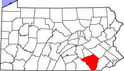
| County | Lancaster |
| Township | Fulton |
| Elevation | 141 ft (43 m) |
| Time zone | UTC-5 (Eastern (EST)) |
| • Summer (DST) | UTC-4 (EDT) |
| ZIP code | 17563 |
| Area code(s) | 717 |
| GNIS feature ID | 1183417[1] |
Peach Bottom, Pennsylvania is an unincorporated village in Fulton Township, Lancaster County, in the state of Pennsylvania in the United States. It lies on the east bank of the Susquehanna River.
The original town of Peach Bottom was located across the river in York County. With the construction of the Columbia and Port Deposit Railroad up the east side of the Susquehanna (1866-1868), a station was built on the Lancaster County side, near the mouth of Peters Creek, from which Peach Bottom could be reached by ferry. This was known as Peach Bottom Station.
The Peach Bottom Railway had terminals at both Peach Bottom and Peach Bottom Station; a planned bridge to connect them was never built. The line on the east side became the Lancaster, Oxford and Southern Railroad and on the west side, the Maryland and Pennsylvania Railroad.
When the Conowingo Dam was built (1926-1928), the Columbia and Port Deposit was relocated higher up the hillside, and both Peach Bottom and Peach Bottom Station were submerged. The present village was built a short distance southeast of the site of Peach Bottom Station.
It is the site of a post office (ZIP code 17563).
The Peach Bottom Nuclear Generating Station lies across the river, on the site of the original town. In 2016, the U.S. Nuclear Regulatory Commission (NRC) estimated that a major fire at the spent fuel pool at the Peach Bottom Nuclear Generating Station would displace an estimated 3.46 million people from 31,000 square kilometers of contaminated land, while a study conducted at Princeton University suggested that the number of displaced people could go as high as 18.1 million people.[2]
Peach Bottom marks the Mason–Dixon line.
Notable residents
- Christopher McDougall – Writer and journalist, author of Born to Run: A Hidden Tribe, Superathletes, and the Greatest Race the World Has Never Seen (2009)[3][4][5]
- Bryan Cutler – Majority whip Pennsylvania House Representatives
References
- ↑ "Peach Bottom". Geographic Names Information System. United States Geological Survey.
- ↑ Stone, Richard (23 May 2016). "Spent fuel fire on U.S. soil could dwarf impact of Fukushima". Science | AAAS. Retrieved 30 May 2016.
- ↑ Stauffer, Cindy (2015-05-23). "Barefoot running guru launches new book at Lancaster fundraiser with parkour, knife throwing". LNP. Retrieved 2016-10-22.
- ↑ Rutter, Jon (2015-04-08). "Natural Born Heroes' finds barefoot runner authoring World War II adventure". LNP. Retrieved 2016-10-22.
- ↑ Leighton, Kelly (2015-04-06). "Running guru Chris McDougall to kick off book tour in Lancaster". Pennlive.com. Retrieved 2016-10-18.