Eden Township, Lancaster County, Pennsylvania
| Eden Township, Pennsylvania | |
|---|---|
| Township | |
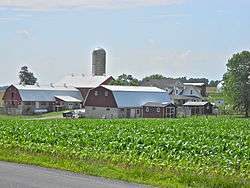 Farm near the township office | |
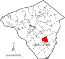 Map of Lancaster County, Pennsylvania highlighting Eden Township | |
 Map of Lancaster County, Pennsylvania | |
| Country | United States |
| State | Pennsylvania |
| County | Lancaster |
| Settled | 1830 |
| Incorporated | 1855 |
| Government | |
| • Type | Board of Supervisors |
| Area[1] | |
| • Total | 12.57 sq mi (32.55 km2) |
| • Land | 12.53 sq mi (32.46 km2) |
| • Water | 0.03 sq mi (0.08 km2) |
| Population (2010) | |
| • Total | 2,094 |
| • Estimate (2016)[2] | 2,172 |
| • Density | 173.29/sq mi (66.90/km2) |
| Time zone | UTC-5 (Eastern (EST)) |
| • Summer (DST) | UTC-4 (EDT) |
| Area code(s) | 717 |
| FIPS code | 42-071-22336 |
| Website | Eden Township |
| Historical population | |||
|---|---|---|---|
| Census | Pop. | %± | |
| 2000 | 1,856 | — | |
| 2010 | 2,094 | 12.8% | |
| Est. 2016 | 2,172 | [2] | 3.7% |
| U.S. Decennial Census[3] | |||
Eden Township is a township in southeastern Lancaster County, Pennsylvania, United States. At the 2010 census the population was 2,094.[4] It is part of the Solanco School District.
History
Eden Township was named for the furnace at Mount Eden.[5]
What is now Eden Township was part of Sadsbury, Chester County before the formation of Lancaster County.
In 1744, Sadsbury Township was split into two; the western part was organized as Bart Township and the eastern part remained Sadsbury Township. In 1854, Bart Township was split into two, with the western part organized as Eden Township, and the eastern part remaining Bart Township.[5]
Geography
According to the U.S. Census Bureau, the township has a total area of 12.4 square miles (32 km2), all of it land.
Demographics
As of the census[6] of 2000, there were 1,856 people, 578 households, and 476 families residing in the township. The population density was 149.4 people per square mile (57.7/km²). There were 606 housing units at an average density of 48.8/sq mi (18.8/km²). The racial makeup of the township was 98.81% White, 0.48% Black or African American, 0.11% Asian, 0.05% Pacific Islander, 0.11% from other races, and 0.43% from two or more races. 0.97% of the population were Hispanic or Latino of any race.
There were 578 households, out of which 43.4% had children under the age of 18 living with them, 72.8% were married couples living together, 5.7% had a female householder with no husband present, and 17.5% were non-families. 14.0% of all households were made up of individuals, and 6.6% had someone living alone who was 65 years of age or older. The average household size was 3.21 and the average family size was 3.57.
In the township the population was spread out, with 34.1% under the age of 18, 10.1% from 18 to 24, 25.9% from 25 to 44, 21.8% from 45 to 64, and 8.2% who were 65 years of age or older. The median age was 30 years. For every 100 females, there were 99.8 males. For every 100 females age 18 and over, there were 95.2 males.
The median income for a household in the township was $44,620, and the median income for a family was $47,857. Males had a median income of $34,917 versus $21,638 for females. The per capita income for the township was $16,764. About 7.5% of families and 8.9% of the population were below the poverty line, including 11.2% of those under age 18 and 6.0% of those age 65 or over.
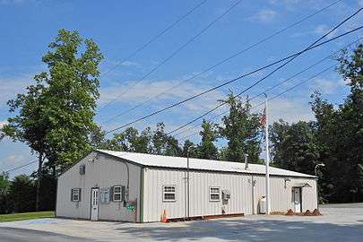 Township office
 Sign in the township office parking lot on the hitching rail for Amish buggies
References
- ↑ "2016 U.S. Gazetteer Files". United States Census Bureau. Retrieved Aug 14, 2017.
- 1 2 "Population and Housing Unit Estimates". Retrieved June 9, 2017.
- ↑ "Census of Population and Housing". Census.gov. Retrieved June 4, 2016.
- ↑ https://factfinder.census.gov/faces/nav/jsf/pages/community_facts.xhtml?src=bkmk#
- 1 2 Everets & Stewart, Historical Atlas of Lancaster Co. Pennsylvania Illustrated, 1875, p. XVI.
- ↑ "American FactFinder". United States Census Bureau. Archived from the original on 2013-09-11. Retrieved 2008-01-31.
Coordinates: 39°55′00″N 76°06′59″W / 39.91667°N 76.11639°W