Conewago, Pennsylvania
| Conewago, Pennsylvania | |
|---|---|
| Unincorporated community | |
 Conewago, Pennsylvania | |
| Coordinates: 40°9′29″N 76°39′37″W / 40.15806°N 76.66028°WCoordinates: 40°9′29″N 76°39′37″W / 40.15806°N 76.66028°W | |
| Country | United States |
| State | Pennsylvania |
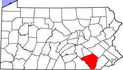
| County | Lancaster |
| Township | West Donegal |
| Elevation | 420 ft (130 m) |
| Time zone | UTC-5 (Eastern (EST)) |
| • Summer (DST) | UTC-4 (EDT) |
| Area code(s) | 717 |
| GNIS feature ID | 1203322[1] |
Conewago is an unincorporated community in West Donegal Township in Lancaster County, Pennsylvania, United States. Conewago is located at the intersection of Zeager Road and Bossler Road near Conewago Creek.[2]
References
- ↑ "Conewago". Geographic Names Information System. United States Geological Survey.
- ↑ Lancaster County, Pennsylvania Highway Map (PDF) (Map). PennDOT. 2012. Retrieved August 29, 2013.
This article is issued from
Wikipedia.
The text is licensed under Creative Commons - Attribution - Sharealike.
Additional terms may apply for the media files.