Sainte-Hélène-de-Chester, Quebec
| Sainte-Hélène-de-Chester | |
|---|---|
| Municipality | |
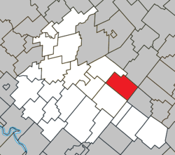 Location within Arthabaska RCM. | |
 Sainte-Hélène-de-Chester Location in southern Quebec. | |
| Coordinates: 46°02′N 71°42′W / 46.033°N 71.700°WCoordinates: 46°02′N 71°42′W / 46.033°N 71.700°W[1] | |
| Country |
|
| Province |
|
| Region | Centre-du-Québec |
| RCM | Arthabaska |
| Constituted | January 1, 1859 |
| Government[2] | |
| • Mayor | Lionel Fréchette |
| • Federal riding | Richmond—Arthabaska |
| • Prov. riding | Drummond–Bois-Francs |
| Area[2][3] | |
| • Total | 84.10 km2 (32.47 sq mi) |
| • Land | 83.96 km2 (32.42 sq mi) |
| Population (2011)[3] | |
| • Total | 358 |
| • Density | 4.3/km2 (11/sq mi) |
| • Pop 2006-2011 |
|
| Time zone | UTC−5 (EST) |
| • Summer (DST) | UTC−4 (EDT) |
| Postal code(s) | G0P 1H0 |
| Area code(s) | 819 |
| Highways |
|
| Website |
www |
Sainte-Hélène-de-Chester is a municipality located in the Centre-du-Québec region of Quebec, Canada.
It was formerly a township municipality named Chester-Est, but it changed its name and its status on May 3, 2008.[4]
The old Sainte-Hélène-de-Chester and Trottier Mill were two former small towns within this municipality.
Sources
References
- ↑ Reference number 401316 of the Commission de toponymie du Québec (in French)
- 1 2 Geographic code 39035 in the official Répertoire des municipalités (in French)
- 1 2 "(Code 2439035) Census Profile". 2011 census. Statistics Canada. 2012.
- ↑ http://www.stat.gouv.qc.ca/publications/referenc/pdf2008/modif_mai08.pdf%5Bpermanent+dead+link%5D
Places adjacent to Sainte-Hélène-de-Chester, Quebec | ||||||||||
|---|---|---|---|---|---|---|---|---|---|---|
| ||||||||||
| Cities | |
|---|---|
| Municipalities | |
| Parishes | |
| Townships | |
| |
This article is issued from
Wikipedia.
The text is licensed under Creative Commons - Attribution - Sharealike.
Additional terms may apply for the media files.