Saint-Samuel, Quebec
| Saint-Samuel | |
|---|---|
| Municipality | |
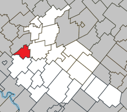 Location within Arthabaska RCM. | |
 Saint-Samuel Location in southern Quebec. | |
| Coordinates: 46°04′N 72°13′W / 46.067°N 72.217°WCoordinates: 46°04′N 72°13′W / 46.067°N 72.217°W[1] | |
| Country |
|
| Province |
|
| Region | Centre-du-Québec |
| RCM | Arthabaska |
| Constituted | March 9, 1878 |
| Government[2] | |
| • Mayor | René Mongrain |
| • Federal riding | Richmond—Arthabaska |
| • Prov. riding | Drummond–Bois-Francs |
| Area[2][3] | |
| • Total | 44.40 km2 (17.14 sq mi) |
| • Land | 43.36 km2 (16.74 sq mi) |
| Population (2011)[3] | |
| • Total | 743 |
| • Density | 17.1/km2 (44/sq mi) |
| • Pop 2006-2011 |
|
| Postal code(s) | G0Z 1G0 |
| Area code(s) | 819 |
| Website |
www |
Saint-Samuel is a municipality located in the Centre-du-Québec region of Quebec, Canada.
References
Places adjacent to Saint-Samuel, Quebec | |
|---|---|
| Cities | |
|---|---|
| Municipalities | |
| Parishes | |
| Townships | |
| |
This article is issued from
Wikipedia.
The text is licensed under Creative Commons - Attribution - Sharealike.
Additional terms may apply for the media files.