Drummond Regional County Municipality
| Drummond | |
|---|---|
| Regional county municipality | |
 | |
| Coordinates: 45°53′N 72°29′W / 45.883°N 72.483°WCoordinates: 45°53′N 72°29′W / 45.883°N 72.483°W[1] | |
| Country |
|
| Province |
|
| Region | Centre-du-Québec |
| Effective | January 1, 1982 |
| County seat | Drummondville |
| Government[2] | |
| • Type | Prefecture |
| • Prefect | Jean-Pierre Vallée |
| Area[2][3] | |
| • Total | 1,627.20 km2 (628.27 sq mi) |
| • Land | 1,600.62 km2 (618.00 sq mi) |
| Population (2011)[3] | |
| • Total | 98,681 |
| • Density | 61.7/km2 (160/sq mi) |
| • Pop 2006-2011 |
|
| • Dwellings | 45,249 |
| Time zone | UTC−5 (EST) |
| • Summer (DST) | UTC−4 (EDT) |
| Area code(s) | 819 |
| Website |
www |
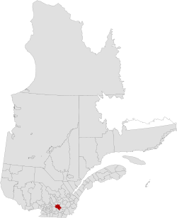
Drummond is a regional county municipality in the Centre-du-Québec region of Quebec, Canada. The seat is Drummondville.
Subdivisions
There are 18 subdivisions within the RCM:[2]
|
|
|
|
|
Demographics
Mother tongue language from Canada 2006 Census
| Language | Population | Pct (%) |
|---|---|---|
| French only | 87140 | 95.70% |
| English only | 1165 | 1.28% |
| Both English and French | 275 | 0.30% |
| Other languages | 2475 | 2.72% |
Transportation
Access Routes
Highways and numbered routes that run through the municipality, including external routes that start or finish at the county border:[4]
See also
References
- ↑ Reference number 141104 of the Commission de toponymie du Québec (in French)
- 1 2 3 Ministère des Affaires municipales, des Régions et de l'Occupation du territoire: Drummond Regional County Municipality
- 1 2 2011 Statistics Canada Census Profile: Drummond Regional County Municipality, Quebec
- ↑ Official Transport Quebec Road Map
Adjacent Counties & Equivalent Territories | |
|---|---|
| Regional county municipalities and equivalent territories | |
|---|---|
| Municipalities | |
This article is issued from
Wikipedia.
The text is licensed under Creative Commons - Attribution - Sharealike.
Additional terms may apply for the media files.