Saint-Siméon, Eure
| Saint-Siméon | |
|---|---|
| Commune | |
 | |
 Saint-Siméon Location within Normandy region  Saint-Siméon | |
| Coordinates: 49°17′09″N 0°31′15″E / 49.2858°N 0.5208°ECoordinates: 49°17′09″N 0°31′15″E / 49.2858°N 0.5208°E | |
| Country | France |
| Region | Normandy |
| Department | Eure |
| Arrondissement | Bernay |
| Canton | Beuzeville |
| Government | |
| • Mayor (2008–2014) | Daniel Reculard |
| Area1 | 7.49 km2 (2.89 sq mi) |
| Population (2008)2 | 312 |
| • Density | 42/km2 (110/sq mi) |
| Time zone | UTC+1 (CET) |
| • Summer (DST) | UTC+2 (CEST) |
| INSEE/Postal code | 27603 /27560 |
| Elevation |
70–164 m (230–538 ft) (avg. 132 m or 433 ft) |
|
1 French Land Register data, which excludes lakes, ponds, glaciers > 1 km2 (0.386 sq mi or 247 acres) and river estuaries. 2 Population without double counting: residents of multiple communes (e.g., students and military personnel) only counted once. | |
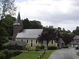
Saint-Siméon is a commune in the Eure department in Normandy in northern France.
Population
| Historical population | ||
|---|---|---|
| Year | Pop. | ±% |
| 1962 | 221 | — |
| 1968 | 239 | +8.1% |
| 1975 | 213 | −10.9% |
| 1982 | 236 | +10.8% |
| 1990 | 282 | +19.5% |
| 1999 | 278 | −1.4% |
| 2008 | 312 | +12.2% |
See also
References
| Wikimedia Commons has media related to Saint-Siméon (Eure). |
This article is issued from
Wikipedia.
The text is licensed under Creative Commons - Attribution - Sharealike.
Additional terms may apply for the media files.