Beaubray
| Beaubray | |
|---|---|
| Commune | |
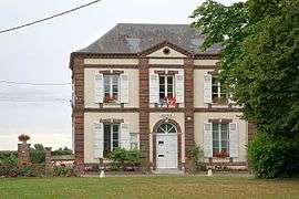 The town hall in Beaubray | |
 Beaubray Location within Normandy region  Beaubray | |
| Coordinates: 48°54′47″N 0°54′48″E / 48.9131°N 0.9133°ECoordinates: 48°54′47″N 0°54′48″E / 48.9131°N 0.9133°E | |
| Country | France |
| Region | Normandy |
| Department | Eure |
| Arrondissement | Évreux |
| Canton | Conches-en-Ouche |
| Intercommunality | Pays de Conches |
| Government | |
| • Mayor (2008–2014) | Denis Cavelier |
| Area1 | 15.43 km2 (5.96 sq mi) |
| Population (2008)2 | 282 |
| • Density | 18/km2 (47/sq mi) |
| Time zone | UTC+1 (CET) |
| • Summer (DST) | UTC+2 (CEST) |
| INSEE/Postal code | 27047 /27190 |
| Elevation |
127–192 m (417–630 ft) (avg. 175 m or 574 ft) |
|
1 French Land Register data, which excludes lakes, ponds, glaciers > 1 km2 (0.386 sq mi or 247 acres) and river estuaries. 2 Population without double counting: residents of multiple communes (e.g., students and military personnel) only counted once. | |
Beaubray is a commune in the Eure department in Normandy in northern France.
Population
| Historical population | ||
|---|---|---|
| Year | Pop. | ±% |
| 1962 | 215 | — |
| 1968 | 227 | +5.6% |
| 1975 | 252 | +11.0% |
| 1982 | 222 | −11.9% |
| 1990 | 254 | +14.4% |
| 1999 | 266 | +4.7% |
| 2008 | 282 | +6.0% |
See also
References
| Wikimedia Commons has media related to Beaubray. |
| Authority control |
|---|
This article is issued from
Wikipedia.
The text is licensed under Creative Commons - Attribution - Sharealike.
Additional terms may apply for the media files.