Bourg-Beaudouin
| Bourg-Beaudouin | |
|---|---|
| Commune | |
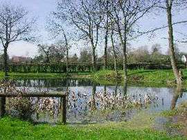 The lake in Bourg-Beaudouin | |
 Bourg-Beaudouin Location within Normandy region  Bourg-Beaudouin | |
| Coordinates: 49°23′13″N 1°18′28″E / 49.3869°N 1.3078°ECoordinates: 49°23′13″N 1°18′28″E / 49.3869°N 1.3078°E | |
| Country | France |
| Region | Normandy |
| Department | Eure |
| Arrondissement | Les Andelys |
| Canton | Romilly-sur-Andelle |
| Intercommunality | L'Andelle |
| Government | |
| • Mayor (2008–2014) | Philippe Halot |
| Area1 | 5.33 km2 (2.06 sq mi) |
| Population (2008)2 | 741 |
| • Density | 140/km2 (360/sq mi) |
| Time zone | UTC+1 (CET) |
| • Summer (DST) | UTC+2 (CEST) |
| INSEE/Postal code | 27104 /27380 |
| Elevation |
89–155 m (292–509 ft) (avg. 135 m or 443 ft) |
|
1 French Land Register data, which excludes lakes, ponds, glaciers > 1 km2 (0.386 sq mi or 247 acres) and river estuaries. 2 Population without double counting: residents of multiple communes (e.g., students and military personnel) only counted once. | |
Bourg-Beaudouin is a commune in the Eure department in Normandy in northern France.
Population
| Historical population | ||
|---|---|---|
| Year | Pop. | ±% |
| 1962 | 312 | — |
| 1968 | 323 | +3.5% |
| 1975 | 343 | +6.2% |
| 1982 | 446 | +30.0% |
| 1990 | 624 | +39.9% |
| 1999 | 675 | +8.2% |
| 2008 | 741 | +9.8% |
See also
References
External links
| Wikimedia Commons has media related to Bourg-Beaudouin. |
| Authority control |
|---|
This article is issued from
Wikipedia.
The text is licensed under Creative Commons - Attribution - Sharealike.
Additional terms may apply for the media files.