Hortelã
| Hortelã | |
|---|---|
 | |
| Coordinates: 16°36′40″N 24°21′11″W / 16.611°N 24.353°WCoordinates: 16°36′40″N 24°21′11″W / 16.611°N 24.353°W | |
| Country | Cape Verde |
| Island | São Nicolau |
| Municipality | Tarrafal de São Nicolau |
| Civil parish | São Francisco de Assis |
| Population (2010)[1] | |
| • Total | 181 |
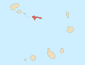
Hortelã is a settlement in the western part of the island of São Nicolau, Cape Verde. In 2010 its population was 181. It is situated at the southern foot of Monte Gordo, 5 km north of Tarrafal de São Nicolau and 6 km west of Ribeira Brava.
See also
References
- ↑ "2010 Census results". Instituto Nacional de Estatística Cabo Verde (in Portuguese). 24 November 2016.
The island of São Nicolau | ||||||
|---|---|---|---|---|---|---|
| Ribeira Brava |
|  | ||||
| Tarrafal de São Nicolau |
| |||||
| Mountains | ||||||
| Other topics | ||||||
This article is issued from
Wikipedia.
The text is licensed under Creative Commons - Attribution - Sharealike.
Additional terms may apply for the media files.