Romagnat
| Romagnat | |
|---|---|
| Commune | |
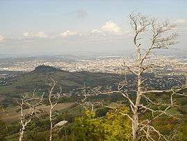 | |
 Romagnat Location within Auvergne-Rhône-Alpes region  Romagnat | |
| Coordinates: 45°43′48″N 3°06′04″E / 45.730°N 3.101°ECoordinates: 45°43′48″N 3°06′04″E / 45.730°N 3.101°E | |
| Country | France |
| Region | Auvergne-Rhône-Alpes |
| Department | Puy-de-Dôme |
| Arrondissement | Clermont-Ferrand |
| Canton | Aubière |
| Intercommunality | Clermont Auvergne Métropole |
| Government | |
| • Mayor (2014–2020) | Laurent Brunmurol[1] |
| Area1 | 16.84 km2 (6.50 sq mi) |
| Population (2012[2])2 | 8,013 |
| • Density | 480/km2 (1,200/sq mi) |
| Time zone | UTC+1 (CET) |
| • Summer (DST) | UTC+2 (CEST) |
| INSEE/Postal code | 63307 /63540 |
| Elevation |
391–837 m (1,283–2,746 ft) (avg. 468 m or 1,535 ft) |
|
1 French Land Register data, which excludes lakes, ponds, glaciers > 1 km2 (0.386 sq mi or 247 acres) and river estuaries. 2 Population without double counting: residents of multiple communes (e.g., students and military personnel) only counted once. | |
Romagnat is a commune in the Puy-de-Dôme department in Auvergne in central France.
Twin towns
See also
References
- ↑ List of mayors of Puy-de-Dôme, 2014. Retrieved from fr.wikipedia on 2014-06-09
- ↑ 2012 Census, Insee
| Wikimedia Commons has media related to Romagnat. |
This article is issued from
Wikipedia.
The text is licensed under Creative Commons - Attribution - Sharealike.
Additional terms may apply for the media files.