Saint-Gervazy
- Not to be confused with Saint-Gervasy in the Gard department.
| Saint-Gervazy | |
|---|---|
| Commune | |
 | |
 Saint-Gervazy Location within Auvergne-Rhône-Alpes region  Saint-Gervazy | |
| Coordinates: 45°24′54″N 3°12′58″E / 45.415°N 3.216°ECoordinates: 45°24′54″N 3°12′58″E / 45.415°N 3.216°E | |
| Country | France |
| Region | Auvergne-Rhône-Alpes |
| Department | Puy-de-Dôme |
| Arrondissement | Issoire |
| Canton | Brassac-les-Mines |
| Intercommunality | Lembron Val d'Allier |
| Government | |
| • Mayor (2001–2008) | Bernard Jourlin |
| Area1 | 14.23 km2 (5.49 sq mi) |
| Population (2006)2 | 294 |
| • Density | 21/km2 (54/sq mi) |
| Time zone | UTC+1 (CET) |
| • Summer (DST) | UTC+2 (CEST) |
| INSEE/Postal code | 63356 /63340 |
| Elevation |
458–790 m (1,503–2,592 ft) (avg. 500 m or 1,600 ft) |
|
1 French Land Register data, which excludes lakes, ponds, glaciers > 1 km2 (0.386 sq mi or 247 acres) and river estuaries. 2 Population without double counting: residents of multiple communes (e.g., students and military personnel) only counted once. | |


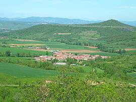
Saint-Gervazy is a commune in the Puy-de-Dôme department in Auvergne in central France.
See also
References
| Wikimedia Commons has media related to Saint-Gervazy. |
This article is issued from
Wikipedia.
The text is licensed under Creative Commons - Attribution - Sharealike.
Additional terms may apply for the media files.