Nohanent
| Nohanent | |
|---|---|
| Commune | |
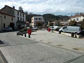 "Place de la Farge" square | |
 Nohanent Location within Auvergne-Rhône-Alpes region  Nohanent | |
| Coordinates: 45°48′31″N 3°03′20″E / 45.8086°N 3.0556°ECoordinates: 45°48′31″N 3°03′20″E / 45.8086°N 3.0556°E | |
| Country | France |
| Region | Auvergne-Rhône-Alpes |
| Department | Puy-de-Dôme |
| Arrondissement | Clermont-Ferrand |
| Canton | Cébazat |
| Intercommunality | Clermont Auvergne Métropole |
| Government | |
| • Mayor (2014–2020) | Laurent Ganet |
| Area1 | 4.2 km2 (1.6 sq mi) |
| Population (2014[1])2 | 2,139 |
| • Density | 510/km2 (1,300/sq mi) |
| Time zone | UTC+1 (CET) |
| • Summer (DST) | UTC+2 (CEST) |
| INSEE/Postal code | 63254 /63830 |
| Elevation |
385–634 m (1,263–2,080 ft) (avg. 500 m or 1,600 ft) |
| Website | ville-nohanent.fr |
|
1 French Land Register data, which excludes lakes, ponds, glaciers > 1 km2 (0.386 sq mi or 247 acres) and river estuaries. 2 Population without double counting: residents of multiple communes (e.g., students and military personnel) only counted once. | |
Nohanent is commune in the Puy-de-Dôme department in Auvergne-Rhône-Alpes in central France.
See also
References
- ↑ Population 2014 (in French). Insee. Retrieved 28 August 2017.
External links
| Wikimedia Commons has media related to Nohanent. |
- Official Website (in French)
This article is issued from
Wikipedia.
The text is licensed under Creative Commons - Attribution - Sharealike.
Additional terms may apply for the media files.