Dallet
| Dallet | |
|---|---|
| Commune | |
 | |
 Dallet Location within Auvergne-Rhône-Alpes region  Dallet | |
| Coordinates: 45°46′17″N 3°14′22″E / 45.7714°N 3.2394°ECoordinates: 45°46′17″N 3°14′22″E / 45.7714°N 3.2394°E | |
| Country | France |
| Region | Auvergne-Rhône-Alpes |
| Department | Puy-de-Dôme |
| Arrondissement | Arrondissement of Clermont-Ferrand |
| Canton | Canton of Pont-du-Château |
| Intercommunality | Communauté de communes Mur ès Allier |
| Government | |
| • Mayor (2008–2014) | Gilles Voldoire |
| Area1 | 6.67 km2 (2.58 sq mi) |
| Population (1999)2 | 1,022 |
| • Density | 150/km2 (400/sq mi) |
| Time zone | UTC+1 (CET) |
| • Summer (DST) | UTC+2 (CEST) |
| INSEE/Postal code | 63133 /63111 |
| Elevation |
305–603 m (1,001–1,978 ft) (avg. 320 m or 1,050 ft) |
|
1 French Land Register data, which excludes lakes, ponds, glaciers > 1 km2 (0.386 sq mi or 247 acres) and river estuaries. 2 Population without double counting: residents of multiple communes (e.g., students and military personnel) only counted once. | |
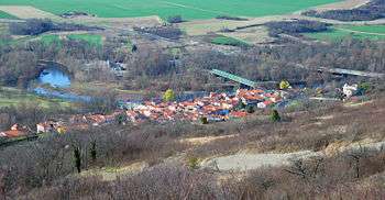
Dallet is a commune in the Puy-de-Dôme department in Auvergne in central France.
Dallet and the Allier River
See also
References
| Wikimedia Commons has media related to Dallet. |
This article is issued from
Wikipedia.
The text is licensed under Creative Commons - Attribution - Sharealike.
Additional terms may apply for the media files.