River Leven, North Yorkshire
| River Leven | |
|---|---|
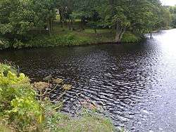 The mouth of the Leven. | |
| Country | England |
| Physical characteristics | |
| Main source |
Kildale Moor, North Yorkshire 279 metres (915 ft) 54°27′50″N 1°2′47″W / 54.46389°N 1.04639°W |
| River mouth |
River Tees at Yarm 16 metres (52 ft) 54°30′31″N 1°20′12″W / 54.50861°N 1.33667°WCoordinates: 54°30′31″N 1°20′12″W / 54.50861°N 1.33667°W |
| Length | 46.2 kilometres (28.7 mi) |
| Basin features | |
| Basin size | 196.3 square kilometres (75.8 sq mi) |
The River Leven is a river in North Yorkshire, England, a tributary to the River Tees. It rises on Warren Moor, part of Kildale Moor, in the North York Moors and flows to the north of the moors to join the River Tees at Yarm.
Course
The source of the river is on Warren Moor, part of Kildale Moor, just south of the village of Kildale. It flows east until it reaches the Whitby to Middlesbrough rail line where it does a complete turnaround to flow west to Kildale. It then flows south-south-west through woodland to the confluence with Dundale Beck where it turns north-west through Low Easby and Little Ayton, before turning west and then south-west at Great Ayton. It runs parallel to the A173 to Stokesley. The river becomes increasingly meandering as it continues south-west past Skutterskelfe to Hutton Rudby and Rudby, where it turns north-west and then west again over Slape Stones waterfall. At Crathorne it turns north and then north-east as far as Middleton-on-Leven before passing under the A19 in a north-west direction. The final couple of miles are north and north-west between Ingleby Barwick and Yarm, before the river joins the River Tees.[1]
Water levels
| Monitoring station[2] | Station elevation | Low water level | High water level | Record high level |
|---|---|---|---|---|
| Easby | 101.3 m (332 ft) | 0.11 m (0.36 ft) | 0.4 m (1.3 ft) | 1.25 m (4.1 ft) |
| Great Ayton | 83 m (272 ft) | 0.03 m (0.098 ft) | 0.5 m (1.6 ft) | 1.64 m (5.4 ft) |
| Stokesley | 67 m (220 ft) | 0.09 m (0.30 ft) | 0.8 m (2.6 ft) | 1.62 m (5.3 ft) |
| Foxton Bridge | 56 m (184 ft) | 0.21 m (0.69 ft) | 1.5 m (4.9 ft) | 2.63 m (8.6 ft) |
- Low and High Water Levels are an average figure.
Geology
The river drains from the Cleveland Hills across a mixed geology of mostly Permian and Jurassic age bedrock of low permeability. Most of the deposits on top of the bedrock are boulder clay. There is mixed agriculture, with some moorland and forestry near the source.[3]
Natural history
Due to a weir on the lower river built during the Industrial Revolution, migratory and territorial fish and mammals had been missing from the river. In 2007, the Environment Agency built a fish bypass at the weir and in 2011, was able to announce the return of spawning salmon to the river for the first time in 150 years.[4]
History
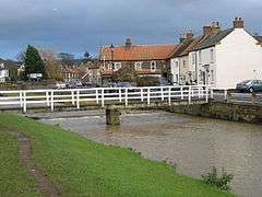
In Stokesley, the river is crossed by a 17th-century packhorse bridge, Taylorson's Bridge,[5] which was once the only crossing into the town.[6] The Domesday Book records the existence of a water mill on the banks of the river in the town.[7] In Hutton Rudby there is a plaque on a bridge that marks the spot of a water mill that, amongst several uses, once made sailcloth.[8]
Lists
Tributaries
|
Settlements
|
Crossings
|
Gallery
 Bridge over the Leven at Great Ayton
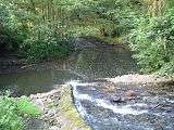 Coul Beck joining the River Leven near Rudby
 Leven Bridge over the River Leven at Low Leven
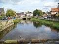 River Leven, Great Ayton
 River Leven, Low Green, Great Ayton
Sources
References
- ↑ "Moors Knowledge". Retrieved 24 August 2011.
- ↑ "River levels". Archived from the original on 9 October 2011. Retrieved 23 December 2010.
- ↑ "Geology". Retrieved 24 August 2011.
- ↑ "Salmon returns". Archived from the original on 9 October 2011. Retrieved 24 August 2011.
- ↑ Hinchliffe, Ernest (1994). A Guide to the Packhorse Bridges of England. Milnrow, Cumbria: Cicerone Press. p. 81. ISBN 1-85284-143-5.
- ↑ "Local history". Retrieved 24 August 2011.
- ↑ "Stokesley History". Retrieved 21 August 2011.
- ↑ "Hutton Rudby History". Archived from the original on 1 October 2011. Retrieved 24 August 2011.