Allens West railway station
| Allens West | |
|---|---|
 | |
| Location | |
| Place | Eaglescliffe |
| Local authority | Stockton-on-Tees |
| Grid reference | NZ413145 |
| Operations | |
| Station code | ALW |
| Managed by | Northern |
| Number of platforms | 2 |
| DfT category | F2 |
|
Live arrivals/departures, station information and onward connections from National Rail Enquiries | |
| Annual rail passenger usage* | |
| 2012/13 |
|
| 2013/14 |
|
| 2014/15 |
|
| 2015/16 |
|
| 2016/17 |
|
| History | |
| 1940 | Station opens as Allens West Halt |
| 4 October 1970 | Station renamed Allens West |
| National Rail – UK railway stations | |
| * Annual estimated passenger usage based on sales of tickets in stated financial year(s) which end or originate at Allens West from Office of Rail and Road statistics. Methodology may vary year on year. | |
|
| |
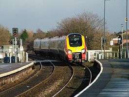
Allens West railway station is in the town of Eaglescliffe within the borough of Stockton-on-Tees, England. It is located on the Tees Valley Line 7 miles (11 km) west of Middlesbrough and 8 miles (13 km) east of Darlington. The station is operated by Northern who provide all passenger train services.
Facilities
The station is unmanned and has no permanent buildings other than standard waiting shelters on each platform. No ticket provision is available here, so intending passengers must purchase tickets prior to travel or on the train. Facilities here were improved in April 2013. The package for this station included new fully lit waiting shelters, renewed station signage, digital CIS displays and the installation of CCTV. The long-line Public Address system (PA) has been renewed and upgraded with pre-recorded train announcements.[1] Train running information can be obtained via the public payphone on platform 2 and timetable posters. Step-free access is available to both platforms via the nearby level crossing.[2]
History
Opened by the London and North Eastern Railway during the Second World War as an unadvertised station to serve a nearby Royal Navy stores depot, the station then passed on to the Eastern Region of British Railways on nationalisation in 1948. Following the construction of new housing in the area the station became an advertised public station on 3 October 1971 [3]
When Sectorisation was introduced, the station was served by Regional Railways until the Privatisation of British Railways. The level crossing here was upgraded by Network Rail in the autumn 2013 from automatic half barriers to full controlled barriers with obstacle detection after several 'near misses' resulting from pedestrians avoiding the lowered barriers and crossing the tracks in front of approaching trains.[4]
Service
Monday to Saturdays, there are two trains per hour westbound to Darlington and eastbound to Middlesbrough and beyond (Saltburn).[5] Certain westbound trains continue beyond Darlington to Bishop Auckland (every two hours off-peak, hourly at peak times).
On Sundays there is an hourly service in each direction, with one train every second hour extended to Bishop Auckland westbound.
References
- ↑ "Tees Valley Unlimited Progress Report" (PDF). TVU. TVU. December 2013. Archived from the original (PDF) on 4 October 2015. Retrieved 18 December 2015.
- ↑ Allens West station facilities National Rail Enquiries; Retrieved 15 February 2017
- ↑ Private and Untimetabled Railway Stations by G.Croughton and others
- ↑ "Level crossing at Allens West being upgraded after two near-misses with children" Blackburn, Mike, Gazette Live news article 20-11-2013; Retrieved 15 February 2017
- ↑ Table 44 National Rail timetable, December 2016
- Butt, R. V. J. (1995). The Directory of Railway Stations: details every public and private passenger station, halt, platform and stopping place, past and present (1st ed.). Sparkford: Patrick Stephens Ltd. ISBN 978-1-85260-508-7. OCLC 60251199.
- Jowett, Alan (2000). Jowett's Nationalised Railway Atlas (1st ed.). Penryn, Cornwall: Atlantic Transport Publishers. ISBN 978-0-906899-99-1. OCLC 228266687.
External links
- Train times and station information for Allens West railway station from National Rail
| Preceding station | Following station | |||
|---|---|---|---|---|
| Northern Tees Valley Line | ||||
Coordinates: 54°31′26″N 1°21′47″W / 54.524°N 1.363°W