River Wiske
| River Wiske | |
|---|---|
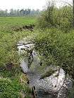
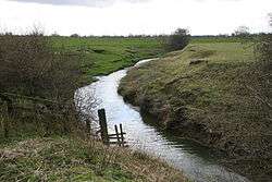 River Wiske close to its confluence with the River Swale | |
| Country | England |
| Physical characteristics | |
| Main source |
Confluence of Stony Lane Beck and Carr Beck nr Ingleby Arncliffe 69 metres (226 ft) 54°23′10″N 1°19′25″W / 54.38611°N 1.32361°W |
| River mouth |
River Swale nr Kirby Wiske 21 metres (69 ft) 54°14′38″N 1°26′19″W / 54.24389°N 1.43861°WCoordinates: 54°14′38″N 1°26′19″W / 54.24389°N 1.43861°W |
| Length | 46.9 kilometres (29.1 mi) |
| Basin features | |
| Basin size | 215.5 square kilometres (83.2 sq mi) |
| River Wiske | |||||||||||||||||||||||||||||||||||||||||||||||||||||||||||||||||||||||||||||||||||||||||||||||||||||||||||||||||||||||||||||||||||||||||||||||||||||||||||||||||||||||||||||||||||||||||||||||||||||||||||||||||||||||||||||||||||||||||||||||||||||||||||||||||||||||||||||||||||||||||||||||||||||||||||||||||||||||||||||||||||
|---|---|---|---|---|---|---|---|---|---|---|---|---|---|---|---|---|---|---|---|---|---|---|---|---|---|---|---|---|---|---|---|---|---|---|---|---|---|---|---|---|---|---|---|---|---|---|---|---|---|---|---|---|---|---|---|---|---|---|---|---|---|---|---|---|---|---|---|---|---|---|---|---|---|---|---|---|---|---|---|---|---|---|---|---|---|---|---|---|---|---|---|---|---|---|---|---|---|---|---|---|---|---|---|---|---|---|---|---|---|---|---|---|---|---|---|---|---|---|---|---|---|---|---|---|---|---|---|---|---|---|---|---|---|---|---|---|---|---|---|---|---|---|---|---|---|---|---|---|---|---|---|---|---|---|---|---|---|---|---|---|---|---|---|---|---|---|---|---|---|---|---|---|---|---|---|---|---|---|---|---|---|---|---|---|---|---|---|---|---|---|---|---|---|---|---|---|---|---|---|---|---|---|---|---|---|---|---|---|---|---|---|---|---|---|---|---|---|---|---|---|---|---|---|---|---|---|---|---|---|---|---|---|---|---|---|---|---|---|---|---|---|---|---|---|---|---|---|---|---|---|---|---|---|---|---|---|---|---|---|---|---|---|---|---|---|---|---|---|---|---|---|---|---|---|---|---|---|---|---|---|---|---|---|---|---|---|---|---|---|---|---|---|---|---|---|---|---|---|---|---|---|---|---|---|---|---|---|---|---|---|---|---|---|---|---|---|---|---|---|---|---|---|---|
| |||||||||||||||||||||||||||||||||||||||||||||||||||||||||||||||||||||||||||||||||||||||||||||||||||||||||||||||||||||||||||||||||||||||||||||||||||||||||||||||||||||||||||||||||||||||||||||||||||||||||||||||||||||||||||||||||||||||||||||||||||||||||||||||||||||||||||||||||||||||||||||||||||||||||||||||||||||||||||||||||||
The River Wiske is a river in the county of Yorkshire, England and is a tributary of the River Swale. The Wiske gives its name to several of the villages it passes through. The name Wiske is derived from an Old English word wisca meaning a water meadow.[1]
The river was maintained by the River Wiske Internal Drainage Board, which itself, was part of the Shires Group of IDBs.[2] It lies within the national character areas (NCAs) of the Vale of Mowbray and the Tees Lowlands.
Course
The river becomes the Wiske at the confluence of Carr Beck and Stony Lane Beck south of the village of Ingleby Arncliffe close to the Tontine Bridge where the A19 and A172 roads diverge. It flows north in a series of meanders as far as East Rounton where it turns north-westerly and then westerly past Appleton Wiske.[3] The river continues to flow westerly until just after passing under the A167 road near Great Smeaton where it turns south. It follows a mainly southerly direction towards Danby Wiske, Yafforth, and Northallerton. The river then alternates between a southerly and south-south-easterly direction until Kirby Wiske, where it turns south-west to join the River Swale.[4] Water from the river eventually enters the sea at Spurn Head at the mouth of the River Humber.
History
During the drought of 1995/96 Yorkshire Water installed a pipeline connecting the River Tees near Darlington to the river near Birkby, south of Great Smeaton. This link enables water to be transferred from the Tyne and Wear into the Tees and thence to the Wiske for pumping out from the River Ouse at York. Although the pipeline was never used it was tested and remains as an "insurance policy". There are ongoing concerns about the biological impact of mixing water in Yorkshire's rivers.[5]
The river is maintained by the Swale and Ure Internal Drainage Board. It used to be maintained by its own River Wiske IDB, but in 2012, five of the IDBs within the Vale of Mowbray and Hambleton District, were combined to form the one IDB.[6]
The River Wiske suffers from pollution and flooding problems. Pollution is of a high nitrogen content from the agricultural industry[7] whilst excess water from the A19 flows into the river at its source.[8] Flooding of villages on the route and in its tributaries (such as Brompton near Northallerton) has become problematic with limited availability of land upstream to store water in times of high flow.[9][10] The Environment Agency and the Yorkshire Wildlife Trust, have undertaken work along the course of the river to remediate these issues.[11]
Geology
The River Wiske is underlain by a range of geological deposits, including undifferentiated sandstone, conglomerate, undifferentiated mudstone, siltstone and sandstone from the Triassic period, and the Lias group consisting of mudstone, siltstone, limestone and sandstone from the Mesozoic period.[12]
Natural history
There are four areas of non-statutory Nature Conservation Sites along the river: Middlebrough plantation just outside Newby Wiske; Stony Lane Pond near the confluence of Stony Lane Beck and Carr Beck; Pepper Arden Bottoms near East Cowton and Pheasantry Wood and Fox Covert near Danby Wiske.[12]
The river passes through farmland bounded by hedgerows with some wet woodland near Kirby Wiske and some grassland near Newby Wiske.[12] Biodiversity audits carried out in 2010 found European water vole on the river between Danby Wiske and Brompton Beck. European otters were found on the river between North Otterington and Kirby Wiske. Soprano pipistrelle and brown long-eared bat were also found in the area along with kingfisher, reed bunting and lapwing.[12]
Lists
Tributaries
|
Settlements
|
Crossings
|
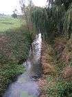
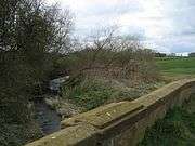
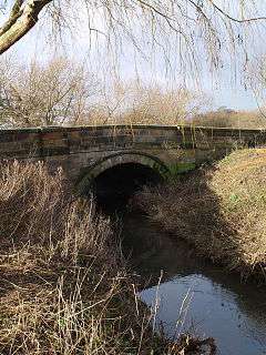
Gallery

54°15′25″N 1°25′22″W / 54.256951°N 1.422807°W
References
- ↑ Ekwall, Eilert (1960). The concise Oxford dictionary of English place-names (4 ed.). Oxford: Clarendon Press. p. 526. ISBN 0-19-869103-3.
- ↑ "Management". Archived from the original on 4 October 2011. Retrieved 21 August 2011.
- ↑ "Wiske from Source to Trenholme Stell". environment.data.gov.uk. Retrieved 29 December 2017.
- ↑ "Wiske from Trenholme Stell to River Swale". environment.data.gov.uk. Retrieved 29 December 2017.
- ↑ Kelly, Martyn (17 June 1996). "Many rivers to cross". The Independent. Retrieved 29 December 2017.
- ↑ "Swale and Ure Drainage Board". www.sandudb.gov.uk. Retrieved 29 December 2017.
- ↑ "NVZ Name: River Wiske from Trenholme Stell to River Swale NVZ" (PDF). environment-agency.gov.uk. June 2016. p. 15. Retrieved 29 December 2017.
- ↑ "River Wiske A Shared Responsibility?" (PDF). ywt.org.uk. p. 1. Retrieved 29 December 2017.
- ↑ "River Wiske - Yorkshire Dales Rivers Trust". Yorkshire Dales Rivers Trust. Retrieved 29 December 2017.
- ↑ "River Wiske Corridor | Yorkshire Wildlife Trust". www.ywt.org.uk. Retrieved 29 December 2017.
- ↑ Foster, Mark (25 August 2017). "River Wiske restoration project is to be extended". Darlington and Stockton Times. Retrieved 29 December 2017.
- 1 2 3 4 "Geology of River Wiske" (PDF). Archived from the original (PDF) on 4 October 2011. Retrieved 21 August 2011.
| Wikimedia Commons has media related to River Wiske. |