River Holme
| River Holme | |
|---|---|
_joining_River_Colne_at_Huddersfield%2C_West_Yorkshire%2C_UK_(RLH).JPG) River Holme (left) joining the River Colne at Huddersfield | |
| Country | England |
| Physical characteristics | |
| Main source |
Holmbridge 188 metres (617 ft) 53°13′15″N 1°49′27″W / 53.22083°N 1.82417°W |
| River mouth |
River Colne at Huddersfield 72 metres (236 ft) 53°38′21″N 1°47′4″W / 53.63917°N 1.78444°WCoordinates: 53°38′21″N 1°47′4″W / 53.63917°N 1.78444°W |
| Length | 13.86 kilometres (8.61 mi) |
| Basin features | |
| Progression | Colne–Calder–Aire–Ouse–Humber–North Sea |
| Basin size | 97.4 square kilometres (37.6 sq mi) |
The River Holme is a river in the Holme Valley, West Yorkshire, England and is a tributary of the River Colne. It starts from Digley reservoir and is then fed firstly by the run-off stream from Brownhill Reservoir, then by Dobbs Dike. Most of the banks of the upper part of the river are urbanised and are part of the Holme Valley civil parish.
Course
From Digley reservoir, the river flows north east through Holmbridge and Holmfirth. It flows north-north-east to Thongsbridge and Brockholes before turning north and reaching Honley, Berry Brow and Lockwood. It then proceeds northwards and joins the River Colne just south of Huddersfield town centre at Folly Hall.[1]
The Environment Agency have a gauging station at Queen's Mill in Huddersfield where the recorded average low river level is 0.25 metres (0.82 ft) and the high river level is 1.2 metres (3.9 ft). The record highest level recorded was 2.5 metres (8.2 ft).[2]
Flooding
The river was prone to flooding with the earliest recorded in 1738. In 1840 Bilberry Reservoir was built over an existing stream, but the work had not been carried out properly and the stream not correctly redirected. The result was that, in February 1852, the reservoir broke its confines and flooded the Holme Valley as far as Holmfirth. It resulted in 81 fatalities and the destruction of many homes and businesses.[3][4]
Geography
The start of the river valley is surrounded by the high hills of Holme Moss, Harden Moss and Cartworth Moor. The underlying bedrock was laid down in the Upper Carboniferous period and consists primarily of Millstone Grit with some sandstone interspersed with thin coal seams.[5]
Lists
Tributaries
|
Settlements
|
Road crossings
|
Gallery
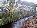 River Holme, Thongsbridge
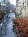 River Holme, Thongsbridge
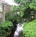 River Holme - Towngate
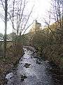 River Holme at Holmfirth
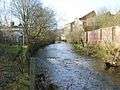 River Holme in Lockwood Huddersfield
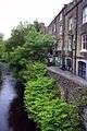 The River Holme in Holmfirth
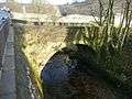 Old bridge over the River Holme, off Woodhead Road, Holmfirth
See also
References
- ↑ Huddersfield One
- ↑ "River Levels". Environment Agency River and Sea Levels. Retrieved 28 August 2011.
- ↑ "Floods". Holmfirth Floods. Retrieved 28 August 2011.
- ↑ Huddersfield One
- ↑ "River Valley Geology". Archived from the original on 3 September 2003. Retrieved 28 August 2011.