Richmond River
| Richmond | |
| River[1] | |
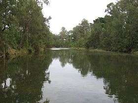 The Richmond River at Casino, 2006. | |
| Name origin: Charles, the fifth Duke of Richmond[2] | |
| Country | Australia |
|---|---|
| State | New South Wales |
| Regions | NSW North Coast (IBRA), Northern Rivers |
| Local government areas | Kyogle, Richmond Valley, Ballina |
| Tributaries | |
| - left | Findon Creek, Gradys Creek, Lynchs Creek, Fawcetts Creek, Wilsons River, Emigrant Creek |
| - right | Back Creek, Roseberry Creek, Horse Station Creek, Eden Creek, Bungawalbin Creek, Shannon Brook |
| Source | McPherson Range |
| - location | west of Mount Lindesay, near Woodenbong |
| - elevation | 236 m (774 ft) |
| - coordinates | 28°19′48″S 152°40′30″E / 28.33000°S 152.67500°E |
| Mouth | Coral Sea, South Pacific Ocean |
| - location | near Ballina |
| - elevation | 0 m (0 ft) |
| - coordinates | 28°52′36″S 153°35′29″E / 28.87667°S 153.59139°ECoordinates: 28°52′36″S 153°35′29″E / 28.87667°S 153.59139°E |
| Length | 394 km (245 mi) |
| Depth | 3.2 m (10 ft) |
| Volume | 119,314 m3 (4,213,534 cu ft) |
| Basin | 6,862 km2 (2,649 sq mi) |
| Area | 38 km2 (15 sq mi) |
| National parks | Border Ranges NP, Richmond Range NP |
 Location of the Richmond River mouth in New South Wales | |
| Website: NSW Environment and Heritage webpage | |
| [3] | |
The Richmond River is a river with a mature wave dominated, barrier estuary,[1] situated in the Northern Rivers region of New South Wales, Australia.
Course and features
The river rises in the Great Dividing Range, on the southern slopes of McPherson Range, west of Mount Lindesay, and flows generally south east and north east, joined by twelve tributaries, including the Wilsons River, before reaching its mouth at its confluence with the Coral Sea of the South Pacific Ocean near between Ballina; descending 256 metres (840 ft) over its 237 kilometres (147 mi) course.[3]
On its journey it passes through the towns of Kyogle, Casino, Coraki and Woodburn. Summerland Way is situated adjacent to much of the middle reaches of the course of Richmond River. At Ballina, the Pacific Highway crosses the river.
The catchment area of the river is estimated at 6,862 square kilometres (2,649 sq mi), which makes it the sixth largest catchment in New South Wales; and its floodplain has an area of over 1,000 square kilometres (390 sq mi).[4]
History

Aboriginal history
The traditional custodians of the land surrounding the Richmond River are the Aboriginal people of the Githabul,[5] whose territory reached north to the current city of Toowoomba and included the current towns of Tenterfield and Warwick. One of the annual rituals of the Githabul people was the movement from the mountain ranges to the coast during the winter months, when the mullet were plentiful.[6]
European history
Omitted by Captain James Cook when he sailed up the east coast of the Australian mainland in 1770, it wasn't until Captain Henry John Rous identified the mouth of the river in 1828 that it was discovered by Europeans. Rous entered the river and sailed about 20 miles (32 km) up river. He subsequently named the river Richmond after the fifth Duke of Richmond.[2] Later that year the explorer Allan Cunningham reached the river by land.[6]
The river was a major port from the 1840s until well into the 20th century. Soon after the first white settlers arrived they discovered the abundant supply of Australian Red Cedar in the Richmond Valley and immediately began logging. The river was vital in the transportation of this resource.
At the time of its discovery in 1828 and until the late 1890s the river had a treacherous mouth of shifting sand bars, and many ships and lives were lost on it. Understandably, a decision was made to construct two breakwaters to channel the river's flow and these were completed in the early 1900s. The construction of the breakwaters also led to the formation of Shaw's Bay (after sand built up behind what is now called Lighthouse or Main Beach).
In 1846, a conflict between white settlers and local Aborigines in the river valley (the Richmond River massacre) caused the deaths of around 100 of the latter.
With the decline of shipping as a transport mode, owing to better roads and rail, and the closing of the North Coast Steam Navigation Company (the major shipping firm of the area) in 1954, the river became less important as a port.
Current usage
For boats, the river is navigable for a short way up its length, possibly as far as Casino. Wilsons River, which flows through the city of Lismore and is a major tributary of the Richmond, is navigable at least as far as Boatharbour, approximately 12 kilometres (7.5 mi) upstream from Lismore.
The Richmond River is heavily used for irrigation along its length. Several weirs have been constructed in order to mitigate the effects of flooding, most notably at Casino.
Fauna
The freshwater reaches of the Richmond River once supported the endemic Richmond River Cod, similar to Murray Cod and possibly a subspecies of Eastern Freshwater Cod. Unfortunately this unique native fish became extinct between the 1930s and 1950s due to habitat degradation and gross overfishing, including with dynamite during the building of the local railway line. The endangered Oxleyan Pygmy Perch has been recorded from the river.
See also
References
- 1 2 Roy, P. S; Williams, R. J; Jones, A. R; Yassini, I; et al. (2001). "Structure and Function of South-east Australian Estuaries". Estuarine, Coastal and Shelf Science. 53: 351–384. doi:10.1006/ecss.2001.0796.
- 1 2 "Richmond River". Geographical Names Register (GNR) of NSW. Geographical Names Board of New South Wales. Retrieved 3 February 2013.
- 1 2 "Map of Richmond River, NSW". Bonzle Digital Atlas of Australia. Retrieved 3 February 2013.
- ↑ Cavanagh, Damion; Dalrymple, Brad; Wood, Michael (2007). "Managing water quality in the Richmond River Estuary, Australia" (PDF). 10th International River Symposium. Brisbane, Australia: Richmond River County Council. Retrieved 3 February 2013.
- ↑ "District History". Richmond River Historical Society. 2002. Retrieved 3 February 2013.
- 1 2 "Casino: Pleasant country town on the banks of the Richmond River". The Sydney Morning Herald. 8 February 2004.
External links
- "Richmond River catchment" (map). Office of Environment and Heritage. Government of New South Wales.
- Richmond River County Council
- Northern Rivers Catchment Management Authority
River systems and rivers of the Northern Rivers catchments, New South Wales, Australia | |
|---|---|
| Tweed Shire and Tweed River | |
| Byron Shire and Brunswick River | |
| Richmond Valley and Richmond River | |
| Clarence Valley and Clarence River |
|
| Coffs Harbour, Bellingen Shire, and Bellinger River | |
| Nambucca Shire, Kempsey Shire, and Nambucca-Macleay rivers | |
| Port Macquarie-Hastings and Hastings River | |
| |