Pacific Highway (Australia)
| Pacific Highway New South Wales | |||||
|---|---|---|---|---|---|
 | |||||
| General information | |||||
| Type | Highway | ||||
| Length | 790 km (491 mi)[1][2][3][4] | ||||
| Route number(s) | |||||
| Major junctions | |||||
| |||||
| North end |
| ||||
| |||||
| South end |
| ||||
| |||||
| NE end |
| ||||
| |||||
| SW end |
| ||||
| |||||
| North end |
| ||||
| |||||
| South end |
| ||||
| Location(s) | |||||
| Major settlements | Ballina, Grafton, Coffs Harbour, Kempsey, Taree, Newcastle, Gosford, Wahroonga | ||||
| Highway system | |||||
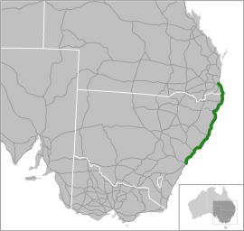
The Pacific Highway is a 790-kilometre-long (490 mi)[1][2][3][4] national highway and major transport route along the central east coast of Australia, with the majority of it being part of Australia's national route 1.
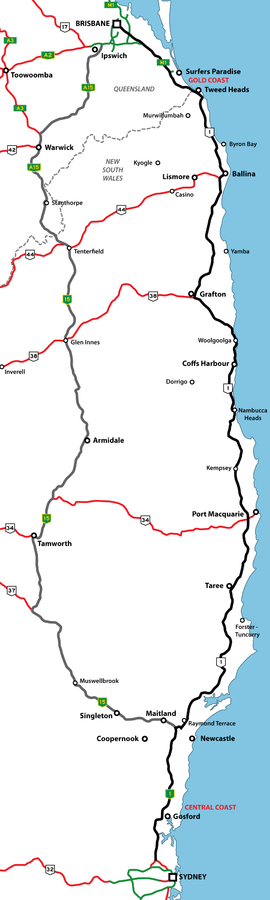
The highway and its adjoining Pacific Motorway between Brisbane and Brunswick Heads and Pacific Motorway between Sydney and Newcastle links the state capitals of Sydney in New South Wales with Brisbane in Queensland, approximately paralleling the Tasman Sea of the South Pacific Ocean coast, via Gosford, Newcastle, Taree, Port Macquarie, Kempsey, Coffs Harbour, Grafton, and Ballina. The highway stops short of the Queensland Gold Coast where the highway has been diverted as a motorway and the former highway subsequently renamed as the Gold Coast Highway.
The Pacific Highway is one of the busiest highways in Australia, and is subject to continual upgrade to a dual carriageway (minimum four-lane) divided road, with about 81% of the entire route built to this standard as of 1 October 2017.[6] In June 2015, the Commonwealth and NSW governments announced their intention to upgrade the entire highway to dual carriageway by 2020.[7]
Route description
A map of the Pacific Highway between Nambucca Heads to its northern terminus, northwest of Byron Bay. Thereafter the Pacific Motorway continues north to Brisbane.
KEY
The Pacific Highway is a 790-kilometre-long (490 mi)[1][2][3][4] national highway and major transport route along the central east coast of Australia, with the majority of it being part of Australia's national route 1.
Various sections of the route are dual carriageway or motorway-standard:
- Brisbane to Ballina: Completely replaced by the Pacific Motorway as part of the 1996 Upgrade Masterplan.
- Ballina to Hexham: Progressively being converted to dual carriageway or freeway standards, as part of the 1996 Upgrade Masterplan.
- Hexham to Wahroonga: replaced by the Pacific Motorway (also known as the Sydney–Newcastle Freeway and formerly the F3 Freeway) as the national route between Wahroonga and Beresfield in sections between 1965 and 1993.
- Wahroonga to Sydney CBD: divided metropolitan road, with Metroad route substituting the national route, the route via M2 Motorway and Pennant Hills Road as an alternative.
The Pacific Highway passes through some of Australia's fastest growing regions, the NSW's Central Coast and North Coast and also the Brisbane-Gold Coast corridor, with tourism and leisure being the primary economic activity. Hence the traffic is heavy, particularly during holiday seasons, resulting in major congestion. For direct Sydney–Brisbane travel, the New England Highway is an alternative that passes through fewer major towns and carries less local traffic. Another alternate route is via the scenic Bucketts Way and Thunderbolts Way to the Northern Tablelands at Walcha before rejoining the New England Highway at Uralla. This route reduces the distance of the Sydney to Brisbane trip by about 70 kilometres (43 mi).
Major cities and towns along the Pacific Highway include: Gosford, Wyong, Newcastle, Taree, Port Macquarie, Kempsey, Coffs Harbour, Grafton, Ballina and Byron Bay, all in New South Wales; and Gold Coast in Queensland.
Major river crossings include the Hawkesbury, Hunter, Myall (just to the east of Bulahdelah), Manning (south of Coopernook), Hastings (west of Port Macquarie), Macleay (just to the east of Frederickton), Nambucca (near Macksville), Bellinger (near Raleigh), Clarence (via the Harwood Bridge near Maclean), Richmond (at Ballina), Brunswick, and Tweed rivers.
Sydney to Kariong
From Sydney the Pacific Highway starts as the continuation of the Bradfield Highway at the northern end of the Sydney Harbour Bridge, immediately north of the Sydney central business district and is the main route as far as the suburb of Wahroonga. From the Harbour Bridge to the Gore Hill Freeway at Artarmon it has no route number and from the Gore Hill Freeway to Wahroonga it is designated as A1. When the Warringah Freeway was built in the late 1960s, southbound traffic was diverted through North Sydney via Mount Street. In the late 1980s it was again diverted via Berry Street.
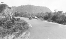
From Wahroonga, the Pacific Highway is mostly parallel to the freeway until Kariong (at which point it diverts into the Central Coast through Gosford and Wyong). The section of the highway from Cowan to Kariong follows a scenic winding route with varying speed limits, typically 60 or 80 km/h (37 or 50 mph).
Somersby to Hexham
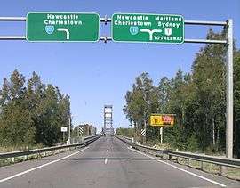
The section of what was formerly the Pacific Highway from the Wiseman's Ferry Road junction at Somersby, through to the Pacific Highway exit at Gosford (adjacent to Brian McGowan Bridge), has been rebadged as the Central Coast Highway with the route number A49. Then the highway continues north without a route number through the Central Coast suburbs of Ourimbah and Wyong as a regional route before meeting with a spur of the Pacific Motorway near Doyalson numbered as "A43". At this point the Pacific Highway becomes "A43" for most of its length, and is a four-lane regional highway passing Lake Macquarie and on through the suburbs of the cities of Lake Macquarie and Newcastle before rejoining national route 1 at Hexham.
From Bennetts Green to Sandgate it is supplemented by the Newcastle Inner City Bypass, through New Lambton and Jesmond. Two lengths of this route (Bennetts Green-Kotara Heights and Jesmond-Sandgate) have been replaced by freeway.
North of Hexham
From Hexham, the Pacific Highway (A1) passes up the NSW north coast to Brunswick Heads[5] where it becomes the Pacific Motorway (M1) through to Brisbane.
Former sections
The Pacific Highway used to be an undivided road from Sydney to Brisbane when it was first proclaimed. As of January 2014 it is made up of four separate sections within New South Wales: Warringah Freeway, North Sydney to Gosford Interchange near Kariong; Henry Parry Drive, Wyoming to Sydney - Newcastle Freeway at Ourimbah Interchange; Wyong Road, Tuggerah to Hunter Street, Wickham; and Maitland Road, Warrabrook to the Queensland Border.[8]
Before the Central Coast Highway was proclaimed, one of the sections from Ourimbah to Sydney were undivided. When a part of the highway (Kariong to Gosford section) was converted to Central Coast Highway, this section was split into two: Kariong to Sydney, and Ourimbah to Wyoming. The short section from Gosford to Wyoming was renamed as Mann Street.
Even though these sections are not gazetted as the highway any more, maps continue to show both the current road name and "Pacific Highway" together.
Major intersections
The major intersections of the Pacific Highway, spread over 790 kilometres (490 mi) on the eastern seaboard of New South Wales comprise a mix of freeway grade-separated conditions, suburban and urban roads. Between the Pacific Motorway at Brunswick Heads in the north, and the highway's southern terminus at Bradfield Highway and Cahill Expressway in North Sydney, major intersections include:


History
Initially, the primary mode of transport of the coastal areas between Sydney and Brisbane was by boat. From the roads radiating out from the port towns, the intervening hills were eventually crossed to create a continuous route along the coast, but this did not occur until the first decade of the 20th century. By contrast a continuous inland route from Newcastle to Brisbane via the Northern Tablelands had been in existence since the 1840s. A direct coastal route between Sydney and Newcastle was not completed until 1930, and completion of the sealing of the Pacific Highway did not occur until 1958 (at Koorainghat, south of Taree). The last of the many ferries across the coastal rivers was not superseded by a bridge until 1966 (the Harwood Bridge across the south channel of the Clarence River – the north channel had been bridged in 1931).
Between 1925 and 1930 the then-Main Roads Board reconstructed a route between Hornsby and Calga that had been abandoned some forty years earlier, in order to provide a direct road link between Sydney and Newcastle. In addition a replacement route, from Calga into the gorge of Mooney Mooney Creek and up to the ridge at Kariong above Gosford, was also required. This new Sydney–Newcastle route via Calga and Gosford was some 80 kilometres (50 mi) shorter than the previous route via Parramatta, McGraths Hill, Maroota, Wisemans Ferry, Wollombi and Cessnock. At first Peats Ferry was reinstituted to cross the Hawkesbury River, with construction of the bridge not beginning until 1938, due to the Great Depression. Due to the onset of World War II, the Peats Ferry Bridge was not completed until May 1945.
In 1928 the road from Sydney to Newcastle (still under construction) was proclaimed as part of the Great Northern Highway, and the road from Hexham to Tweed Heads as the North Coast Highway. In 1931 the full length from Sydney to Brisbane was proclaimed as the Pacific Highway.
Until the 1990s most road freight between Sydney and Brisbane passed along the New England Highway instead, due to the easier topography of the Northern Tablelands it traverses. Between 1950 and 1967, traffic on the Pacific Highway quadrupled due to the attraction of coastal towns between Sydney and Brisbane for retirement living and tourism.
Two major coach accidents on the Pacific Highway in 1989 near Grafton (in which 20 people died) and at Clybucca near Kempsey (in which 35 people died) resulted in a public outcry over the poor quality of the road and its high fatality rate.[9] The Pacific Highway was never part of the federally funded system of National Highways. This appears to be because when the federal government funding of the 'national highway' system began in 1974, the longer New England Highway was chosen rather than the Pacific Highway as the Sydney–Brisbane link due to its easier topography and consequent lower upgrade costs.
Yet the highway was undeniably heavily used by interstate traffic and its upgrade was beyond the resources of the New South Wales government alone. The NSW and federal governments argued for years about how the responsibility for funding the highway's upgrade should be divided between themselves, only coming up with a mutually acceptable upgrade package just after the 1996/97 financial year.
1996 upgrade masterplan
Single carriageway sections from Tweed Heads to Hexham are progressively being converted to freeway or dual carriageway standards. These are currently being upgraded as part of a joint New South Wales and federal funding arrangement and upgrade masterplan commencing in 1996. At the time, the plan targeted to have the Pacific Highway upgraded to dual carriageway by 2016. The current strategy divides the remaining sections into three levels of priority:[10]
- Priority 1: Tweed Heads to Ballina, Port Macquarie to Hexham, Woolgoolga to Raleigh (now completed)
- Priority 2: Raleigh to Port Macquarie (expected to be completed by 2018)
- Priority 3: Ballina to Woolgoolga (expected to be completed by 2020)
In the meantime, numerous sections of existing single carriageway road have been upgraded by re-alignments and safety improvement work including the addition of overtaking lanes, pavement widening and median barriers. Most large towns have bypasses of a freeway standard, with Coffs Harbour and Grafton being important remainders. Overall the highway has become safer and travelling times have been substantially reduced, particularly during holiday periods. As of 31 May 2018, about 20% of the Pacific Highway from Tweed Heads to Hexham remained one lane in each direction with some form of overtaking opportunity occasionally (or three lanes undivided on occasions), 80% (522 km) was dual carriageway and about 20% (135 km) of dual carriageway was under construction.[10] Continuous dual carriageway, much of it freeway standard, now extends from Mayfield West to Halfway Creek, 38 km south of Grafton.[11]
As of 31 March 2016 the status of four lane dual carriageway on the highway was:[12]
| Section | Total length (km) | 4-lane divided highway (km) | |||
|---|---|---|---|---|---|
| Current | Completion | Current | Under construction |
Planned | |
| Tweed Heads to Ballina (Bruxner Highway) including part of Pacific Motorway |
90.5 | 88.5 | 88.5 | 0 | 0 |
| Ballina to Coffs Harbour | 206.5 | 198.5 | 81 | 22.5 | 103 |
| Coffs Harbour to Port Macquarie (Oxley Highway) | 151 | 146 | 40.5 | 105.5 | 0 |
| Port Macquarie to Mayfield West | 221 | 223 | 223 | 0 | 0 |
| Totals | 666 | 653 | 428 | 127 | 103 |
Projects
| Project | Length (km) | Construction dates | Value | Status | Description | Distance from Sydney (km) | |
|---|---|---|---|---|---|---|---|
| Start | End | ||||||
| Tugun Bypass | 7 | June 2006[13] | 3 June 2008[13] | $543 million[13] | Complete | Part of the Pacific Motorway, partly in Queensland | 823 |
| Banora Point | 2.5[14] | December 2009[14] | 22 September 2012[14] | $359 million[14] | Complete | Part of the Pacific Motorway | 817 |
| Chinderah bypass | 5.8[15] | 1993[16] | 29 November 1996[15] | $67 million[15] | Complete | Part of the Pacific Motorway | 812 |
| Yelgun to Chinderah | 28.6[17] | May 2000[17] | 6 August 2002[17] | $348 million[17] | Complete | Part of the Pacific Motorway, includes 3 interchanges | 784 |
| Brunswick Heads Bypass (stage 1) | 3.4[18] | 12 September 1996[18] | 5 June 1998[18] | $17 million[18] | Complete | Part of the Pacific Motorway, first 2 lanes | 774 |
| Brunswick Heads to Yelgun | 8.6[19] | July 2005[16] | 11 July 2007[19] | $219 million[20] | Complete | Part of the Pacific Motorway, duplication | 777 |
| Tandy's Lane realignment | 5.5[21] | October 1999[22] | 19 December 2001[23] | $44 million[22] | Complete | Part of the Pacific Motorway | 773 |
| Ewingsdale to Tyagarah realignment | 4.3[24] | Late 1996[23] | 16 October 1998[24] | $22 million[24] | Complete | Part of the Pacific Motorway | 765 |
| Ewingsdale interchange | 1.9[25] | February 1999[25] | 20 December 2000[25] | $22.5 million[25] | Complete | Part of the Pacific Motorway | 764 |
| Tintenbar to Ewingsdale | 17[26] | May 2012[26] | 18 December 2015[26] | $862 million[26] | Complete | Four lane motorway (limited access), new alignment, 110 km/h speed limit, twin-tube road tunnel under St Helena Hill. | 749 |
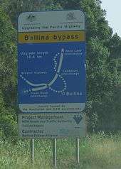
| Ballina Bypass | 12[27] | May 2008[27] | 28 April 2012[27] | $640 million[27] | Complete | New alignment | 737 |
| Pimlico to Teven | 2.3[28] | November 2013[28] | 5 May 2016[29] | $92 million[28] | Stage 2 complete | Duplication, rebuilding of old carriageway, stage 3 to be completed as part of Woolgoolga to Ballina project | 733 |
| Devils Pulpit | 7.3[30] | December 2011[30] | 20 March 2014[30] | $77 million[30] | Complete | Four lanes, partly new alignment | 678 |
| Glenugie upgrade | 2.5[31] | 2010 | 9 February 2012[31] | $60 million[32] | Complete | Four lanes, partly new alignment. Northbound carriageway due to open in 2019[33] | 590 |
| Halfway Creek | 3.4[34] | Late 2002[35] | June 2004 | TBA | Complete | Partly new alignment. | 583 |
| Woolgoolga to Ballina | 155[36] | Early 2015 (est.)[37] | 2020
Woolgoolga to Halfway Creek 24 October 2017 Halfway Creek to Glenugie 23 August 2017[38] |
$4.3 billion[39] | Under Construction
26 km Complete |
Duplication of existing highway with a major realignment of the existing Pacific Highway between Kangaroo Trail Road to Range Road, Glenugie to Maclean and Trustums Hill Road to Coolgardie Road | 561 |
| Sapphire to Woolgoolga | 25[40] | August 2010[40] | 30 July 2014[41] | $850 million[40] | Complete | Four lane divided highway, new alignment, 10 km Woolgoolga bypass opened to traffic on 16 December 2013 | 535 |
| Korora Hill Reconstruction | 1.5[42] | January 1997[42] | 15 December 1997[42] | $6 million[42] | Complete | Duplication and reconstruction | 533 |
| Coffs Harbour Bypass | 12[43] | 2020[43] | 2023[43] | $1.2 billion[43] | In planning | four lane freeway with 3 interchanges, new alignment, 2 tunnels and a cut and cover tunnel | 524 |
| Lyons Rd to Englands Rd | 5.3[44] | October 1997[45] | 25 May 2001[45] | $73m[46] | Complete | Duplication and reconstruction | 520 |
| Bonville upgrade | 9.6[47] | November 2006[48] | 16 September 2008[48] | $245m[47] | Complete | Duplication and reconstruction, covered tunnel for koalas | 514 |
| Raleigh Deviation | 8[49] | January 1995[49] | 24 September 1998[49] | $72m[49] | Complete | Duplication and reconstruction | 506 |
| Nambucca Heads to Urunga | 22[50] | November 2013[51] | 22 July 2016[52][53][54] | $780 million[50] | Complete | Four lane limited access freeway, 110 km/h, 3 interchanges, bypasses Urunga | 484 |
| Warrell Creek to Nambucca Heads | 20[10] | December 2014[10] | 18 December 2017 (Nambucca and Macksville bypass) | $830 million[10] | Open to Traffic with finishing work underway | Four lane limited access freeway, 110 km/h, 2 interchanges, including bypasses of Warrell Creek, Macksville and Bellwood | 464 |
| Eungai Duplication | 4.2[57] | January 1998[49] | March 1999[49] | $15m[57] | Complete | Duplication of first carriageway, which was opened on 23 February 1994[58] | 455 |
| Frederickton to Eungai | 26.5[59] | August 2013[59] | 16 May 2016[59] | $675 million | Complete | Four lane divided highway. Freeway from Stuarts Point interchange to South Kempsey. 110 km/h speed limit | 427 |
| Kempsey Bypass | 14.5[60] | June 2010[60] | 27 March 2013[60] | $618 million[60] | Complete | Dual carriageway freeway with 3.2 kilometres (2.0 mi) bridge over Macleay River, New alignment | 413 |
| Kundabung to Kempsey | 14[10] | November 2014[10] | 6 September 2017 (Opened to 2 lanes each way on 1 November 2017)[61][10] | $230 million[10] | Complete | Upgrade of current road to four lanes, partially limited-access (One lane opened in each carriageway. Other lanes will open end of October 2017) | 398 |
| Oxley Highway to Kundabung[10] | 23[10] | October 2014[10] | 17 November 2017[62] | $820 million[10] | Complete | Four lane divided road (freeway south of Haydon's Wharf Road interchange), bridges over the Hastings and Wilson rivers, 2 interchanges, deep cutting through Cooperabung range. | 373 |
| Herons Creek Deviation Duplication | 14[63] | November 1997[64] | 3 July 1998[63] | $19m[63] | Complete | Duplication of the first carriageway, which was opened in 2 stages: the northern stage from Ryans Road to the Oxley Highway in December 1990 and the southern stage in November 1993.[63] | 359 |
| Herons Creek to Stills Road Upgrade | 3.5[65] | March 2011[65] | 25 October 2013[66] | $60m[65] | Complete | Replacement of substandard carriageway (part of the old highway) to raise the road to freeway standard. | 356 |
| Coopernook to Herons Creek | 33[67] | November 2007[67] | 23 July 2010[67] | $555m[68] | Complete | Upgrade of highway to four lanes including a western bypass of Moorland, Johns River and an eastern bypass of Kew. | 325 |
| Coopernook Bypass | 4.2[69] | February 2004[70] | 22 March 2006[69] | $44m[70] | Complete | Four lane bypass. | 321 |
| Taree to Coopernook | 7.5[71] | November 2001[70] | 4 August 2005[71] | $59m[71] | Complete | Upgrade to four lanes, two new bridges over Ghinni Ghinni Creek and two cattle underpasses. Some upgrading, including fout-lane sections had commenced in September 1996 and was completed in 1998. | 312 |
| Taree Bypass | 14.5[72] | July 1993 (first carriageway)[73] | 14 December 1997 (first carriageway); 12 April 2000 (second carriageway)[73] | $126m[74] | Complete | Four lane highway, new alignment | 303 |
| Possum Brush to Taree | 17[75] | 1990[75] | 19 August 1991 (Possum Brush Deviation); 24 May 1994 (Rainbow Flat Deviation)[75] | TBA | Complete | Four lane highway, old road used for northbound carriageway between Failford Road and Bonvale Close, planned to be replaced as part of Failford Road to Tritton Road upgrade | 294 |
| Failford Road to Tritton Road upgrade | 3[76] | TBA | TBA | TBA | In planning | New carriageway and interchange with Failford Road | 293 |
| Bundacree Creek to Possum Brush | 9.7[77] | September 2004[78] | 4 November 2006[79] | $115m[79] | Complete | Four lanes generally along old alignment, including upgrade of existing Nabiac bypass, new interchange and bridges. | 277 |
| Wang Wauk to Bundacree Creek | 4.8[80] | August 1997[80] | 10 December 1998[80] | $21m[80] | Complete | Four lanes generally along old alignment. | 272 |
| Coolongolook to Wang Wauk | 11.7[81] | December 1999[82] | 29 July 2001[81] | $49m[83] | Complete | Four lanes generally along old alignment, 80 km/h zone through Coolongolook. | 263 |
| Bulahdelah to Coolongolook | 23[84] | April 1997[82] | 27 October 1999[82] | $130m[83] | Complete | Four lanes freeway on new alignment. Replaces the original winding highway which is now called Wootton Way. | 236 |
| Bulahdelah upgrade | 8.6[85] | August 2010[85] | 27 June 2013[85] | $315 million[85] | Complete | Four lane highway, new alignment | 232 |
| Karuah to Bulahdelah | 11 (section 1),[86] 23 (section 2 and 3)[87] | June 2005 (section 1)[88] February 2007 (sections 2 and 3) | 15 December 2006 (section 1),[88] 2 October 2009 (sections 2 and 3)[88] | $114m (section 1),[86] - (sections 2 and 3) | Complete | Four lane highway (section 1 from Karuah to 2 kilometres (1.2 mi) north of Myall Way and sections 2 and 3 further north) | 193 |
| Karuah bypass | 9.8[89] | June 2002[90] | 22 September 2004[91] | $117m[90] | Complete | Four lane freeway, bridge over Karuah River and interchanges at either end. | 187 |
| Raymond Terrace to Karuah | 18[92] | August 1998[92] | 1 December 2000[92] | $86m[92] | Complete | Four lane highway, consisting of new 2-lane northbound carriageway and upgrade of old road as southbound carriageway | 165 |
| Raymond Terrace Bypass | 7.6[93] | November 1993[93] | 17 December 1998[93] | $78m[93] | Complete | Four lane freeway, including 1 interchange and pairs of bridges at three other places | 162 |
| M1 to Raymond Terrace | 15[94] | TBA | TBA | TBA | In planning | Four lane freeway connecting the M1 to Pacific Highway, four interchanges, 2.6 km bridge over the Hunter River, bypasses Hexham, Tarro and Beresfield while replacing the existing route through Heatherbrae | 147 |
Most of the Pacific Highway is freeway standard with single lane sections between Glenugie and Ballina, 6 km around Warrell Creek and the Coffs Harbour urban area (not freeway standard – but still 4 lanes)
Environmental impact assessments have been completed for every section with these exceptions. Coffs Harbour Bypass and M1 to Raymond Terrace
Preferred routes have been selected for every stretch on the Pacific Highway.
Bulahdelah was the last town to be bypassed between Hexham and Port Macquarie. A joint federal-New South Wales A$315 million initiative was approved in July 2007, and enabled the construction of about 8.6 kilometres (5.3 mi) of four lane divided road with an eastern bypass of the Bulahdelah township.[95] The bypass opened in late 2013.
The 12.4 kilometres (7.7 mi) long Ballina Bypass was completed and open to traffic from 28 April 2012 at a cost of A$640 million. The northern section of the bypass (Cumbalum Interchange to Ross Lane Interchange) opened in March 2011 while the central section (Teven Road Interchange to Cumbalum Interchange) partially opened in December 2011; with northbound lanes from Teven to Bruxner opened in February 2012.[96]
Funding issues
In 2007 mounting pressure was placed on the federal government to provide additional funding for the highway. On 10 October 2007 the Federal Minister for Transport and Regional Services pledged $2.4 billion in funding for the highway, subject to dollar for dollar funding by the NSW state government. However, the NSW state government refused to match funding. In the lead up to the 2007 federal election, then opposition leader Kevin Rudd pledged $1.5 billion in funding.[97] As part of Auslink 2 (Nation Building Program), the federal government announced in its 2009 federal budget that $3.1 billion would be spent on the highway up until 2014[98] at which time just 63% of the highway would be duplicated.[99] The NSW government will spend just $500 million over that same period, with $300 million cut as a result of the 2008 mini budget.[100][101]
From time to time, there are proposals in the media for the private sector to build a fully controlled-access high-speed tollway between Newcastle and the Queensland border, possibly using the BOT system of infrastructure provision. Nothing has eventuated from these proposals.[102]
The section of the highway from Cowan to Kariong follows a scenic winding route with varying speed limits, typically 60 or 80 km/h (37 or 50 mph). This section was damaged quite severely during severe weather in June 2007. Five people died when a bridge over Piles Creek collapsed and the entire section was closed due to subsidence 2 km (1.2 mi) further south. The road was reopened in 2009 when the Holt-Bragg Bridge was opened, named after the family that had perished.
Former routes
A 50 kilometres (31 mi) section of road between the Pacific Motorway at Kariong, and the Pacific Highway at Doyalson was renamed the Central Coast Highway from 9 August 2006.[103]
A 39 kilometres (24 mi) section through Kempsey and Frederickton was replaced by a new freeway bypass and bridge over the Macleay River in 2013 and 2016. The original route which included the site of the Kempsey bus crash was renamed the Macleay Valley Way.[104]
Former route numbers
Former road routes have included:[105]


Safety
The Pacific Highway is one of the most dangerous and deadly stretches of road in Australia. Between 1995 and 2009, over 400 people died on the highway. In 1989, two separate bus crashes, the Grafton bus crash (in which 20 people died) and the Kempsey bus crash (in which 35 died) on the highway were two of the worst road accidents in Australia's history.[111] In 2010, 38 people died on the Pacific Highway, and in 2011, 25 people.[112] Over the past 15 years, the New South Wales Roads & Traffic Authority reports that about 1,200 people have been injured each year.[112]
Much of the danger of the Pacific Highway lies in the fact that it contains long stretches of undivided road along which all types of vehicles, including private automobiles, buses, vans and trucks, simultaneously travel at speeds approaching and in excess of 100 kilometres per hour (62 mph). The undivided sections carry a high risk of head-on collisions. After the 1989 crashes, the investigating coroner, Kevin Waller, recommended that the highway be fully divided along its entire length, but only 51% had been divided by 2012.[113] Motorists surveyed by the National Roads and Motorists' Association voted the Pacific Highway the worst road in New South Wales in 2012.[114]
See also
References
- 1 2 3 Pacific Highway, Valery NSW 2454, Australia to 3776 Pacific Highway, Tyagarah NSW 2481, Australia (Map). Google Maps. 2016. Retrieved 23 November 2016.
- 1 2 3 Hunter River, Hexham NSW, Australia to Pacific Highway, Valery NSW 2454, Australia (Map). Google Maps. 2016. Retrieved 23 November 2016.
- 1 2 3 Peats Ferry Bridge, Australia to Hunter River, Hexham NSW Australia (Map). Google Maps. 2016. Retrieved 23 November 2016.
- 1 2 3 Peats Ferry Bridge, Australia to 32 Pacific Highway, North Sydney NSW 2060, Australia (Map). Google Maps. 2016. Retrieved 23 November 2016.
- 1 2 "NEW SOUTH WALES GOVERNMENT GAZETTE No. 57" (PDF). Parliament of New South Wales. 10 May 2013. Archived from the original (PDF) on 3 March 2016.
- ↑ "Pacific Highway upgrade achievement report" (PDF). Roads and Maritime Services. Government of New South Wales. 28 February 2017. Retrieved 2 May 2017.
- ↑ "Pacific Highway upgrade six monthly report card" (PDF). Roads & Maritime Services. Government of New South Wales. June 2015. Retrieved 23 November 2016.
- ↑ "Schedule of Classified Roads and Unclassified Regional Roads" (PDF). Roads and Maritime Services. January 2014. pp. 2–4. Archived (PDF) from the original on 3 March 2016. Retrieved 14 March 2017. Archived 14 March 2017 at WebCite
- ↑ "Pacific Highway Upgrade". Parliament of New South Wales. 3 December 2003.
- 1 2 3 4 5 6 7 8 9 10 11 12 13 "Pacific Highway upgrade: Achievement report - May 2018" (PDF). Roads and Maritime Services. May 2018. p. 2. Retrieved 10 August 2018.
- ↑ "Warrell Creek to Nambucca Highway upgrade completed". Nambucca Guardian. 29 June 2018. Retrieved 29 June 2018.
- ↑ http://www.rms.nsw.gov.au/documents/projects/key-build-programs/pacific-highway/pacific-highway-dual-carriageway-status-map.pdf
- 1 2 3 "Tugun Bypass project". Queensland Government. 7 January 2014. Retrieved 6 February 2014.
- 1 2 3 4 "Banora Point project". Roads and Maritime Services. Retrieved 6 February 2014.
- 1 2 3 "Project Fact Sheet: Chinderah Bypass" (PDF). Roads and Maritime Services. Retrieved 6 February 2014.
- 1 2 "Pacific Highway: Section: Chinderah to Tweed Heads". ozroads. Retrieved 6 February 2014.
- 1 2 3 4 "Yelgun to Chinderah (official opening brochure)" (PDF). Roads and Maritime Services. Retrieved 6 February 2014.
- 1 2 3 4 "Project Fact Sheet: Brunswick Heads Bypass (stage 1)" (PDF). Roads and Maritime Services. Retrieved 6 February 2014.
- 1 2 "Brunswick Heads to Yelgun". Roads and Maritime Services. Retrieved 6 February 2014.
- ↑ "Brunswick Heads to Yelgun - Pacific Highway". AbiGroup. Retrieved 6 February 2014.
- ↑ "Tandy's Lane". Roads and Maritime Services. Retrieved 6 February 2014.
- 1 2 "Tandy's Lane". Baulderstone. Retrieved 6 February 2014.
- 1 2 "Pacific Highway: Section: Ewingsdale to Brunswick Heads". ozroads. Retrieved 6 February 2014.
- 1 2 3 "Project Fact Sheet: Ewingsdale to Tyagarah" (PDF). Roads and Maritime Services. Retrieved 6 February 2014.
- 1 2 3 4 "Project Fact Sheet: Ewingsdale interchange" (PDF). Roads and Maritime Services. Retrieved 6 February 2014.
- 1 2 3 4 "Tintenbar to Ewingsdale". Roads and Maritime Services. Retrieved 6 February 2014.
- 1 2 3 4 "Ballina bypass". Roads and Maritime Services. Retrieved 6 February 2014.
- 1 2 3 "Pimlico to Teven upgrade". Roads and Maritime Services. Retrieved 6 February 2014.
- ↑ http://www.northernstar.com.au/news/new-section-of-pacific-highway-to-open-this-aftern/3017320/
- 1 2 3 4 "Devils Pulpit upgrade". Roads and Maritime Services. Retrieved 7 February 2014.
- 1 2 "Glenugie upgrade". Roads and Maritime Services. Retrieved 7 February 2014.
- ↑ "Glenugie upgrade". Roads Australia. Retrieved 7 February 2014.
- ↑ NSW, Roads and Maritime Services,. "Woolgoolga to Ballina - Pacific Highway upgrade". Roads and Maritime Services. Retrieved 2017-09-15.
- ↑ "Halfway Creek". Roads and Maritime Services. Retrieved 7 February 2014.
- ↑ "Pacific Highway: Section: Halfway Creek". ozroads. Retrieved 7 February 2014.
- ↑ Woolgoolga to Ballina. Roads and Maritime Services
- ↑ Pacific Highway upgrade continues. The Land
- ↑ Charles, Caitlan. "Highway works 70% complete". Grafton Daily Examiner. Retrieved 2017-12-07.
- ↑ Green Light for The Woolgoolga to Ballina Upgrade. NBN News
- 1 2 3 "Sapphire to Woolgoolga". Roads and Maritime Services. Retrieved 7 February 2014.
- ↑ "Honk, honk". ABC News Coffs Coast. 30 July 2014. Retrieved 31 July 2014.
- 1 2 3 4 "Project Fact Sheet: Korora Hill Reconstruction" (PDF). Roads and Maritime Services. Retrieved 7 February 2014.
- 1 2 3 4 "Coffs Bypass timeline". Coffs Coast Advocate. Retrieved 8 May 2018.
- ↑ "Lyons Rd to Englands Rd". Roads and Maritime Services. Retrieved 7 February 2014.
- 1 2 "Pacific Highway: Section: Lyons Rd to Englands Rd". ozroads. Retrieved 7 February 2014.
- ↑ "Lyons Rd to Englands Rd" (PDF). Roads and Maritime Services. Retrieved 7 February 2014.
- 1 2 "Bonville upgrade" (PDF). Roads and Maritime Services. Retrieved 7 February 2014.
- 1 2 "Pacific Highway: Section: Bonville (9-19km south of Coffs Harbour)". ozroads. Retrieved 7 February 2014.
- 1 2 3 4 5 6 "Project Fact Sheet: Raleigh Deviation" (PDF). Roads and Maritime Services. Retrieved 7 February 2014.
- 1 2 "Nambucca Heads to Urunga upgrade". Roads and Maritime Services. Retrieved 7 February 2014.
- ↑ Pacific Highway Upgrade. Roads and Maritime Services
- ↑ "Final countdown for Pacific Hwy opening". Retrieved 2016-07-20.
- 1 2 "Pacific Highway Upgrade Achievement Report - September 2015" (PDF). Roads and Maritime Services.
- ↑ Ramsey, Britt (2016-07-21). "Nambucca Heads to Urunga bypass open". Retrieved 2016-07-22.
- ↑ Davis, Mel (2017-12-06). "Macksville highway bypass to open before Christmas". Port Macquarie News. Retrieved 2017-12-07.
- ↑ "Pacific Highway upgrade of 'notorious' section now open to traffic". Retrieved 2018-06-29.
- 1 2 "Project Fact Sheet: Eungai Duplication" (PDF). Roads and Maritime Services. Retrieved 7 February 2014.
- ↑ "Pacific Highway: Section: Eungai Creek/Allgomera Creek". ozroads. Retrieved 7 February 2014.
- 1 2 3 "Frederickton to Eungai". Roads and Maritime Services. Retrieved 7 February 2014.
- 1 2 3 4 "Kempsey Bypass". Roads and Maritime Services. Retrieved 7 February 2014.
- ↑ NSW, Roads and Maritime Services,. "Kundabung to Kempsey project". Roads and Maritime Services. Retrieved 2017-09-15.
- ↑ Fairhurst, Tracey (17 November 2017). "Port Macquarie to Kundabung - Pacific Highway upgrade officially opens". Macquarie PortNews. Fairfax Regional Media. Retrieved 2 December 2017.
- 1 2 3 4 "Project Fact Sheet: Herons Creek Duplication" (PDF). Roads and Maritime Services. Retrieved 7 February 2014.
- ↑ "Pacific Highway: Herons Creek to Oxley Highway". ozroads. Retrieved 7 February 2014.
- 1 2 3 "Herons Creek to Stills Road Upgrade". Roads and Maritime Services. Retrieved 7 February 2014.
- ↑ Pacific Highway Achievement Report October 2013
- 1 2 3 "Coopernook to Herons Creek". Roads and Maritime Services. Retrieved 7 February 2014.
- ↑ "Kew Bypass opens on Pacific Highway" (Press release). Peter Besseling. Retrieved 7 February 2014.
- 1 2 "Coopernook Bypass". Roads and Maritime Services. Retrieved 7 February 2014.
- 1 2 3 "Pacific Highway: Section: Coopernook". ozroads. Retrieved 7 February 2014.
- 1 2 3 "Taree to Coopernook" (PDF). Roads and Maritime Services. Retrieved 7 February 2014.
- ↑ "Taree Bypass". Roads and Maritime Services. Retrieved 7 February 2014.
- 1 2 "Pacific Highway: Section: Taree". ozroads. Retrieved 7 February 2014.
- ↑ "Taree Bypass" (PDF). Roads and Maritime Services. Retrieved 7 February 2014.
- 1 2 3 "Pacific Highway: Section: Possum Brush to Taree". ozroads. Retrieved 8 February 2014.
- ↑ "Failford Road to Tritton Road upgrade". Roads and Maritime Services. Retrieved 8 February 2014.
- ↑ "Bundacree Creek to Possum Brush". Roads and Maritime Services. Retrieved 8 February 2014.
- ↑ "Pacific Highway: Section: Bundacree Creek to Possum Brush". ozroads. Retrieved 8 February 2014.
- 1 2 "Bundacree Creek to Possum Brush" (PDF). Roads and Maritime Services. Retrieved 8 February 2014.
- 1 2 3 4 "Wang Wauk to Bundacree Creek" (PDF). Roads and Maritime Services. Retrieved 8 February 2014.
- 1 2 "Coolongolook to Wang Wauk". Roads and Maritime Services. Retrieved 8 February 2014.
- 1 2 3 "Pacific Highway: Section: Coolongolook to Wang Wauk River". ozroads. Retrieved 8 February 2014.
- 1 2 "Coolongolook to Wang Wauk" (PDF). Roads and Maritime Services. Retrieved 8 February 2014.
- ↑ "Bulahdelah to Coolongolook" (PDF). Roads and Maritime Services. Retrieved 8 February 2014.
- 1 2 3 4 "Bulahdelah upgrade". Roads and Maritime Services. Retrieved 8 February 2014.
- 1 2 "Karuah to Bulahdelah section 1" (PDF). Roads and Maritime Services. Retrieved 8 February 2014.
- ↑ "Karuah to Bulahdelah sections 2 and 3". Roads and Maritime Services. Retrieved 8 February 2014.
- 1 2 3 "Pacific Highway: Section: Karuah to Bulahdelah". ozroads. Retrieved 8 February 2014.
- ↑ "Karuah bypass". Roads and Maritime Services. Retrieved 8 February 2014.
- 1 2 "Pacific Highway: Section: Karuah". ozroads. Retrieved 8 February 2014.
- ↑ Peter Phibbs, Alexa Heidrich, Cole Cooney (eds.). "The Karuah Highway: Bypass Economic and Social Impacts: 5 year report". Roads and Maritime Services. Retrieved 8 February 2014.
- 1 2 3 4 "Raymond Terrace to Karuah Upgrade" (PDF). Roads and Maritime Services. Retrieved 8 February 2014.
- 1 2 3 4 "Raymond Terrace Bypass" (PDF). Roads and Maritime Services. Retrieved 8 February 2014.
- ↑ NSW, Roads and Maritime Services,. "M1 Pacific Motorway extension to Raymond Terrace". Retrieved 2016-07-20.
- ↑ "Bulahdelah upgrade". Pacific Highway Upgrade. Roads and Maritime Services. 11 March 2013. Retrieved 16 March 2013.
- ↑ "Ballina Bypass". Road projects: Pacific Highway upgrade. Roads and Maritime Services. 28 November 2012. Retrieved 16 March 2013.
- ↑ "Rudd pledges $1.5b for Pacific Hwy upgrade". Australian Broadcasting Corporation. 6 November 2007. Retrieved 27 November 2007.
- ↑ (12 May 2009). Federal Road Investment Program Steps Up A Gear. Media Release. Minister for Infrastructure and Transport.
- ↑ "Nation Building program Projects Pacific Highway". Australian Government. Archived from the original on 29 September 2009. Retrieved 29 September 2009.
- ↑ "Pacific Highway upgrade". NSW Roads & Traffic Authority. 19 October 2009. Retrieved 20 October 2009.
- ↑ Gordon, Josh (8 March 2009). "Pacific Highway to hell". Sydney Morning Herald. Archived from the original on 29 September 2009. Retrieved 29 September 2009.
- ↑ Lewis, Steve (28 June 2007). "Drivers hit with more toll roads". news.com.au.
- ↑ Kariong to Doyalson. Roads & Traffic Authority.
- ↑ "Renaming of the Pacific Highway following completion of the Kempsey Bypass" (PDF). Kempsey Shire Council. 21 August 2012. Retrieved 23 April 2017.
- ↑ Highway One – NSW Section, Ozroads Website. Retrieved on 15 May 2013
- ↑ NSW State Route 111, Ozroads, Retrieved on 1 June 2013.
- ↑ NSW State Route 83, Ozroads, Retrieved on 1 June 2013.
- ↑ Metroad 1, Ozroads, Retrieved on 1 June 2013.
- ↑ NSW State Route 14, Ozroads, Retrieved on 3 June 2013.
- ↑ Metroad 10, Ozroads, Retrieved on 1 June 2013.
- ↑ Scott, Belinda (22 December 2009). "Australia's worst crash". The Coffs Coast Advocate. North Coast News. Retrieved 28 July 2012.
- 1 2 "Crash statistics". NSW Centre for Road Safety, New South Wales Roads & Traffic Authority. Government of New South Wales. 11 June 2013. Retrieved 16 July 2013.
- ↑ "Death road detour for retired NSW coroner Kevin Waller". Daily Telegraph.
- ↑ "Motorists vote Pacific Highway worst" (Press release). National Roads and Motorists' Association. 2012. Retrieved 16 July 2013.
External links
Route map:


Road infrastructure in Sydney | |||||
|---|---|---|---|---|---|
| Freeways |
| ||||
| Highways | |||||
| Numbered routes | |||||
| Major interchanges | |||||
| Bridges |
| ||||
| Vehicle ferries | |||||
| Proposals |
| ||||
| Operators | |||||
| |||||
| ||